Skip header and navigation

Revise Search

17 records – page 1 of 2.

Family record of Jacob B. Reist and Mary Peifer Reist of Lancaster County, Pennsylvania

https://collections.lancasterhistory.org/en/permalink/lhdo5083
Author
Rohrer, Mary R.
Date of Publication
1979.
Call Number
929 R378rm
Responsibility
compiled by Mary R. Rohrer and Mrs. Roy E. Sauder.
Author
Rohrer, Mary R.
Place of Publication
Manheim, Pa
Publisher
M.R. Rohrer,
Date of Publication
1979.
Physical Description
118 p. : ports. ; 23 cm.
Subjects
Reist family.
Buckwalter family.
Mummaw family.
Martin family.
Hess family.
Stoner family.
Additional Author
Sauder, Roy E.,
Location
Lancaster History Library - Book
Call Number
929 R378rm
Less detail

The Wenger book : a foundation book of American Wengers

https://collections.lancasterhistory.org/en/permalink/lhdo5152
Date of Publication
1978.
Call Number
929 W474w

Routes of the Garden Spot Trolleys map

https://collections.lancasterhistory.org/en/permalink/lhdo5479
Date of Publication
1977.
Call Number
974.815 SEPA 102
  1 document  
Responsibility
Drawn by B. W. Rohrbeck.
Place of Publication
[s.l.]
Publisher
[s.n.] ,
Date of Publication
1977.
Physical Description
1 map ; 36 x 46 cm.
Notes
Includes route names.
Subjects
Street-railroads - Pennsylvania - Lancaster County
Transportation - Pennsylvania - Lancaster County
Lancaster County (Pa.) - Maps.
Location
Lancaster History Library - Map
Call Number
974.815 SEPA 102
Documents

map_974.815_SEPA_102_.pdf

Read PDF Download PDF
Less detail

[Map of Mount Joy, Pa. area]

https://collections.lancasterhistory.org/en/permalink/lhdo1860
Date of Publication
1971
Call Number
974.815 MJOT 100
Responsibility
Lancaster County Planning Commission.
Place of Publication
[Lancaster, Pa.]
Publisher
Lancaster County Planning Commission ,
Date of Publication
1971
Physical Description
1 map ; 56 x 86 cm
Notes
Includes portions of East Donegal, Mount Joy and Rapho townships.
Subjects
Land use - Pennsylvania - Lancaster County
Lancaster County (Pa.) - Maps.
Location
Lancaster History Library - Map
Call Number
974.815 MJOT 100
Less detail

1875 historical atlas of Lancaster County, Pennsylvania

https://collections.lancasterhistory.org/en/permalink/lhdo15911
Corporate Author
Everts and Stewart.
Date of Publication
1976.
Call Number
912.74815 E93
Responsibility
compiled, drawn, and published from personal examinations and surveys by Everts & Stewart.
Corporate Author
Everts and Stewart.
Place of Publication
Knightstown, IN
Publisher
Bookmark,
Date of Publication
1976.
Physical Description
xviii, 120 p. : ill., maps, ports. ; 43 cm.
Notes
Reprint of the 1875 ed. published by Everts and Stewart, Philadelphia under title: Combination atlas map of Lancaster County, Pennsylvania.
"Sponsored by the Lancaster County Historical Society, Lancaster, Pennsylvania."
Kept on top of counter-height shelving unit in Reading Room.
Subjects
Real property - Pennsylvania - Lancaster Co. - Maps.
Lancaster County (Pa.) - Maps.
Lancaster County (Pa.) - Directories.
Lancaster County (Pa.) - History.
Additional Corporate Author
Everts and Stewart.
Location
Lancaster History Library - Reference
Call Number
912.74815 E93
Less detail

Lancaster County, the heart of the Pennsylvania Dutch Country

https://collections.lancasterhistory.org/en/permalink/lhdo17501
Corporate Author
Pennsylvania Dutch Tourist Bureau.
Edition
Rev. 1973.
Date of Publication
1973] c1962.
Call Number
974.815 LACO 160
Corporate Author
Pennsylvania Dutch Tourist Bureau.
Edition
Rev. 1973.
Place of Publication
[Lancaster
Date of Publication
1973] c1962.
Physical Description
col. map 42 x 50 cm. folded to 27 x 19 cm.
Notes
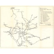
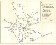
Folded title: Official Pennsylvania Dutch guide map.
Includes descriptive index of "Pennsylvania Dutch Tourist Bureau members," index to points of interest, calendar of annual events, and diagr. of visitors' center area.
Descriptive index, indexed map of "City of Lancaster," tourist information, and illus. (part col.) on verso.
Scale ca. 1:170,000.
Subjects
Lancaster County (Pa.) - Maps.
Lancaster (Pa.) - Maps.
Tourist maps.
Location
Lancaster History Library - Map
Call Number
974.815 LACO 160
Less detail

Atlas of surveys of the county of Lancaster, State of Pennsylvania

https://collections.lancasterhistory.org/en/permalink/lhdo18022
Corporate Author
Graves & Steinbarger.
Date of Publication
1978] 1899.
Call Number
912.74815 G776
Responsibility
compiled from actual surveys, city and county records.
Corporate Author
Graves & Steinbarger.
Place of Publication
[Elizabethtown, Pa
Publisher
Elizabethtown Historical Society,
Date of Publication
1978] 1899.
Physical Description
85, [10] p. : chiefly maps ; 46 cm.
Notes
Cover title: Atlas of surveys of Lancaster County, Penna. 1899.
Reprint of the 1899 edition.
Subjects
Real property - Pennsylvania - Lancaster County - Maps.
Lancaster County (Pa.) - Maps.
Location
Lancaster History Library - Reference
Call Number
912.74815 G776
Less detail

Lancaster County : 1970 census tracts

https://collections.lancasterhistory.org/en/permalink/lhdo5750
Date of Publication
December 1972..
Call Number
974.815 LACO 502 Oversize
Responsibility
prepared for the Lancaster County Planning Commission.
Place of Publication
Norristown, Pa
Publisher
Vernon Graphics, Inc. ,
Date of Publication
December 1972..
Physical Description
1 map ; 100 x 110 cm.
Notes
Blue line print.
Includes index.
Subjects
Census districts - Pennsylvania - Lancaster County
Lancaster County (Pa.) - Maps.
Location
Lancaster History Library - Map
Call Number
974.815 LACO 502 Oversize
Less detail

Lancaster County Pennsylvania

https://collections.lancasterhistory.org/en/permalink/lhdo5751
Date of Publication
1971.
Call Number
974.815 LACO 503 Oversize
Responsibility
prepared for the Lancaster Count Planning Commission.
Place of Publication
Norristown, Pa
Publisher
Vernon Graphics ,
Date of Publication
1971.
Physical Description
1 map ; 99 x 109 cm.
Subjects
Lancaster County (Pa.) - Maps.
Location
Lancaster History Library - Map
Call Number
974.815 LACO 503 Oversize
Less detail

17 records – page 1 of 2.