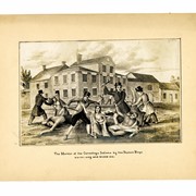
Photograph of the lithograph, "The Murder of the Conestoga Indians by the Paxton Boys. N.W. Cor. King and Prince Sts."
Description
Photograph of the lithograph, "The Murder of the Conestoga Indians by the Paxton Boys" northwest corner of King Street and Prince Street. This lithograph was created by T. Sinclair's Lith., Philadelphia, for the book, "Events in Indian History," by James Witmer which was published in Lancaster by G. Hills & Co. in 1841.
Papers regarding the Paxton Boys and the Conestoga Massacre (MG0614)
George Steinman Papers, Series 1 (MG0184_S01) https://collections.lancasterhistory.org/en/permalink/786b3ffc-7908-40de-9362-817467455650
George Steinman Papers, Series 2 (MG0184_S02) https://collections.lancasterhistory.org/en/permalink/6c7e11c6-f3ca-469c-891a-145832196710
Notes
Preferred Citation: Title or description of item, date (day, month, year), George Steinman Papers (MG0184), Series 2, Object ID, LancasterHistory, Lancaster, Pennsylvania. URL if applicable. Date accessed (day, month, year).
Access Conditions / Restrictions
Please use digital images and transcriptions when available. Original documents may be used by appointment--contact Research@LancasterHistory.org prior to visit.
Copyright
Images have been provided for research purposes only. Please contact Research@LancasterHistory.org for a high-resolution image and permission to publish.
LancasterHistory retains the rights to the digital images and content presented. The doctrine of fair use allows limited use of copyrighted material without permission from the copyright holder. Fair use includes comment, criticism, teaching, and private scholarship. Any images and data downloaded, printed or photocopied for these purposes should provide a citation. All other uses beyond those allowed by fair use require written permission.
Permission for reproduction and/or publication must be obtained in writing from LancasterHistory. Persons wishing to publish any material from this site must assume all responsibility for identifying and satisfying any claimants of copyright or other use restrictions. Publication fees may apply.
Credit
Courtesy of LancasterHistory, Lancaster, Pennsylvania.
Other Numbers
MG-184, Series 2
Other Number
MG-184, Series 2, Folder 16, Item 17
Classification
MG0184
Description Level
Item
Custodial History
Added to database 12 September 2023.
Digitization of this document was funded by the Pennsylvania Historical and Museum Commission, PHMC Appl ID # C980002119, 2021-2024.
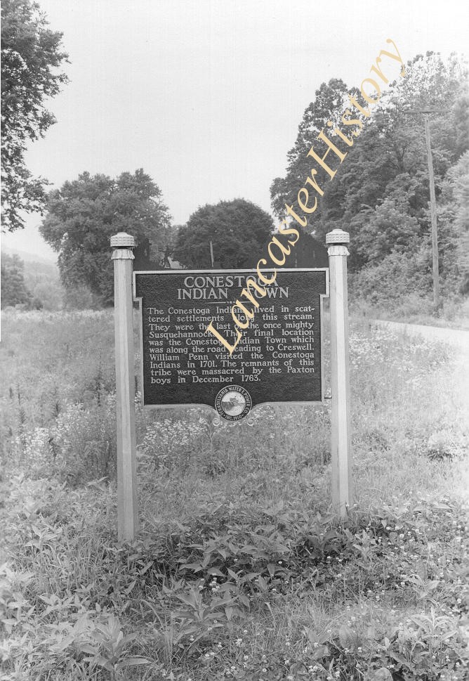
Historic marker placed by Pennsylvania Water and Power Company near Safe Harbor. Conestoga Indian Town. The Conestoga Indians lived in sacttered settlements along this stream. They were the last of the once mighty Susquehannocks. Their f
Historic marker placed by Pennsylvania Water and Power Company near Safe Harbor. Conestoga Indian Town. The Conestoga Indians lived in sacttered settlements along this stream. They were the last of the once mighty Susquehannocks. Their f
Description
Historic marker placed by Pennsylvania Water and Power Company near Safe Harbor. "Conestoga Indian Town. The Conestoga Indians lived in sacttered settlements along this stream. They were the last of the once mighty Susquehannocks. Their final location was the Conestoga Indian Town which was along the road leading to Creswell. William Penn visited the Conestoga indians in 1701. The remnants of this tribe were massacred by the Paxton boys in December 1763."
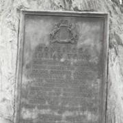
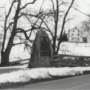
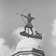
Boulder and bronze tablet at the site of Conestoga Indian Town. The town was located on the road from Letort to Safe Harbor in Manor Township between the years of 1682 and 1763. Monument erected in 1924.
Provenance
Album of historical markers erected by the Lancaster County Historical Society, compiled by George L. Heiges in 1986.
Historic marker placed by the Pennsylvania Water and Power Corporation near Safe Harbor.
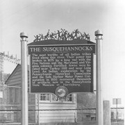
The Susquehannocks. The most warlike of all Indian tribes lived along this river. Thier power was broken in 1675 by a long war with the Five Natio
Description
Historic marker placed by the Pennsylvania Water and Power Corporation near Safe Harbor:
"The Susquehannocks. The most warlike of all Indian tribes lived along this river. Thier power was broken in 1675 by a long war with the Five Nations, and the Maryland and Virginia colonies. Fortified towns were located near Turkey Hill and near Long Level. An Indian exploration by the Pennsylvania Historical Commission and the Safe Harbor Water Power Corporation in 1930 recovered thousands of artifacts, now in the Pennsylvania State Museum at Harrisburg."
Historic marker placed by Pennsylvania Water and Power Company near Safe Harbor.
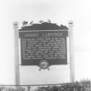
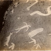
Indian Carvings. Petroglyphs, dating back to the original Algonquin Indians who lovedin this vicinity, can be seen on the Big and Little Indian Rocks in the
Historic marker placed by Pennsylvania Water and Power Company near Safe Harbor.
Indian Carvings. Petroglyphs, dating back to the original Algonquin Indians who lovedin this vicinity, can be seen on the Big and Little Indian Rocks in the
Description
Historic marker placed by Pennsylvania Water and Power Company near Safe Harbor.
"Indian Carvings. Petroglyphs, dating back to the original Algonquin Indians who lovedin this vicinity, can be seen on the Big and Little Indian Rocks in the river bed 800 feet downstream. Other rock carvings, now submerged, were found on Walnut Island and near Creswell above the dam. These were preserved by plaster casts made by the Pennsylvania Historical Commission in 1930."
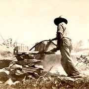
These old photos taken back in the early 1930s prior to the closure of the dam at Safe Harbor are on Indian petrographs on rocks that later were submerged in the Susquehanna River. These are presented to the LCHS by Brig. Gen. Richard B. Nissley, 1117 Wheatland Ave., Lancaster.
He says they were taken by his scoutmaster when Gen. Nissley was a Boy Scout.