Skip header and navigation

Revise Search

10 records – page 1 of 1.

Corporate Author
Reading Company. Office of the Chief Engineer.
Date of Publication
1934.
Call Number
912.74 100
Corporate Author
Reading Company. Office of the Chief Engineer.
Place of Publication
[S.l.]
Publisher
The Office,
Date of Publication
1934.
Physical Description
1 map : ink drawing ; 55 x 71 cm.
Notes
"H.L.L." in margin.
Scale 1" = 9 miles.
Summary
Shows Reading Company owned, leased and operated lines in Connecticut, New York, New Jersey, Pennsylvania, Delaware, with an inset for Virginia and Maryland.
Shows the Central Railroad Company of New Jersey lines.
Shows other lines in which Reading Company has a substantial stock ownership.
Subjects
Railroads - Connecticut - Maps.
Railroads - New York (State) - Maps.
Railroads - New Jersey - Maps.
Railroads - Pennsylvania - Maps.
Railroads - Delaware - Maps.
Railroads - Maryland - Maps.
Railroads - Virginia - Maps.
Railroads.
Connecticut.
Delaware.
Maryland.
New Jersey.
New York (State)
Pennsylvania.
Virginia.
Maps.
Location
Lancaster History Library - Map
Call Number
912.74 100
Less detail

Road map of Lancaster County

https://collections.lancasterhistory.org/en/permalink/lhdo7516
Corporate Author
Lancaster Automobile Club, Inc.
Date of Publication
[1930-1953]
Call Number
974.815 LACO 100
Responsibility
compiled by the Lancaster Automobile Club, Inc.
Corporate Author
Lancaster Automobile Club, Inc.
Place of Publication
Washington, DC
Publisher
American Automobile Association ,
Date of Publication
[1930-1953]
Physical Description
6 maps : col. ; on sheets 42 x 46 cm. folded to 21 x 12 cm.
Notes
8104, 8104 A, 8104 B, 8104 C, 8104 E-1, 8104-D.
Contents
Insets : Columbia, Pa. and Lancaster, Pa.
Subjects
Roads - Pennsylvania - Lancaster County - Maps.
Lancaster County (Pa.) - Maps.
Coumbia (Pa.) - Maps.
Lancaster (Pa.) - Maps.
Additional Corporate Author
American Automobile Association.
Location
Lancaster History Library - Map
Call Number
974.815 LACO 100
Less detail

Map of the public roads in Lebanon County, Pennsylvania : constructed from actual surveys made under direction of the Department of Highways, by authority of an Act of Assembly approved May 31, 1911

https://collections.lancasterhistory.org/en/permalink/lhdo20365
Corporate Author
Pennsylvania. Dept. of Highways.
Edition
Rev. Feb. 1931.
Date of Publication
1931.
Call Number
Under Review
Corporate Author
Pennsylvania. Dept. of Highways.
Edition
Rev. Feb. 1931.
Place of Publication
[Harrisburg]
Publisher
Pennsylvania Department of Highways,
Date of Publication
1931.
Physical Description
1 map : col. ; 68 x 73 cm.
Notes
Map includes route numbers, railroads, streams, and important building locations.
Oriented with north toward top.
"March 1, 1914."
Subjects
Transportation - Pennsylvania - Lebanon County - Maps.
Railroads - Pennsylvania - Lebanon County - Maps.
Roads - Pennsylvania - Lebanon County - Maps.
Lebanon County (Pa.) - Maps.
Location
Lancaster History Library - To be Reviewed
Call Number
Under Review
Less detail

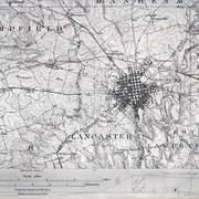
Map of the public roads in Lancaster County, Pennsylvania : constructed from actual surveys made under direction of the State Highway Department by authority of an Act of Assembly approved May 31, 1911

https://collections.lancasterhistory.org/en/permalink/lhdo15375
Corporate Author
Pennsylvania. Dept. of Highways.
Edition
Rev. Feb. 1931.
Date of Publication
1931.
Call Number
974.815 LACO 514 Oversize
Corporate Author
Pennsylvania. Dept. of Highways.
Edition
Rev. Feb. 1931.
Place of Publication
[Harrisburg, Pa.]
Publisher
Pennsylvania Dept. of Highways,
Date of Publication
1931.
Physical Description
1 map : col. ; 116 x 114 cm.
Notes
Map includes route numbers, railroads, streams, and important building locations.
"January 1912."
Subjects
Transportation - Pennsylvania - Lancaster County - Maps.
Railroads - Pennsylvania - Lancaster County - Maps.
Lancaster County (Pa.) - Maps.
Location
Lancaster History Library - Map
Call Number
974.815 LACO 514 Oversize
Less detail
Collection
Darmstaetter Collection
Title
Photograph- Plan for South East Ward.
Object ID
D-07-03-39
Date Range
1931/05/25
  1 image  
Object Name
Negative
Collection
Darmstaetter Collection
Title
Photograph- Plan for South East Ward.
Description
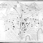
Plan for South East Ward also showing 1 drawing each of Odd Fellows Hall, Residence of Mrs. S. A. Porter, H. Leamans Rifle Works, Residence of Clement B. Grubb, German Reformed Church, Residence of Emanuel C. Reigard, Esq., and Residence of E. C. Darlington, Esq.. Locations of buildings are noted. 1 print only
Date Range
1931/05/25
Year Range From
1931
Storage Location
LancasterHistory, Lancaster, PA
People
Porter, Mrs. S. A.
Leaman, H.
Grubb, Clement B.
Reigard, Emanuel C.
Darlington, E. C.
Studio
Darmstaetter's
Subcategory
Documentary Artifact
Classification
Maps
Business & Commerce
Church Exterior
Civic Associations
Dwellings
Place
Lancaster
Object Name
Negative
Film Size
8 x 10 inches
Object ID
D-07-03-39
Negative Number
yes
Other Number
735-404
Images
Less detail
Collection
Darmstaetter Collection
Title
Photograph- Plan for South East Ward.
Object ID
D-07-03-38
Date Range
1931/05/25
  1 image  
Object Name
Negative
Collection
Darmstaetter Collection
Title
Photograph- Plan for South East Ward.
Description
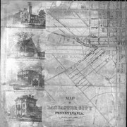
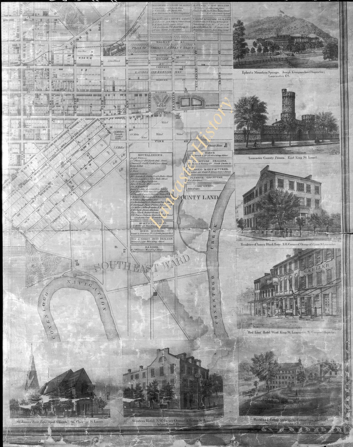
Plan for South East Ward, also showing 1 drawing each of St. James Free Episcopal Church, Western Hotel, Rockland Cotton Mill, Red Lion Hotel, Residence of James Black, Esq., Lancaster County Prison, Ephrata Mountain Springs--locations of buildings are noted. 1 print only
Date Range
1931/05/25
Year Range From
1931
Storage Location
LancasterHistory, Lancaster, PA
People
Black, James
Studio
Darmstaetter's
Subcategory
Documentary Artifact
Classification
Maps
Business & Commerce
Church Exterior
Dwellings
Government & Politics
Place
Lancaster
Object Name
Negative
Film Size
8 x 10 inches
Object ID
D-07-03-38
Negative Number
yes
Other Number
735-404
Images
Less detail
Collection
Darmstaetter Collection
Title
Photograph- Plan of North West Ward.
Object ID
D-07-03-37
Date Range
1931/05/25
  1 image  
Object Name
Negative
Collection
Darmstaetter Collection
Title
Photograph- Plan of North West Ward.
Description
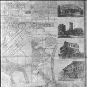
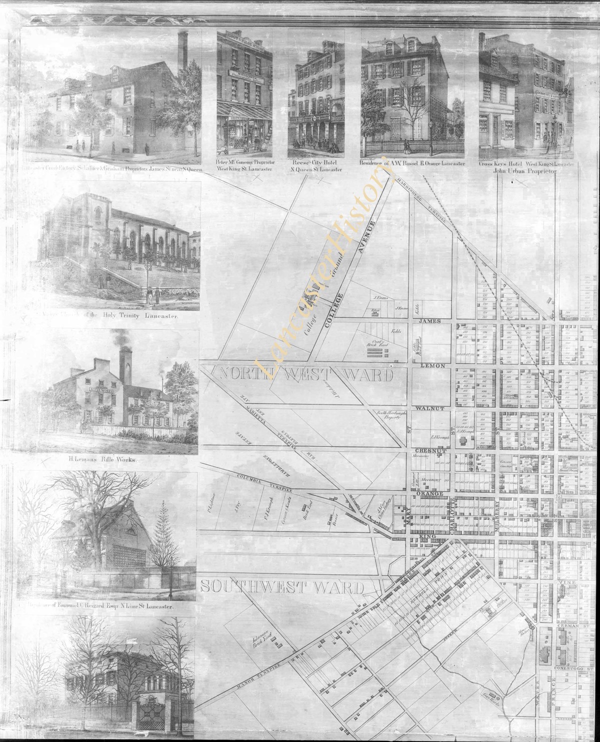
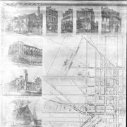
Plan of North West Ward also showing 1 drawing each of Cross Keys Hotel, Residence of A. W. Russel, Reese's City Hotel, McConomy Store, Lancaster Coach Factory, Lutheran Church of the Holy Trinity, H. Logman's (?) Rifle Works, Residence of Emanuel C. Reigard, Esq., and 1 unidentified building. Locations of buildings are noted. 1 print only
Date Range
1931/05/25
Year Range From
1931
Storage Location
LancasterHistory, Lancaster, PA
People
Russel, A. W.
Reigart, Emanuel C.
Studio
Darmstaetter's
Subcategory
Documentary Artifact
Classification
Maps
Business & Commerce
Dwellings
Church Exterior
Place
Lancaster
Object Name
Negative
Film Size
8 x 10 inches
Object ID
D-07-03-37
Negative Number
yes
Other Number
735-404
Images
Less detail
Collection
Darmstaetter Collection
Title
Photograph- Map of Lancaster City and suburbs.
Object ID
D-07-03-29
Date Range
1930/10/27
  1 image  
Object Name
Negative
Collection
Darmstaetter Collection
Title
Photograph- Map of Lancaster City and suburbs.
Description
Map of Lancaster City and suburbs. 1 print only
Date Range
1930/10/27
Year Range From
1930
Storage Location
LancasterHistory, Lancaster, PA
Studio
Darmstaetter's
Subcategory
Documentary Artifact
Classification
Maps
Place
Lancaster
Object Name
Negative
Film Size
7 x 5 inches
Object ID
D-07-03-29
Negative Number
yes
Other Number
721-1665
Images
Less detail
Collection
Darmstaetter Collection
Title
Photograph- Map showing Lancaster City, Lancaster Township, Hempfield Township, East and West Lampeter Townships.
Object ID
D-07-03-28
Date Range
1930/10/27
  1 image  
Object Name
Negative
Collection
Darmstaetter Collection
Title
Photograph- Map showing Lancaster City, Lancaster Township, Hempfield Township, East and West Lampeter Townships.
Description
Map showing Lancaster City, Lancaster Township, Hempfield Township, East and West Lampeter Townships. 1 print only
Date Range
1930/10/27
Year Range From
1930
Storage Location
LancasterHistory, Lancaster, PA
Studio
Darmstaetter's
Subcategory
Documentary Artifact
Classification
Maps
Place
Lancaster County
Object Name
Negative
Film Size
7 x 5 inches
Object ID
D-07-03-28
Negative Number
yes
Other Number
721-1665
Images
Less detail

Map of the public roads in Lancaster County, Pennsylvania / constructed from actual surveys made under the direction of the Department of Highways by authority of an act of assembly approved May 31, 1911

https://collections.lancasterhistory.org/en/permalink/lhdo5748
Date of Publication
1934.
Call Number
974.815 LACO 500 Oversize
Place of Publication
[Harrisburg]
Publisher
[s.n.] ,
Date of Publication
1934.
Physical Description
1 map ; 105 x 115 cm.
Notes
Map includes route numbers, railroads and streams.
"Maintenance District No. 7-3".
Blueprint.
Subjects
Roads - Pennsylvania - Maps.
Transportation - Pennsylvania - Maps.
Railroads - Pennsylvania - Lancaster County - Maps.
Location
Lancaster History Library - Map
Call Number
974.815 LACO 500 Oversize
Less detail

10 records – page 1 of 1.