A review of the political conflict in America, from the commencement of the anti-slavery agitation to the close of southern reconstruction; comprising also a resume of the career of Thaddeus Stevens: being a survey of the struggle of parties which destroyed the republic and virtually monarchized its government
Our first century: being a popular descriptive portraiture of the one hundred great and memorable events of perpetual interest in the history of our country, political, military, mechanical, social, scientific and commercial: embracing also delineations of all the great historic characters celebrated in the annals of the republic; men of heroism, statesmanship, genius, oratory, adventure and philanthropy
The English pilot: describing the sea-coasts, capes, headlands, streights, soundings, sands, shoals, rocks and dangers. The bays, roads, harbours and ports. In the Oriental navigation: shewing the property ande nature of the winds and monsoons in those seas; with the courses and distances frtom one place to another; the setting of the tides and currents; the ebbing and flowing of the sea. Also, a new talble of variations; and a correct table of longitudes and latitudes. With many other things necessary to be known. Containing several large draughts of ports, islands, and descriptions; collected from the practice and experience of divers able and expert navigators of our own and foreign nations
Printed for W. and J. Mount, T. Page and son, on Tower-Hill,
Date of Publication
1761.
Physical Description
70 p, [43] leaves of plates (some folded) : ill, maps; 51 cm.
Notes
Divided into three parts. the first, shewing the nature and properties of the winds and monsoons in the navigation from England to the East-Indies, and the whole Oriental Ocean, and thereby how to shape a course from one port to another, according to the time of year in those seas. The second, containing necessry instructions for sailing between England and the East-Indies, in the spring and autumn. The third, describing the sea-coasts, capes, headlands, streights, soundings, shoals, rocks and dangers. The islands, bays, roads, harbours and ports from Cape Bona-Esperance, to all parts of the Oriental Ocean, being corrected and augmented, with several additions, not before publish'd.
Depths shown by soundings.
Includes charts, coastal profiles, illustrations, maps, and plans.
All pages tipped in.
Jasper Yeates's Colonial Law Library.
Signature of Jasper Yeates at top of title page, 1766.
Book Number 1 as arranged by Yeates
Mount, John,
Full blind-tooled leather binding; covers loose repaired with leather strips top and bottom
Contents
Charts: [1] A new map of the world according to Wrights alias Mercators projections &cc --[2] A new and correct chart of England Scotland and Ireland -- [3] A correct chart of the chanel between England and France -- [4] A large draught of the Isle of Wight and Owers -- [5] A new and correct large draught of Plymouth Sound Catt-water and Hamowse --[6] A chart of the coasts of Ireland and part of England -- [7] A chart of the sea coast from England to the Streights -- [8] A correct chart of the coast of Portugal & Barbaria -- [ 9] A chart of the coast of Guinea from Cape de Verd to Cape Bona Esperança -- [10] A general chart from England to Cape Bona Esperance with the coast of Brasille -- [11] A draught of Cape Bona Esperanca -- [12] A new mappe of Saint Hellena -- [13] A draught of the south part of Africa from Cape Bona Esperance to Delagoa -- [14] A chart of the western part of the East-Indies -- [15] A new draught of the island of Madagascar ats St. Lorenzo with Augustin Bay and the island of Bombals at large -- [16] The lslnad of Diego Rays, latitude South 19°.40¹ -- [17] A chart of the island of Mauritius -- [18] A chart of the Striats of Babelmandell and Moha -- [19] A large draught of the coast of Arabia from Maculla to Dofar -- [20] A large draught of the Golf of Persia -- [21] A large chart of part of the coast of Guzaratt & India from Diu Head to Bombay -- [22] A new mapp of the island of Bombay and Sallset -- [23] A large draught of part of the coast of India from Bombay to Bassalore -- [24] A large draught of the Mallabar coast from Bassalore to Cape Comaroone -- [25] A new mapp of the island of Zeloan -- [26] A large chart of part of the coast of Coremandell from Point Pedro to Armegon -- [27] A new chart of part of the coast of Coremandell from Armegon to Binnlepatam -- [28] A new chart of the coast of Orixa and Galconda --[29] A new and correct chart shewing the goeing over the Braces with the sands shoals depth of water and anchorage from Point Palmiras to Hughley in the Bay of Bengall -- [30] A map of the River English in the Bay of Delagoa -- [31] A new and correct chart, shewing the sands, shoals, mud-banks, depth of water & anchorage. With the going of the Braces, from P. Palmiras to Calcutta in the Hughley in the Bay of Bengall -- [32] A mapp of the great River Ganges as it emptieth it selfe in the Bay of Bengala -- [33] A chart of the easternmost part of the East Indies and China, from Cape Comarine to Iapan, with all the adjacents islands -- [34] A new and corrrect chart of Mergui with the islands adjacent & shewing the sands, shoalds, banks depths of water and anchorage &c. -- [35] A new and correct chart of part of the island of Java from the West End to Batavia with the Streights of Sunda -- [36] A large draught of the coast of Iava from Bantam Point to Batavia -- [37] A large draught of the east end of Java and Madura shewing the Streights of Bally -- [38] A large chart describing streights of Malacca and Singapore -- [39] A large draught of the coast of China from Amoye to Chusan with the harbour of Amoye at large -- [40] A large draught of the north part of China shewing all the passages and channels into the harbour of Chusan -- [41] A large draught from Benjar on the island of Borneo to Macasser on the island of Celebes shewing the streights of Bally with the islands to the eastward thereof -- [42] A large draught of the south part of Borneo -- [43] A draught of the coast of New Holland and parts adjacent.
A history of the origin of the appellation Keystone State as applied to the commonwealth of Pennsylvania : together with extracts from many authorities relative to the adoption of the Declaration of Independence by the Continental Congress, July 4th, 1776 ; to which is appended the New Constitution of Pennsylvania with an alphabetical contents
First edition, covering only the years 1774-1776, published in Philadelphia by the same editor in 1839.
Summary
From The History Society of Pennsylvania: Christopher Marshall was born in Dublin, Ireland, on November 6, 1709. He was educated in England and sailed to America sometime in the late 1720s. By 1729, he had established a pharmacy shop in Philadelphia, Pennsylvania. His success as a pharmacist and chemist allowed him to retire from business in 1774, but he remained a vital public figure. In 1776, he became a delegate to the Philadelphia Provincial Council, and he was twice appointed to the Continental Committee of Council and Safety. His retirement afforded him the time to keep diaries of public and personal events. He wrote these "remembrances" almost daily from about 1774 to at least 1795. In 1777, Marshall relocated to Lancaster, Pennsylvania, to improve his health and to avoid the British armies. After hostilities ceased, Marshall moved back to Philadelphia where he died on May 7, 1797.
This collection contains documents beginning with the American Revolution and continuing through the War of 1812, Mexican War, Civil War, World War I, World War II, and the Korean War. There are account books, notes and written letters, vouchers, inspections of camps, receipts of payments, honorable discharge certificates, lists of absentees, envelopes used during the Civil War, and lists of unpaid fines during the service of the Pennsylvania Militia soldiers. There are also newsletters and articles relating to World Wars I and II and the Korean War for advertisement and description of items including the history of the Philadelphia Naval Base.
Votes and proceedings of the House of Representatives of the province of Pennsylvania : met at Philadelphia, on the fourteenth of October, anno Domini, 1767, and continued by adjournments
The underground railroad. A record of facts, authentic narratives, letters, &c., narrating the hardships, hair-breadth escapes and death struggles of the slaves in their efforts for freedom, as related by themselves and others, or witnessed by the author; together with sketches of some of the largest stockholders, and most liberal aiders and advisers, of the road
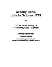
The Revolutionary War Collection contains a variety of materials from and about the Revolutionary War in Lancaster County and Pennsylvania. The original records include correspondence, military pay certificates, court records, and an orderly book kept by Lt. Col. Adam Hubley, Jr. during the Sullivan Campaign of 1779. There are also research notes and secondary sources, including a list of prisoners of war, a list of males in Lancaster County in 1776, Continental Hospital Returns 1777-1780, articles, information on soldiers buried in Lancaster County, and an article about John Paul Jones.
Harmful Language Warning: LancasterHistory is committed to preserving and providing access to materials chronicling Lancaster County's heritage. As a historical resource, this orderly book reflects the racial prejudices of the era and the violence perpetrated against the Haudenosaunee Confederacy during the American War of Independence. In order to maintain the historical integrity and context of collection items, LancasterHistory does not censor historical documents or edit language, titles, or organization names when transcribing original content. This volume contains language that is offensive, oppressive, graphic, and may cause distress. LancasterHistory does not condone the use of this language.
Access Conditions / Restrictions
No restrictions. Please use digital images and transcriptions when available.
Copyright
Collection may not be photocopied. Please direct questions to Research Center Staff at research@lancasterhistory.org.Images have been provided for research purposes only. Please contact research@lancasterhistory.org for a high-resolution image and permission to publish.
LancasterHistory retains the rights to the digital images and content presented. The doctrine of fair use allows limited use of copyrighted material without permission from the copyright holder. Fair use includes comment, criticism, teaching, and private scholarship. Any images and data downloaded, printed or photocopied for these purposes should provide a citation. All other uses beyond those allowed by fair use require written permission.
Permission for reproduction and/or publication must be obtained in writing from LancasterHistory. Some items are photocopies from other collections--researchers must obtain permission for reproduction and publication from the owner of the original material.
Persons wishing to publish any material from this site must assume all responsibility for identifying and satisfying any claimants of copyright or other use restrictions. Publication fees may apply.