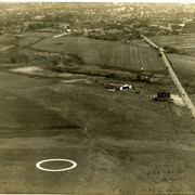
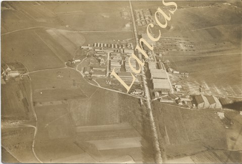
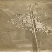
Aerial view of Lancaster Airport. Written on back: "Lancaster Airport, Manheim Pike, 1 mile from city. Taken at 1,000 ft altitude by W. F. Hallowell. Pilot Paul Schlotzhauer."
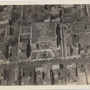
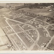
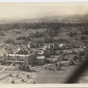
Photograph- Aerial view of Lancaster Boys' High School. Shreiner's Cemetery is just behind the school. Also shows St. John's Reformed Church. All are on West Orange Street.
Photograph- Aerial view of Lancaster Boys' High School. Shreiner's Cemetery is just behind the school. Also shows St. John's Reformed Church. All are on West Orange Street.
Description
Aerial view of Lancaster Boys' High School. Shreiner's Cemetery is just behind the school. Also shows St. John's Reformed Church. All are on West Orange Street.
Provenance
Donated by Jessie Jones Eckhart, daughter of pilot Jesse Jones of Lancaster.