Collection contains the research materials of R. Harold Barton on the mills and bridges of Lancaster County. Included are field notes, working papers, photographer's negatives, and postcards. Indexes are available listing mills by name and location, and bridges by name.
Four notebooks are the finished product of the mills and bridges research of R. Harold Barton. These notebooks are in the library under Barton, R. Harold on the online catalog (LC621.85, B283, v.1-v.4). The notebooks constitute 1 cubic ft. of the collection.
The remaining six boxes are located within the manuscript collection. These boxes house working papers, field notes, worksheets, notebooks, photographs, negatives, additional albums of photographs and other miscellaneous material relating to Lancaster County bridges and mills.
Mr. Barton uses a numerical system to locate bridges and mills by township or by the names of the streams, rivers, runs and creeks. Three indexes have been prepared: one lists the bridges by name, one the location by town or townships, and one the names of the mills.
There are a few notes related to Lancaster County gunsmiths, missionaries, and Indian traders.
System of Arrangement
Collection is arranged by township, number, and index.
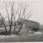
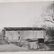
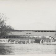
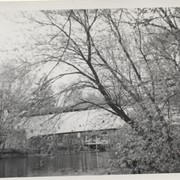
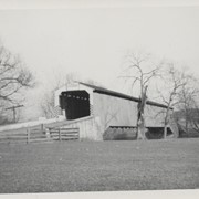
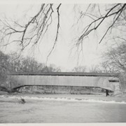
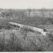
Isaac Shearer's Mill covered bridge, one mile north of Goodville in Caernarvon Township. County maintained on road T-773, built 1878, single span 88 feet long.
Isaac Bear's Mill covered bridge, one mile southwest of Martindale in East Earl Township. County maintained on road T-674, built in 1876, single span 94 feet long.
Martin's Mill, also known as Fiences Mill or Eberly's Mill, two miles south of Murrell in West Earl Township. State supervised on road LR 36122, built in 1846, single span 98.5 feet long. Also called Bitzer's Mill.
Bushong's Mill, near Oregon between Upper Leacock and Manheim Townships. State supervised on road LR 36009, built in 1843, longest single span in the county, 195 feet long.
Nolt's Point Mill, close to William Shand's residence, .5 mile south of Oregon between Upper Leacock and Manheim Townships. County maintained on road T-620, built in 1867, single span 133 feet long. A beautiful stone bridge is close by.
Hunsecker's Mill covered bridge, between Manheim and Upper Leacock Townships. State supervised on road LR 36011, built in 1848, single span 180 feet long. Destroyed during Hurricane Agnes in June 1972, rebuilt.
Isreal Groff's Factory or Umble's Mill at Waters Edge, .5 mile south of Eden between Manheim and East Lampeter Townships. State supervised on road LR 36183, built in 1848, single span 158 feet long.
Snavely's Mill, second lock of the Slackwater Canal, south of Lancaster city, between Lancaster and Pequea Townships. County maintained on road T-504, built in 1857 (first bridge 1836, second bridge 1850), longest bridge in Lancaster County, double span 349 feet long. Destroyed by fire in the 1960s.