Skip header and navigation

Revise Search

10 records – page 1 of 1.

A prologue to the construction of the fifth Columbia-Wrightsville Bridge

https://collections.lancasterhistory.org/en/permalink/lhdo1819
Author
Newcomer, L. W.
Date of Publication
1971.
A Prologue to the Construction of the Fifth Columbia- Wrightsville Bridge by L. W. Newcomer 
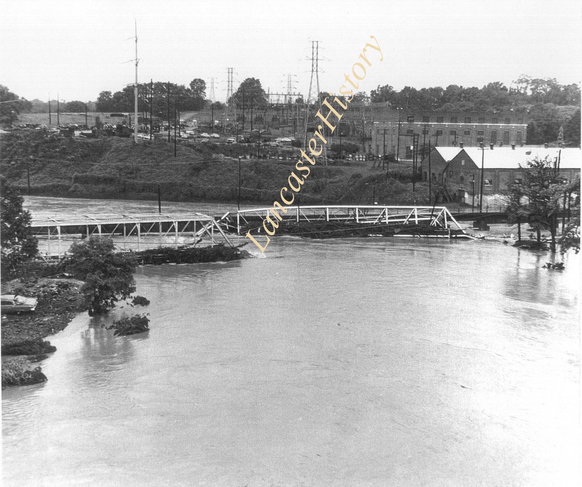
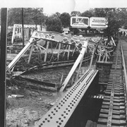
Construction of the fifth Columbia-Wrightsville bridge across the Susquehanna River is described, and recorded for posterity, in the Journal of The Lancaster County Historical Society, Vol. 73, No. 1, 1969
  1 document  
Responsibility
by L. W. Newcomer.
Author
Newcomer, L. W.
Place of Publication
Lancaster, Pa
Publisher
Lancaster County Historical Society,
Date of Publication
1971.
Physical Description
[119]-124 p. ; 23 cm.
Series
Journal of the Lancaster County Historical Society ; v. 75, no. 3
Subjects
Bridges - Pennsylvania - Lancaster County.
Bridges
Columbia-Wrightsville Bridge (Lancaster County, Pa.)
Lancaster County (Pa.) - Politics and government.
York County (Pa.) - Politics and government.
Contained In
Journal of the Lancaster County Historical Society. Volume 75, number 3 (1971), p. 119-124Lancaster History Library - Journal974.9 L245 v.75
Documents

edit_vol75no3pp119_124.pdf

Read PDF Download PDF
Less detail
Collection
General Collection
Title
Photograph- Bell Bank covered bridge across the Octoraro Creek four miles south of Nine Points, between Colerain Township, Lancaster County and Upper Oxford Township, Chester County.
Object ID
1-09-03-45
Date Range
September 1956
  1 image  
Object Name
Print, Photographic
Collection
General Collection
Title
Photograph- Bell Bank covered bridge across the Octoraro Creek four miles south of Nine Points, between Colerain Township, Lancaster County and Upper Oxford Township, Chester County.
Description
Bell Bank covered bridge across the Octoraro Creek four miles south of Nine Points, between Colerain Township, Lancaster County and Upper Oxford Township, Chester County.
Provenance
Lancaster County covered bridge photos taken by M. E. Schroll and Kathryn L. Sauder taken between 1956 and 1958.
Date Range
September 1956
Storage Location
LancasterHistory, Lancaster, PA
Subcategory
Documentary Artifact
Search Terms
Bell Bank Covered Bridge
Bell Bank, Colerain Twp.
Bridges
Covered bridges
Creeks
Octoraro Creek, East Branch
Upper Oxford Twp., Chester County, Pennsylvania
Object Name
Print, Photographic
Print Size
3.5 x 3.5 inches
Condition
Good
Object ID
1-09-03-45
Images
Less detail
Collection
General Collection
Title
Photograph- Bell Bank covered bridge on the Octoraro Creek between Colerain Township, Lancaster County and Upper Oxford Township, Chester County.
Object ID
1-09-03-46
Date Range
August 4,1958
  1 image  
Object Name
Print, Photographic
Collection
General Collection
Title
Photograph- Bell Bank covered bridge on the Octoraro Creek between Colerain Township, Lancaster County and Upper Oxford Township, Chester County.
Description
Bell Bank covered bridge on the Octoraro Creek between Colerain Township, Lancaster County and Upper Oxford Township, Chester County.
Provenance
Lancaster County covered bridge photos taken by M. E. Schroll and Kathryn L. Sauder taken between 1956 and 1958.
Date Range
August 4,1958
Storage Location
LancasterHistory, Lancaster, PA
Subcategory
Documentary Artifact
Search Terms
Bell Bank Covered Bridge
Bell Bank, Colerain Twp.
Bridges
Covered bridges
Creeks
Octoraro Creek, East Branch
Upper Oxford Twp., Chester County, Pennsylvania
Object Name
Print, Photographic
Print Size
3.5 x 3.5 inches
Condition
Good
Object ID
1-09-03-46
Images
Less detail
Collection
General Collection
Object ID
1-09-03-87
Date Range
August 1956
  1 image  
Object Name
Print, Photographic
Collection
General Collection
Description
Wabank Mill Bridge, also called Third Lock Bridge, on the Conestoga River between Lancaster and Pequea townships.
Provenance
Lancaster County covered bridge photos taken by M. E. Schroll and Kathryn L. Sauder taken between 1956 and 1958.
Date Range
August 1956
Storage Location
LancasterHistory, Lancaster, PA
Subcategory
Documentary Artifact
Search Terms
Bridges
Conestoga River
Covered bridges
Creeks
Lancaster Twp.
Mills
Pequea Twp.
Third Lock Bridge
Wabank Mill
Wabank Mill Bridge
Object Name
Print, Photographic
Print Size
3.5 x 3.5 inches
Condition
Good
Object ID
1-09-03-87
Images
Less detail
Collection
General Collection
Object ID
1-09-03-88
Date Range
August 7, 1958
  1 image  
Object Name
Print, Photographic
Collection
General Collection
Description
Wabank Mill bridge, also called Third Lock bridge, on the Conestoga River between Lancaster and Pequea townships. This bridge was replaced by a road relocation in 1958.
Provenance
Lancaster County covered bridge photos taken by M. E. Schroll and Kathryn L. Sauder taken between 1956 and 1958.
Date Range
August 7, 1958
Storage Location
LancasterHistory, Lancaster, PA
Subcategory
Documentary Artifact
Search Terms
Bridges
Conestoga River
Covered bridges
Creeks
Lancaster Twp.
Mills
Pequea Twp.
Third Lock Bridge
Wabank Mill
Wabank Mill Bridge
Object Name
Print, Photographic
Print Size
3.5 x 3.5 inches
Condition
Good
Object ID
1-09-03-88
Images
Less detail
Collection
General Collection
Title
Photograph- Pine Grove covered bridge across the Octoraro Creek, between Little Britain Township, Lancaster County, and Lower Oxford Township, Chester County. Location of pumping station which supplies Chester.
Object ID
1-09-03-47
Date Range
September 1956
  1 image  
Object Name
Print, Photographic
Collection
General Collection
Title
Photograph- Pine Grove covered bridge across the Octoraro Creek, between Little Britain Township, Lancaster County, and Lower Oxford Township, Chester County. Location of pumping station which supplies Chester.
Description
Pine Grove Covered Bridge across the Octoraro Creek, between Little Britain Township, Lancaster County, and Lower Oxford Township, Chester County. Location of pumping station which supplies Chester.
Provenance
Lancaster County covered bridge photos taken by M. E. Schroll and Kathryn L. Sauder taken between 1956 and 1958.
Date Range
September 1956
Storage Location
LancasterHistory, Lancaster, PA
Subcategory
Documentary Artifact
Search Terms
Bridges
Chester County, Pennsylvania
Covered bridges
Creeks
Little Britain Twp.
Octoraro Water Company
Pine Grove Covered Bridge
Pumping stations
Object Name
Print, Photographic
Print Size
3.5 x 3.5 inches
Condition
Good
Object ID
1-09-03-47
Images
Less detail
Collection
General Collection
Object ID
2-05-11-13
Date Range
June 1972
  1 image  
Object Name
Print, Photographic
Collection
General Collection
Description
Flood after Hurricane Agnes at Engleside, showing destroyed bridge, landscape in background
Date Range
June 1972
Storage Location
LancasterHistory, Lancaster, PA
Subcategory
Documentary Artifact
Search Terms
Engleside, Lancaster Twp.
Floods
Bridges
Conestoga River
Hurricane Agnes
Place
Lancaster
Object Name
Print, Photographic
Print Size
11 x 8.5 inches
Object ID
2-05-11-13
Images
Less detail
Collection
General Collection
Object ID
2-07-04-42
Date Range
June 1972
  1 image  
Object Name
Print, Photographic
Collection
General Collection
Description
Flooding at Engleside after hurricane Agnes, showing damaged bridge.
Date Range
June 1972
Creator
Bloomberg, Martin
Storage Location
LancasterHistory, Lancaster, PA
Subcategory
Documentary Artifact
Search Terms
Engleside, Lancaster Twp.
Bridges
Conestoga River
Railroads
Hurricane Agnes
Place
Lancaster
Object Name
Print, Photographic
Print Size
10 x 8 inches
Object ID
2-07-04-42
Images
Less detail
Collection
Lancaster 250 Collection
Object ID
A-08-01-14
Date Range
March 1975
  1 image  
Object Name
Print, Photographic
Collection
Lancaster 250 Collection
Description
A group of Lancaster friends pose before driving the last car over the Engleside Bridge before it was torn down and replaced.
Date Range
March 1975
Storage Location
LancasterHistory, Lancaster, PA
Subcategory
Documentary Artifact
Search Terms
Bridges
Automobiles
Cars
Engleside, Lancaster Twp.
Place
Lancaster Twp.
Object Name
Print, Photographic
Film Size
2.25 x 2.75 inches
Print Size
5 x 7 inches
Object ID
A-08-01-14
Negative Number
yes
Other Number
L-27
Images
Less detail
Collection
General Collection
Object ID
1-09-04-03
Date Range
August 5, 1958
  1 image  
Object Name
Print, Photographic
Collection
General Collection
Description
Zook's Mill covered bridge on the Cocalico Creek on Log Cabin Road west of Brownstown between West Earl and Warwick townships.
Provenance
Lancaster County covered bridge photos taken by M. E. Schroll and Kathryn L. Sauder taken between 1956 and 1958.
Date Range
August 5, 1958
Storage Location
LancasterHistory, Lancaster, PA
Subcategory
Documentary Artifact
Search Terms
Bridges
Brownstown, West Earl Twp.
Cocalico Creek
Covered bridges
Creeks
Log Cabin Road
Rose Hill Bridge
Warwick Twp.
West Earl Twp.
Zook's Mill
Object Name
Print, Photographic
Print Size
3.5 x 4.5 inches
Condition
Good
Object ID
1-09-04-03
Images
Less detail

10 records – page 1 of 1.