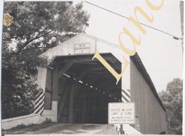
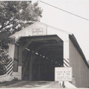
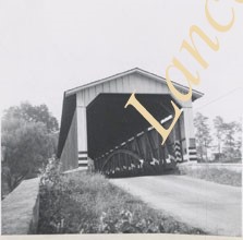
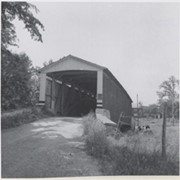
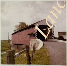
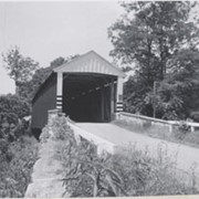
Hunsecker's Mill Bridge on the Conestoga River between Manheim and Upper Leacock townships. Destroyed by Hurricane Agnes, June 22, 1972 but rebuilt on the same site.
Provenance
Lancaster County covered bridge photos taken by M. E. Schroll and Kathryn L. Sauder taken between 1956 and 1958.
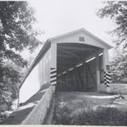
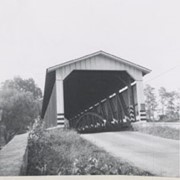
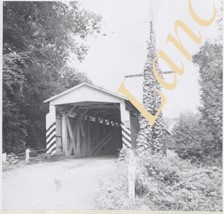
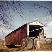
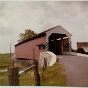
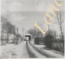
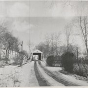
Covered bridge across the Conestoga Creek south of Oregon. Photo is identified as Raub's bridge, but is better known as Pinetown Bridge or Nolt's Point covered bridge.
Provenance
Lancaster County covered bridge photos taken by M. E. Schroll and Kathryn L. Sauder taken between 1956 and 1958.
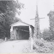
On the Conestoga Creek, Pinetown Road, south of Oregon. Bridge is identified as Raub's bridge but is better known as Pinetown Bridge or Nolt's Point covered bridge.
Provenance
Lancaster County covered bridge photos taken by M. E. Schroll and Kathryn L. Sauder taken between 1956 and 1958.
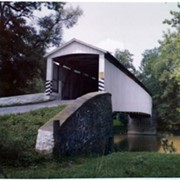
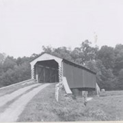
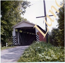
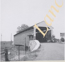
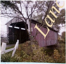
Photograph- Eshleman's Mill covered bridge across Pequea Creek, east of Paradise and Gordonville and north of Leaman Place, between Paradise and Leacock townships.
Photograph- Eshleman's Mill covered bridge across Pequea Creek, east of Paradise and Gordonville and north of Leaman Place, between Paradise and Leacock townships.
Description
Eshleman's Mill covered bridge across Pequea Creek, east of Paradise and Gordonville and north of Leaman Place, between Paradise and Leacock townships.
Provenance
Lancaster County covered bridge photos taken by M. E. Schroll and Kathryn L. Sauder taken between 1956 and 1958.
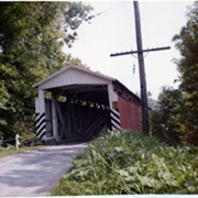
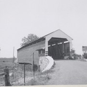
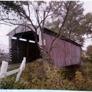
Photograph- Bell Bank covered bridge across the Octoraro Creek four miles south of Nine Points, between Colerain Township, Lancaster County and Upper Oxford Township, Chester County.
Photograph- Bell Bank covered bridge across the Octoraro Creek four miles south of Nine Points, between Colerain Township, Lancaster County and Upper Oxford Township, Chester County.
Description
Bell Bank covered bridge across the Octoraro Creek four miles south of Nine Points, between Colerain Township, Lancaster County and Upper Oxford Township, Chester County.
Provenance
Lancaster County covered bridge photos taken by M. E. Schroll and Kathryn L. Sauder taken between 1956 and 1958.