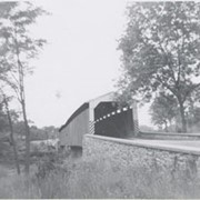
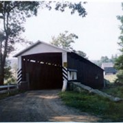
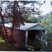
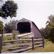
Photograph- Bell Bank covered bridge across the Octoraro Creek four miles south of Nine Points, between Colerain Township, Lancaster County and Upper Oxford Township, Chester County.
Photograph- Bell Bank covered bridge across the Octoraro Creek four miles south of Nine Points, between Colerain Township, Lancaster County and Upper Oxford Township, Chester County.
Description
Bell Bank covered bridge across the Octoraro Creek four miles south of Nine Points, between Colerain Township, Lancaster County and Upper Oxford Township, Chester County.
Provenance
Lancaster County covered bridge photos taken by M. E. Schroll and Kathryn L. Sauder taken between 1956 and 1958.
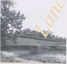
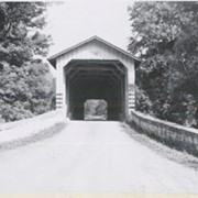
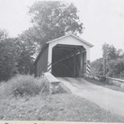
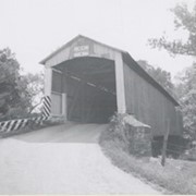
Photograph- Pine Grove covered bridge across the Octoraro Creek, between Little Britain Township, Lancaster County, and Lower Oxford Township, Chester County. Location of pumping station which supplies Chester.
Photograph- Pine Grove covered bridge across the Octoraro Creek, between Little Britain Township, Lancaster County, and Lower Oxford Township, Chester County. Location of pumping station which supplies Chester.
Description
Pine Grove Covered Bridge across the Octoraro Creek, between Little Britain Township, Lancaster County, and Lower Oxford Township, Chester County. Location of pumping station which supplies Chester.
Provenance
Lancaster County covered bridge photos taken by M. E. Schroll and Kathryn L. Sauder taken between 1956 and 1958.
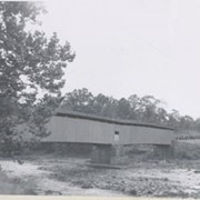
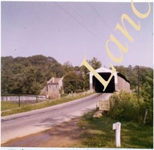
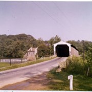
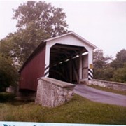
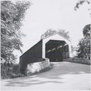
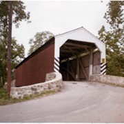
Photograph- Pine Grove covered bridge over the Octoraro Creek between Little Britain Township, Lancaster County and Lower Oxford Township, Chester County.
Photograph- Pine Grove covered bridge over the Octoraro Creek between Little Britain Township, Lancaster County and Lower Oxford Township, Chester County.
Description
Pine Grove Covered Bridge over the Octoraro Creek between Little Britain Township, Lancaster County and Lower Oxford Township, Chester County.
Provenance
Lancaster County covered bridge photos taken by M. E. Schroll and Kathryn L. Sauder taken between 1956 and 1958.
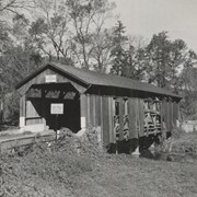
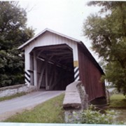
Hunsecker's Mill on the Conestoga east of Landis Valley between Manheim and Upper Leacock townships. Destroyed by Hurricane Agnes, June 22, 1972, but rebuilt.
Provenance
Lancaster County covered bridge photos taken by M. E. Schroll and Kathryn L. Sauder taken between 1956 and 1958.