Skip header and navigation

Revise Search

10 records – page 1 of 1.

Edition
Latest revision 1984.
Date of Publication
June 6, 1964.
Call Number
974.815 MART 501
Responsibility
compiled by Lancaster County Assessment Department.
Edition
Latest revision 1984.
Place of Publication
Lancaster, Pa
Publisher
Lancaster County Assessment Department ,
Date of Publication
June 6, 1964.
Physical Description
1 map ; 71 x 102 cm.
Notes
Appears in: Real Estate Atlas of Lancaster County, Pennsylvania (LC 333.33 R288 1981).
Blue line print.
Contents
Map 18K.
Subjects
Tax assessment - Pennsylvania - Lancaster County
Real property - Pennsylvania - Lancaster County
Lancaster County (Pa.) - Maps.
Martic (Pa. : Township) - Maps.
Providence (Pa. : Township) - Maps.
Location
Lancaster History Library - Map
Call Number
974.815 MART 501
Less detail
Date of Publication
[1960?].
Call Number
974.815 RAPH 501
Responsibility
compiled by Lancaster County Assessment Department.
Place of Publication
Lancaster, Pa
Publisher
Lancaster County Assessment Department
Date of Publication
[1960?].
Physical Description
1 map ; 71 x 102 cm.
Notes
Appears in: Real Estate Atlas of Lancaster County, Pennsylvania. (LC 333.33 R288 1981.
Blue line print.
Contents
Map 9F.
Subjects
Tax assessment - Pennsylvania - Lancaster County
Real property - Pennsylvania - Lancaster County
Landowners - Pennsylvania - Lancaster County
Lancaster County (Pa.) - Maps.
Mount Joy (Pa. : Township) - Maps.
Rapho (Lancaster County, Pa. : Township) - Maps.
Location
Lancaster History Library - Map
Call Number
974.815 RAPH 501
Less detail
Edition
Latest revision 1967.
Date of Publication
1962.
Call Number
974.815 MILL 500
Responsibility
compiled by Lancaster County Assessment Department.
Edition
Latest revision 1967.
Place of Publication
Lancaster, Pa
Publisher
Lancaster County Assessment Department ,
Date of Publication
1962.
Physical Description
1 map ; 71 x 102 cm.
Notes
Appears in: Real Estate Atlas of Lancaster County, Pennsylvania (LC 333.33 R288 1981).
Blue line print.
Contents
Map 14 H12.
Subjects
Tax assessment - Pennsylvania - Lancaster County
Real property - Pennsylvania - Lancaster County
Lancaster County (Pa.) - Maps.
Millersville (Pa.) - Maps.
Manor (Lancaster County, Pa. : Township) - Maps.
Location
Lancaster History Library - Map
Call Number
974.815 MILL 500
Less detail

1875 historical atlas of Lancaster County, Pennsylvania

https://collections.lancasterhistory.org/en/permalink/lhdo15911
Corporate Author
Everts and Stewart.
Date of Publication
1976.
Call Number
912.74815 E93
Responsibility
compiled, drawn, and published from personal examinations and surveys by Everts & Stewart.
Corporate Author
Everts and Stewart.
Place of Publication
Knightstown, IN
Publisher
Bookmark,
Date of Publication
1976.
Physical Description
xviii, 120 p. : ill., maps, ports. ; 43 cm.
Notes
Reprint of the 1875 ed. published by Everts and Stewart, Philadelphia under title: Combination atlas map of Lancaster County, Pennsylvania.
"Sponsored by the Lancaster County Historical Society, Lancaster, Pennsylvania."
Kept on top of counter-height shelving unit in Reading Room.
Subjects
Real property - Pennsylvania - Lancaster Co. - Maps.
Lancaster County (Pa.) - Maps.
Lancaster County (Pa.) - Directories.
Lancaster County (Pa.) - History.
Additional Corporate Author
Everts and Stewart.
Location
Lancaster History Library - Reference
Call Number
912.74815 E93
Less detail

Champion map of Lancaster, Pennsylvania, including a detailed map of Lancaster County

https://collections.lancasterhistory.org/en/permalink/lhdo15373
Corporate Author
Champion Map Corporation.
Date of Publication
[1977]
Call Number
974.815 LACI 522
Alternate Title
Map of Lancaster, Pennsylvania, city & county
Corporate Author
Champion Map Corporation.
Place of Publication
Charlotte, N.C
Publisher
Champion Map Corp.,
Date of Publication
[1977]
Physical Description
2 maps on 1 sheet : back to back, col. ; 60 x 50 cm. and 48 x 57 cm., folded to 23 x 11 cm.
Notes
City map shows radial distances.
Includes street and location indexes.
On verso: text, location index, location map and ill.
"GG-10-FM."
Scale [ca. 1:31,000] and [ca. 1:200,000].
Subjects
Streets - Pennsylvania - Lancaster - Maps.
Roads - Pennsylvania - Lancaster County - Maps.
Lancaster County (Pa.) - Maps.
Lancaster (Pa.) - Maps.
Location
Lancaster History Library - Map
Call Number
974.815 LACI 522
Less detail

Atlas of surveys of the county of Lancaster, State of Pennsylvania

https://collections.lancasterhistory.org/en/permalink/lhdo18022
Corporate Author
Graves & Steinbarger.
Date of Publication
1978] 1899.
Call Number
912.74815 G776
Responsibility
compiled from actual surveys, city and county records.
Corporate Author
Graves & Steinbarger.
Place of Publication
[Elizabethtown, Pa
Publisher
Elizabethtown Historical Society,
Date of Publication
1978] 1899.
Physical Description
85, [10] p. : chiefly maps ; 46 cm.
Notes
Cover title: Atlas of surveys of Lancaster County, Penna. 1899.
Reprint of the 1899 edition.
Subjects
Real property - Pennsylvania - Lancaster County - Maps.
Lancaster County (Pa.) - Maps.
Location
Lancaster History Library - Reference
Call Number
912.74815 G776
Less detail

Map of Lancaster and environs

https://collections.lancasterhistory.org/en/permalink/lhdo15011
Corporate Author
Hammond Incorporated.
Date of Publication
1968.
Call Number
974.815 LACI 518
Alternate Title
Hammond map of the Lancaster area and Lancaster County
Corporate Author
Hammond Incorporated.
Place of Publication
Maplewood, N.J
Publisher
Hammond Inc.,
Date of Publication
1968.
Physical Description
3 maps on 1 sheet : both sides, 2 col. ; 57 x 90 cm. or smaller, on sheet 74 x 107 cm., folded to 27 x 19 cm.
Notes
Includes street indexes and advertisements.
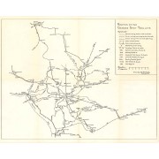
Text, business directory, tourist "Map of Lancaster County" with indexed col. ill., street map of "Lancaster business center," and advertisements on verso.
Subjects
Central business districts - Pennsylvania - Lancaster - Maps.
Lancaster (Pa.) - Maps.
Lancaster Metropolitan Area (Pa.) - Maps.
Lancaster County (Pa.) - Maps.
Additional Corporate Author
Lancaster Chamber of Commerce (Pa.)
Location
Lancaster History Library - Map
Call Number
974.815 LACI 518
Less detail

Champion map of Lancaster, Pennsylvania : including a detailed map of Lancaster County

https://collections.lancasterhistory.org/en/permalink/lhdo15008
Corporate Author
Champion Map Corporation.
Date of Publication
[1974]
Call Number
974.815 LACO 516
Alternate Title
Lancaster market
Responsibility
Copyright Champion Map Corporation, Ronald J. Parton, chief cartographer. [Prepared for Intelligencer Journal, Lancaster New Era, and Sunday News].
Corporate Author
Champion Map Corporation.
Place of Publication
Charlotte, N.C
Publisher
Champion Map Corporation,
Date of Publication
[1974]
Physical Description
2 maps on 1 sheet : both sides, 2 col., ill. ; 63 x 52 cm. and 52 x 59 cm. on sheet 92 x 61 cm., folded to 24 x 11 cm.
Notes
Folded title: Map of Lancaster City & County, Pennsylvania.
"Map no. GB-010-B."
Shows radial distances.
Indexed.
On verso with index: The Lancaster market.
"Printed: April 1974"--Panel.
Subjects
Lancaster (Pa.) - Maps.
Lancaster County (Pa.) - Maps.
Lancaster Region (Pa.) - Maps.
Additional Author
Parton, Ronald J.
Location
Lancaster History Library - Map
Call Number
974.815 LACO 516
Less detail

Routes of the Garden Spot Trolleys map

https://collections.lancasterhistory.org/en/permalink/lhdo5479
Date of Publication
1977.
Call Number
974.815 SEPA 102
  1 document  
Responsibility
Drawn by B. W. Rohrbeck.
Place of Publication
[s.l.]
Publisher
[s.n.] ,
Date of Publication
1977.
Physical Description
1 map ; 36 x 46 cm.
Notes
Includes route names.
Subjects
Street-railroads - Pennsylvania - Lancaster County
Transportation - Pennsylvania - Lancaster County
Lancaster County (Pa.) - Maps.
Location
Lancaster History Library - Map
Call Number
974.815 SEPA 102
Documents

map_974.815_SEPA_102_.pdf

Read PDF Download PDF
Less detail

[Site plan of Rockford Plantation, Lancaster, Pa.] / [prepared for] Junior League of Lancaster, Pa

https://collections.lancasterhistory.org/en/permalink/lhdo5165
Edition
Revised Sept. 16, 1963.
Date of Publication
1963.
Call Number
974.815 WLAM 100
Responsibility
drawn by J. B. E.
Edition
Revised Sept. 16, 1963.
Place of Publication
Lancaster, Pa
Publisher
Huth Engineers ,
Date of Publication
1963.
Physical Description
1 map ; 60 x 76 cm.
Notes
Relief shown by contours.
Blue line print.
Subjects
Historic buildings - Pennsylvania - West Lampeter Township
Lancaster County Central Park (Pa.) - Maps.
Lancaster County (Pa.) - Maps.
Location
Lancaster History Library - Map
Call Number
974.815 WLAM 100
Less detail

10 records – page 1 of 1.