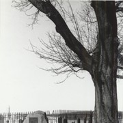
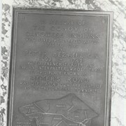
Boulder and bronze tablet at the site of Conestoga Indian Town. The town was located on the road from Letort to Safe Harbor in Manor Township between the years of 1682 and 1763. Monument erected in 1924.
Provenance
Album of historical markers erected by the Lancaster County Historical Society, compiled by George L. Heiges in 1986.
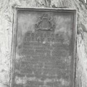
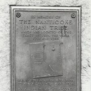
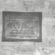
Boulder and bronze tablet at the site of Conoy Indian Town (1718 - 1743) near Bainbridge. It also honored the memory of French trader Peter Bezaillion. He laid out a road from this point to Compass, Chester County. Monument erected in 1933.
Provenance
Album of historical markers erected by the Lancaster County Historical Society, compiled by George L. Heiges in 1986.
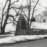
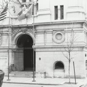
Bronze tablet at 123 North Prince Street, Lancaster. Andrew Ellicott lived here from 1801 until 1813 while he was secretary of the Pennsylvania Land Office. At that time Lancaster was the capital of Pennsylvania. Mathematician, astronomer and surveyor, it was he who completed the layout of Washington, DC.
Provenance
Album of historical markers erected by the Lancaster County Historical Society, compiled by George L. Heiges in 1986.
Bronze tablet on the Revere Tavern in Paradise, formerly the rectory of All Saints Episcopal Church. From 1841 until 1854 the rector was Edward Y. Buchanan, brother of President James Buchanan. He lived here with his wife, Eliza, sister of the songwriter Stephen Foster. Erected in 1954.
Provenance
Album of historical markers erected by the Lancaster County Historical Society, compiled by George L. Heiges in 1986.