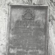
Boulder and bronze tablet at the site of Conestoga Indian Town. The town was located on the road from Letort to Safe Harbor in Manor Township between the years of 1682 and 1763. Monument erected in 1924.
Provenance
Album of historical markers erected by the Lancaster County Historical Society, compiled by George L. Heiges in 1986.
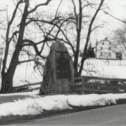
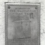
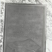
Boulder and bronze tablet at the site of Conoy Indian Town (1718 - 1743) near Bainbridge. It also honored the memory of French trader Peter Bezaillion. He laid out a road from this point to Compass, Chester County. Monument erected in 1933.
Provenance
Album of historical markers erected by the Lancaster County Historical Society, compiled by George L. Heiges in 1986.
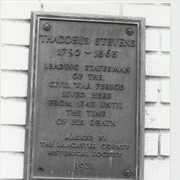
Bronze tablet on the house at 45 South Queen Street, Lancaster, where the Honorable Thaddeus Stevens lived from 1843 until his death. He was a leading statesman of the Civil War period and represented Lancaster County in the U. S. House of Representatives.
Provenance
Album of historical markers erected by the Lancaster County Historical Society, compiled by George L. Heiges in 1986.
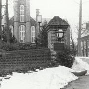
Bronze tablet on brick pillar at the entrance to the campus of Franklin and Marshall College. It was placed there in celebration of the joint sesquicentennial of the Constitution of the United States and the college. In addition, these original trustees of the college - Thomas McKean, Robert Morris, Benjamin Rush and George Clymer - were recognized, as was Benjamin Franklin, who was a patron of the college. Erected in 1937.
Provenance
Album of historical markers erected by the Lancaster County Historical Society, compiled by George L. Heiges in 1986.