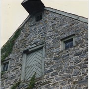
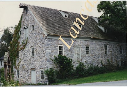
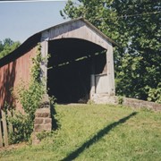
Photograph- Compass Mill at the intersection of Pierson Road and Rothsville Road (Route 772) just outside of Lititz. Built by the Moravian Congregation c. 1755.
Photograph- Compass Mill at the intersection of Pierson Road and Rothsville Road (Route 772) just outside of Lititz. Built by the Moravian Congregation c. 1755.
Description
Compass Mill at the intersection of Pierson Road and Rothsville Road (Route 772) just outside of Lititz. Built by the Moravian Congregation c. 1755.
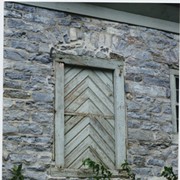
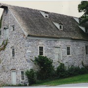
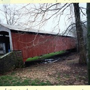
Photograph- Detail of Compass Mill at the intersection of Pierson Road and Rothsville Road (Route 772) just outside of Lititz. Built by the Moravian Congregation c. 1755.
Photograph- Detail of Compass Mill at the intersection of Pierson Road and Rothsville Road (Route 772) just outside of Lititz. Built by the Moravian Congregation c. 1755.
Description
Detail of Compass Mill at the intersection of Pierson Road and Rothsville Road (Route 772) just outside of Lititz. Built by the Moravian Congregation c. 1755.
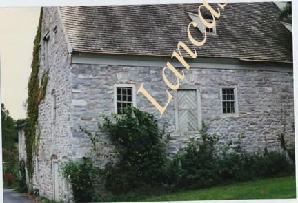
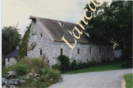
Photograph- Compass Mill at the intersection of Pierson Road and Rothsville Road (Route 772) just outside of Lititz. Built by the Moravian Congregation c. 1755.
Photograph- Compass Mill at the intersection of Pierson Road and Rothsville Road (Route 772) just outside of Lititz. Built by the Moravian Congregation c. 1755.
Description
Compass Mill at the intersection of Pierson Road and Rothsville Road (Route 772) just outside of Lititz. Built by the Moravian Congregation c. 1755.
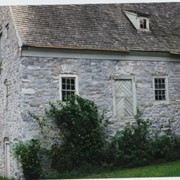
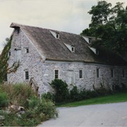
Photograph- Compass Mill at the intersection of Pierson Road and Rothsville Road (Route 772) just outside of Lititz. Built by the Moravian Congregation c. 1755.
Photograph- Compass Mill at the intersection of Pierson Road and Rothsville Road (Route 772) just outside of Lititz. Built by the Moravian Congregation c. 1755.
Description
Compass Mill at the intersection of Pierson Road and Rothsville Road (Route 772) just outside of Lititz. Built by the Moravian Congregation c. 1755.
Photograph- Compass Mill at the intersection of Pierson Road and Rothsville Road (Route 772) just outside of Lititz. Built by the Moravian Congregation c. 1755.
Photograph- Compass Mill at the intersection of Pierson Road and Rothsville Road (Route 772) just outside of Lititz. Built by the Moravian Congregation c. 1755.
Description
Compass Mill at the intersection of Pierson Road and Rothsville Road (Route 772) just outside of Lititz. Built by the Moravian Congregation c. 1755.
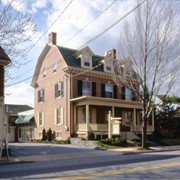
Mrs. John Bachman house, 7 South Decatur Street, Strasburg. Built 1899.
Provenance
Album of 35 mm slides of buildings in Lancaster County designed by architecht C. Emlen Urban. Slides taken by Carol Morgan for a lecture for the Torch Club in June 2002.