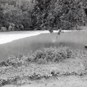
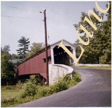
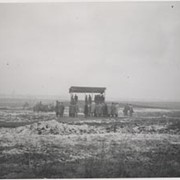
Covered bridge across the Conestoga Creek south of Oregon. Photo is identified as Raub's bridge, but is better known as Pinetown Bridge or Nolt's Point covered bridge.
Provenance
Lancaster County covered bridge photos taken by M. E. Schroll and Kathryn L. Sauder taken between 1956 and 1958.
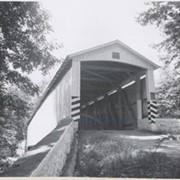
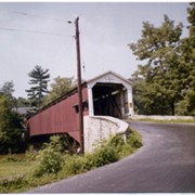
On the Conestoga Creek, Pinetown Road, south of Oregon. Bridge is identified as Raub's bridge but is better known as Pinetown Bridge or Nolt's Point covered bridge.
Provenance
Lancaster County covered bridge photos taken by M. E. Schroll and Kathryn L. Sauder taken between 1956 and 1958.
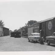
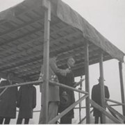
A scene in 1954 at Strasburg. In the rear is the engine house. The coal dock is out of sight ot the left and two sidings for feed are located on the left and on the right where the boxcar was. It was the only freight car on the road.
Provenance
This album is a compilation of research done by Thomas T. Taber of Muncy, PA, in 2006. It includes information about Strasburg; the Lancaster, Oxford and Southern; Peach Bottom; and mining railroads near Marticville.