Union Church also known as Eby Union Church or Strickler Church Cemetery / Location, 722 East from Mount Joy, Pennsylvania, to Strickler Road, and then north on Strickler for 1/2 mile. Rapho Township, Lancaster County
Historic structures Survey and Determination of Eligibility Report : East Lampeter, Leacock, Strasburg, Paradise, Salisbury, and Sadsbury Townships, Lancaster County, Pensylvania
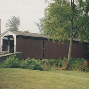
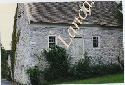
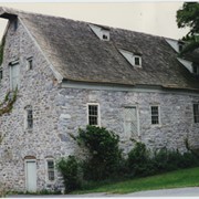
Photograph- Compass Mill at the intersection of Pierson Road and Rothsville Road (Route 772) just outside of Lititz. Built by the Moravian Congregation c. 1755.
Photograph- Compass Mill at the intersection of Pierson Road and Rothsville Road (Route 772) just outside of Lititz. Built by the Moravian Congregation c. 1755.
Description
Compass Mill at the intersection of Pierson Road and Rothsville Road (Route 772) just outside of Lititz. Built by the Moravian Congregation c. 1755.
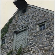
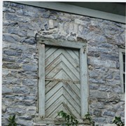
Photograph- Detail of Compass Mill at the intersection of Pierson Road and Rothsville Road (Route 772) just outside of Lititz. Built by the Moravian Congregation c. 1755.
Photograph- Detail of Compass Mill at the intersection of Pierson Road and Rothsville Road (Route 772) just outside of Lititz. Built by the Moravian Congregation c. 1755.
Description
Detail of Compass Mill at the intersection of Pierson Road and Rothsville Road (Route 772) just outside of Lititz. Built by the Moravian Congregation c. 1755.
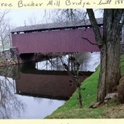
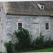
Photograph- Compass Mill at the intersection of Pierson Road and Rothsville Road (Route 772) just outside of Lititz. Built by the Moravian Congregation c. 1755.
Photograph- Compass Mill at the intersection of Pierson Road and Rothsville Road (Route 772) just outside of Lititz. Built by the Moravian Congregation c. 1755.
Description
Compass Mill at the intersection of Pierson Road and Rothsville Road (Route 772) just outside of Lititz. Built by the Moravian Congregation c. 1755.
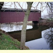
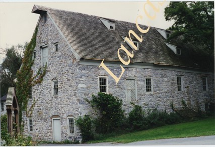
Photograph- Compass Mill at the intersection of Pierson Road and Rothsville Road (Route 772) just outside of Lititz. Built by the Moravian Congregation c. 1755.
Photograph- Compass Mill at the intersection of Pierson Road and Rothsville Road (Route 772) just outside of Lititz. Built by the Moravian Congregation c. 1755.
Description
Compass Mill at the intersection of Pierson Road and Rothsville Road (Route 772) just outside of Lititz. Built by the Moravian Congregation c. 1755.