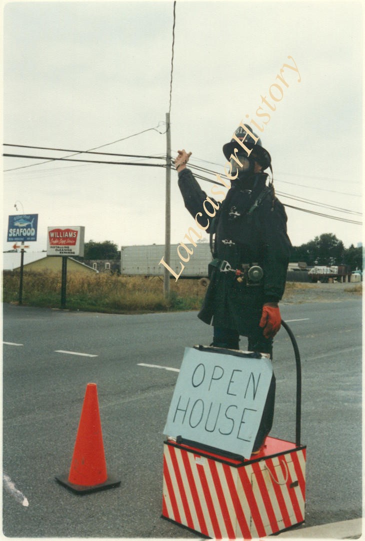
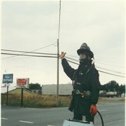
Willow Street Fire Company, fireman showing directions to open house. Photo taken for the Pennsylvania School of the Arts History of the Future Project.
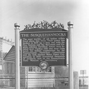
Historic marker placed by the Pennsylvania Water and Power Corporation near Safe Harbor.
The Susquehannocks. The most warlike of all Indian tribes lived along this river. Thier power was broken in 1675 by a long war with the Five Natio
Description
Historic marker placed by the Pennsylvania Water and Power Corporation near Safe Harbor:
"The Susquehannocks. The most warlike of all Indian tribes lived along this river. Thier power was broken in 1675 by a long war with the Five Nations, and the Maryland and Virginia colonies. Fortified towns were located near Turkey Hill and near Long Level. An Indian exploration by the Pennsylvania Historical Commission and the Safe Harbor Water Power Corporation in 1930 recovered thousands of artifacts, now in the Pennsylvania State Museum at Harrisburg."
Photograph- Historic marker placed by Pennsylvania Water and Power Company near Safe Harbor.
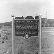
Port of Lancaster. The Conestoga Navigation Company, incorporated 1825, constructed on Conestoga Creek, from lancaster to the Susquehanna River, 9 locks and dams which wer used for slackwater navigation for about 40 years. A rock fill crib dam across the river made possible cargo exchanges with the Susquehanna and Tidewater Canal located on the west shore.
Photograph- Historic marker placed by Pennsylvania Water and Power Company near Safe Harbor.
Port of Lancaster. The Conestoga Navigation Company, incorporated 1825, constructed on Conestoga Creek, from lancaster to the Susquehanna River, 9 locks and dams which wer used for slackwater navigation for about 40 years. A rock fill crib dam across the river made possible cargo exchanges with the Susquehanna and Tidewater Canal located on the west shore.
Description
Historic marker placed by Pennsylvania Water and Power Company near Safe Harbor.
Port of Lancaster. The Conestoga Navigation Company, incorporated 1825, constructed on Conestoga Creek, from lancaster to the Susquehanna River, 9 locks and dams which wer used for slackwater navigation for about 40 years. A rock fill crib dam across the river made possible cargo exchanges with the Susquehanna and Tidewater Canal located on the west shore.