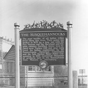
Historic marker placed by the Pennsylvania Water and Power Corporation near Safe Harbor.
The Susquehannocks. The most warlike of all Indian tribes lived along this river. Thier power was broken in 1675 by a long war with the Five Natio
Description
Historic marker placed by the Pennsylvania Water and Power Corporation near Safe Harbor:
"The Susquehannocks. The most warlike of all Indian tribes lived along this river. Thier power was broken in 1675 by a long war with the Five Nations, and the Maryland and Virginia colonies. Fortified towns were located near Turkey Hill and near Long Level. An Indian exploration by the Pennsylvania Historical Commission and the Safe Harbor Water Power Corporation in 1930 recovered thousands of artifacts, now in the Pennsylvania State Museum at Harrisburg."
Signers of Petition: Adam Breneman, George Withers, Joseph Brenneman, Henry Funk, Christian Schitz, Samuel Holl, Jacob Witmer, Daniel Lintner, Abraham Brenneman, John Wittmer, Henry Manning, Peter Rumel, John Sourbeer, John Hartzler.
1 item, 1 piece
Access Conditions / Restrictions
Request at Reference Desk; photocopy made by staff member.
Historic marker placed by Pennsylvania Water and Power Company near Safe Harbor. Conestoga Indian Town. The Conestoga Indians lived in sacttered settlements along this stream. They were the last of the once mighty Susquehannocks. Their f
Historic marker placed by Pennsylvania Water and Power Company near Safe Harbor. Conestoga Indian Town. The Conestoga Indians lived in sacttered settlements along this stream. They were the last of the once mighty Susquehannocks. Their f
Description
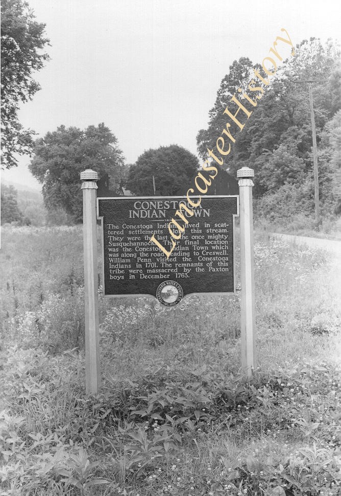
Historic marker placed by Pennsylvania Water and Power Company near Safe Harbor. "Conestoga Indian Town. The Conestoga Indians lived in sacttered settlements along this stream. They were the last of the once mighty Susquehannocks. Their final location was the Conestoga Indian Town which was along the road leading to Creswell. William Penn visited the Conestoga indians in 1701. The remnants of this tribe were massacred by the Paxton boys in December 1763."
Photograph- Historic marker placed by Pennsylvania Water and Power Company near Safe Harbor.
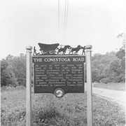
The Conestoga Road. As early as 1638 an Indian trail, used in the fur trade with the Swedish settlements on the Delaware, crossed Conestoga Creek 400 feet upstream. This trail later became the road connecting the Conestoga Indian settlements with Philadelphia. It passes Postlethwaite's Inn, the first courthouse in Lancaster County in 1729.
Photograph- Historic marker placed by Pennsylvania Water and Power Company near Safe Harbor.
The Conestoga Road. As early as 1638 an Indian trail, used in the fur trade with the Swedish settlements on the Delaware, crossed Conestoga Creek 400 feet upstream. This trail later became the road connecting the Conestoga Indian settlements with Philadelphia. It passes Postlethwaite's Inn, the first courthouse in Lancaster County in 1729.
Description
Historic marker placed by Pennsylvania Water and Power Company near Safe Harbor.
The Conestoga Road. As early as 1638 an Indian trail, used in the fur trade with the Swedish settlements on the Delaware, crossed Conestoga Creek 400 feet upstream. This trail later became the road connecting the Conestoga Indian settlements with Philadelphia. It passes Postlethwaite's Inn, the first courthouse in Lancaster County in 1729.
Signers of petition: J. B. Good, Daniel Sensenig, Anthony Good, Jacob Burckhard, Reuben E. Shober, Solomon Good, Peter Musser, John A. Seitzinger, Jonas Musselman, Daniel Bowman, Joseph Good, Adam Kessler, Jacob Good, J. B. Musselman.
3 items, 3 pieces
Access Conditions / Restrictions
Request at Reference Desk; photocopy made by staff member.
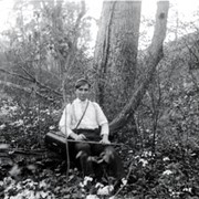
Photograph- "Outing to Safe Harbor and vicinity - Clay and grape vine"
Description
"Outing to Safe Harbor and vicinity - Clay and grape vine"
Provenance
From glass plate negatives bought by Kevin Shue at Horst Auction. Photographer unknown, but most images are of the Warwick Township or Safe Harbor areas.
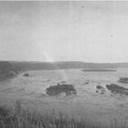
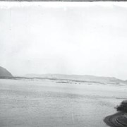
Photograph- "Safe Harbor in distance" - view of Susquehanna River
Description
"Safe Harbor in distance" - view of Susquehanna River
Provenance
From glass plate negatives bought by Kevin Shue at Horst Auction. Photographer unknown, but most images are of the Warwick Township or Safe Harbor areas.