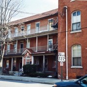
Historic structures Survey and Determination of Eligibility Report : East Lampeter, Leacock, Strasburg, Paradise, Salisbury, and Sadsbury Townships, Lancaster County, Pensylvania
Chapters: People and cultures -- Community -- Education -- Transportation -- Transportation at work -- Business and industry.
Summary
Archival photographs are used to tell the story of these Lancaster County communities - the people and their culture, community, education, transportation, business, and industry.
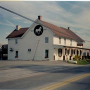
Chapters: INDIAN PEOPLES IN SALISBURY TOWNSHIP // THE BEGINNING OF SALISBURY TOWNSHIP // THE DEVELOPMENT OF SALISBURY TOWNSHIP // SOUTH HERMITAGE // GAP // PUDDINTOWN - BETHANIA - JACKSONVILLE // WHITE CHIMNEYS // BELMONT // BUYERSTOWN // MILLWOOD // LIMEVILLE //BUENA VISTA // WHITE HORSE // SPRING GARDEN // SPRINGVILLE // WELSH MOUNTAIN - MT. AIRY // MEADVILLE // WERTZTOWN // CAMBRIDGE // MAST POST OFFICE // CAINS
Summary
After the introductory chapters, "South Hermitage" begins the book because the Township's first colonist, Robert Gault, settled there. The next chapter, "Gap", contains the oldest documented house still standing in Salisbury Township, the Francis Jones Hotel, 1728, which started commerce there. The history then continues contiguously around the Township. Each chapter contains the history of the land, families, schools, churches, commerce, and in most cases, a personal account of life in the early days of the Township.Maps of each area: 1864, 1875, 1899, 1977 and 1984, precede each chapter so that readers can see at a glance who lived in a specific place. [from Salisburytownship.org]
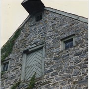
Photograph- Compass Mill at the intersection of Pierson Road and Rothsville Road (Route 772) just outside of Lititz. Built by the Moravian Congregation c. 1755.
Photograph- Compass Mill at the intersection of Pierson Road and Rothsville Road (Route 772) just outside of Lititz. Built by the Moravian Congregation c. 1755.
Description
Compass Mill at the intersection of Pierson Road and Rothsville Road (Route 772) just outside of Lititz. Built by the Moravian Congregation c. 1755.
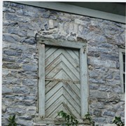
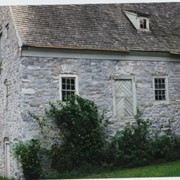
Photograph- Detail of Compass Mill at the intersection of Pierson Road and Rothsville Road (Route 772) just outside of Lititz. Built by the Moravian Congregation c. 1755.
Photograph- Detail of Compass Mill at the intersection of Pierson Road and Rothsville Road (Route 772) just outside of Lititz. Built by the Moravian Congregation c. 1755.
Description
Detail of Compass Mill at the intersection of Pierson Road and Rothsville Road (Route 772) just outside of Lititz. Built by the Moravian Congregation c. 1755.
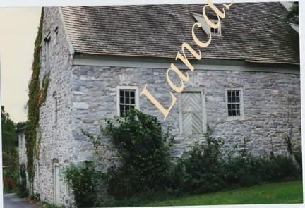
Photograph- Compass Mill at the intersection of Pierson Road and Rothsville Road (Route 772) just outside of Lititz. Built by the Moravian Congregation c. 1755.
Photograph- Compass Mill at the intersection of Pierson Road and Rothsville Road (Route 772) just outside of Lititz. Built by the Moravian Congregation c. 1755.
Description
Compass Mill at the intersection of Pierson Road and Rothsville Road (Route 772) just outside of Lititz. Built by the Moravian Congregation c. 1755.