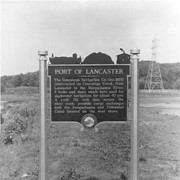
Photograph- Historic marker placed by Pennsylvania Water and Power Company near Safe Harbor.
Port of Lancaster. The Conestoga Navigation Company, incorporated 1825, constructed on Conestoga Creek, from lancaster to the Susquehanna River, 9 locks and dams which wer used for slackwater navigation for about 40 years. A rock fill crib dam across the river made possible cargo exchanges with the Susquehanna and Tidewater Canal located on the west shore.
Description
Historic marker placed by Pennsylvania Water and Power Company near Safe Harbor.
Port of Lancaster. The Conestoga Navigation Company, incorporated 1825, constructed on Conestoga Creek, from lancaster to the Susquehanna River, 9 locks and dams which wer used for slackwater navigation for about 40 years. A rock fill crib dam across the river made possible cargo exchanges with the Susquehanna and Tidewater Canal located on the west shore.
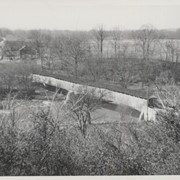
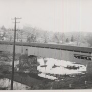
Snavely's Mill, second lock of the Slackwater Canal, south of Lancaster city, between Lancaster and Pequea Townships. County maintained on road T-504, built in 1857 (first bridge 1836, second bridge 1850), longest bridge in Lancaster County, double span 349 feet long. Destroyed by fire in the 1960s.
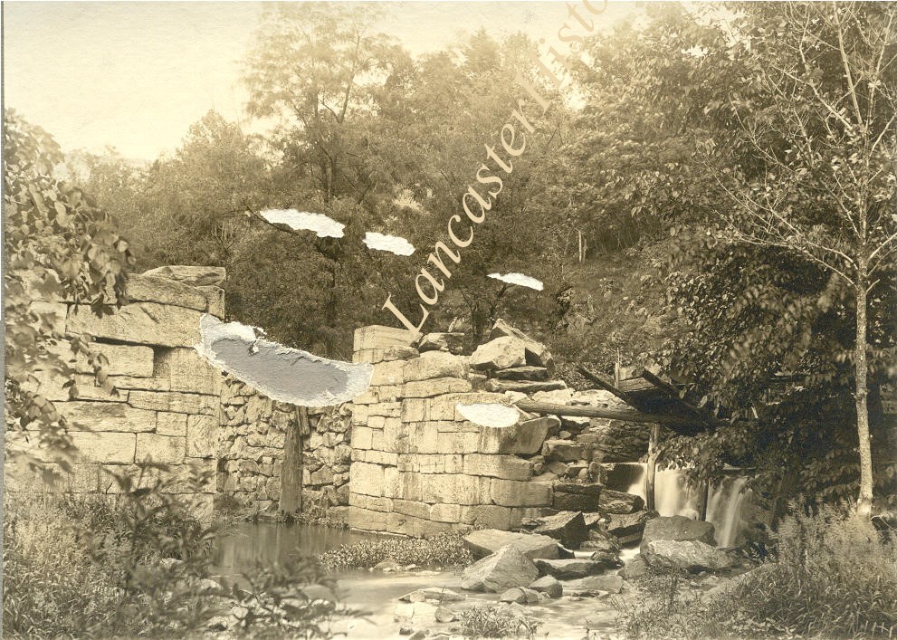
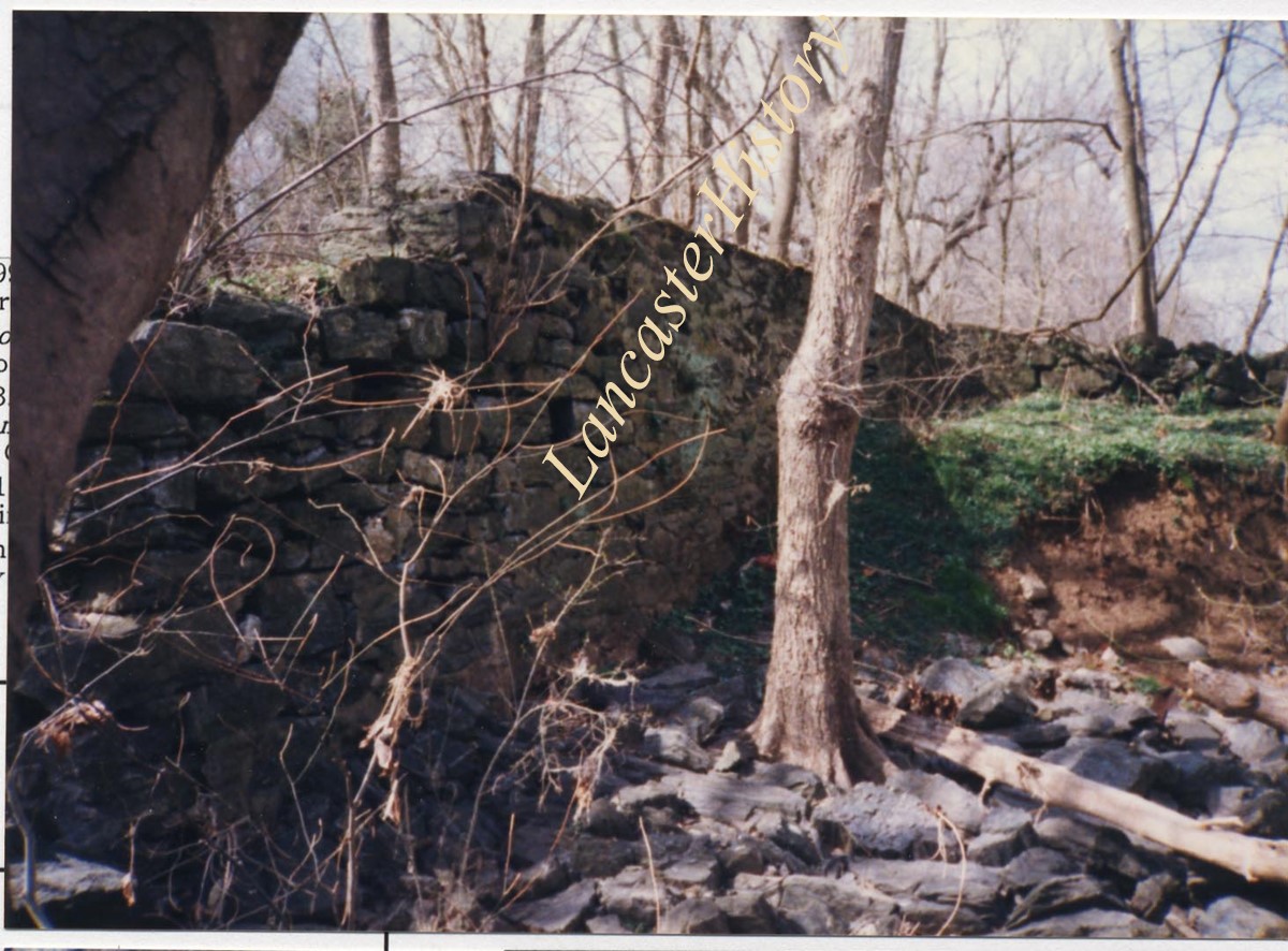
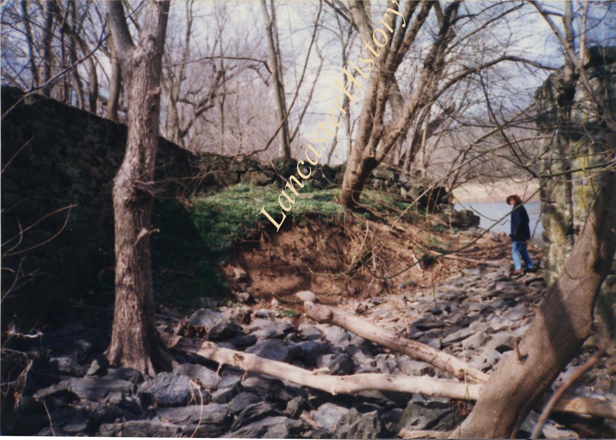
Photograph- This shows the only breakdown that endagesrs the west wall. The prison is filled with rubble stone, fortunately, or flooding would have washed too much away from the eastern portions still standing. The old trolley pylons still stand just southeast of the lock. It is a vital part of Lancaster's history using water to get to down river markets. Lock Number 1 of Conestoga Naviagation Company on the Conestoga River.
Photograph- This shows the only breakdown that endagesrs the west wall. The prison is filled with rubble stone, fortunately, or flooding would have washed too much away from the eastern portions still standing. The old trolley pylons still stand just southeast of the lock. It is a vital part of Lancaster's history using water to get to down river markets. Lock Number 1 of Conestoga Naviagation Company on the Conestoga River.
Description
This shows the only breakdown that endagesrs the west wall. The prison is filled with rubble stone, fortunately, or flooding would have washed too much away from the eastern portions still standing. The old trolley pylons still stand just southeast of the lock. It is a vital part of Lancaster's history using water to get to down river markets. Lock Number 1 of Conestoga Naviagation Company on the Conestoga River.
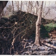
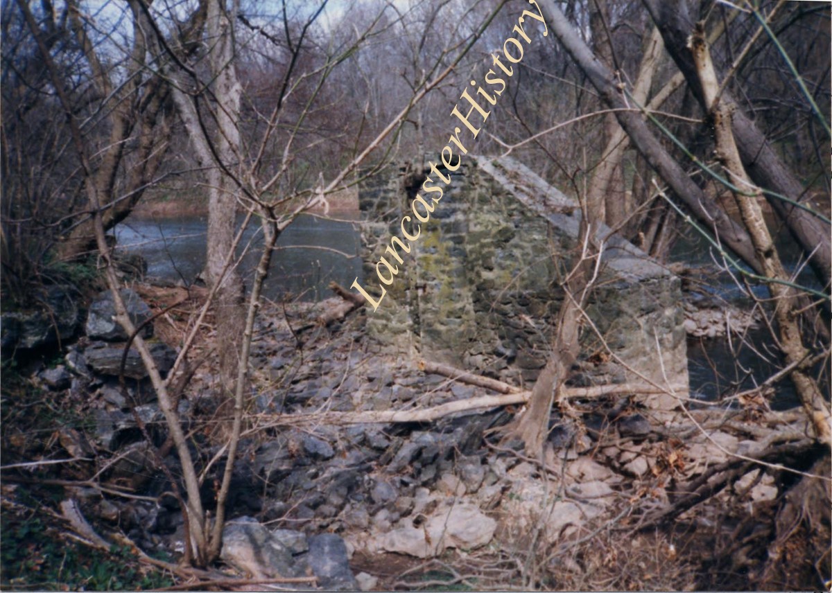
Photograph- This is the other standing portion of the East Wall of Lock Number 1 of the Conestoga Navigation Company canal south of Lancaster on the Conestoga River to Safe Harbor.
Photograph- This is the other standing portion of the East Wall of Lock Number 1 of the Conestoga Navigation Company canal south of Lancaster on the Conestoga River to Safe Harbor.
Description
This is the other standing portion of the East Wall of Lock Number 1 of the Conestoga Navigation Company canal south of Lancaster on the Conestoga River to Safe Harbor.
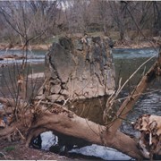
Photograph- This is the boat entrance to the lock and the beginning of the over 100 foot long west wall - all of which seems to be standing except where it is tumbled partely near the lock in the last picture (1-06-04-69). West wall may extend 200 feet. Canal boats were long and narrow, but the lock is really still a good example of the canal works.
Photograph- This is the boat entrance to the lock and the beginning of the over 100 foot long west wall - all of which seems to be standing except where it is tumbled partely near the lock in the last picture (1-06-04-69). West wall may extend 200 feet. Canal boats were long and narrow, but the lock is really still a good example of the canal works.
Description
This is the boat entrance to the lock and the beginning of the over 100 foot long west wall - all of which seems to be standing except where it is tumbled partely near the lock in the last picture (1-06-04-69). West wall may extend 200 feet. Canal boats were long and narrow, but the lock is really still a good example of the canal works.
Photograph- The north gate - east side showing the lock gate groove in the rocks and opposite on west wall of over 100 feet the matching groove and hardware of the gate. This was Lock Number 1 of the Conestoga Navigation Company on the Conestoga River.
Photograph- The north gate - east side showing the lock gate groove in the rocks and opposite on west wall of over 100 feet the matching groove and hardware of the gate. This was Lock Number 1 of the Conestoga Navigation Company on the Conestoga River.
Description
The north gate - east side showing the lock gate groove in the rocks and opposite on west wall of over 100 feet the matching groove and hardware of the gate. This was Lock Number 1 of the Conestoga Navigation Company on the Conestoga River.
Page 39: Horse and carriage, "Wabank Road near New Danville"; Slackwater Road, Millersville, August 1902; Old tavern, Slackwater; Lancaster County farm scene near Millersville, Agust 1902; Electrick Light Station in the distance - Slackwater, August 1902"; Slackwater bridge.
Provenance
First of two Diffenderfer family albums. Compiled by Frank Reid Diffenderfer, a former member of LCHS and an editor of a Lancaster city newspaper. Album documents his family as well as that of his neighbors on North Duke Street, Lancaster, between 1901 and 1903. Neighbors include Charles Fondersmith, Robert Slaymaker, and his daughter, Ida, who married Frank Fondersmith.
Slackwater, aslo known as Shober's Paper Mill, one mile south of Millersville between Conestoga and Manor Townships. State supervised on road LR 36008, oldest bridge still standing, built 1839, double span 269 feet long.