Skip header and navigation

Revise Search

10 records – page 1 of 1.

Discover cultural treasures, Lancaster County

https://collections.lancasterhistory.org/en/permalink/lhdo19262
Corporate Author
R.R. Donnelley and Sons Company. Mapping Services Division.
Date of Publication
[1991?]
Call Number
974.815 LACO 143
Responsibility
maps by Donnelley Mapping Services.
Corporate Author
R.R. Donnelley and Sons Company. Mapping Services Division.
Place of Publication
Lancaster, PA
Publisher
Cultural Council of Lancaster County,
Date of Publication
[1991?]
Physical Description
2 maps on 1 sheet : both sides, col. ; 34 x 37 cm. and 33 x 37 cm., sheet 47 x 38 cm., folded in cover 24 x 11 cm. + index/directory ([30] p. ; 24 cm.)
Notes
Shows arts organizations, libraries, museums, educational institutions, service organizations, and galleries.
Cover title.
Title at top: Discover cultural treasures.
Copyright "Bizcorp and Cultural Council of Lancaster County."
Includes notes, location map, and sponsors' advertisements.
Contents
Map A. Lancaster County -- Map B. Lancaster : city of Lancaster and vicinity.
Subjects
Arts facilities - Pennsylvania - Lancaster County - Maps.
Arts facilities - Pennsylvania - Lancaster - Maps.
Learned institutions and societies - Pennsylvania - Lancaster County - Maps.
Learned institutions and societies - Pennsylvania - Lancaster - Maps.
Museums - Pennsylvania - Lancaster County - Maps.
Museums - Pennsylvania - Lancaster - Maps.
Lancaster County (Pa.) - Maps, Tourist.
Lancaster (Pa.) - Maps, Tourist.
Additional Corporate Author
Cultural Council of Lancaster County (Pa.)
Bizcorp (Firm)
Location
Lancaster History Library - Map
Call Number
974.815 LACO 143
Less detail

New topographical atlas of the state of Pennsylvania; with descriptions historical, scientific and statistical, together with a map of the United States and territories

https://collections.lancasterhistory.org/en/permalink/lhdo18793
Author
Walling, Henry Francis,
Date of Publication
1872.
Call Number
912.748 A881
Responsibility
by Henry F. Walling and O.W. Gray.
Author
Walling, Henry Francis,
Place of Publication
Philadelphia
Publisher
Stedman, Brown & Lyon,
Date of Publication
1872.
Physical Description
1 v. (various pagings) 35 col. maps (part double) 45 cm.
Notes
Cover title: Atlas of Pennsylvania with descriptions.
Subjects
Pennsylvania - Maps.
Pennsylvania - Description and travel.
Additional Author
Gray, Ormando Willis,
Location
Lancaster History Library - Atlas
Call Number
912.748 A881
Less detail

Iron, railroad, canal and coal map of Pennsylvania, &c. : showing the relative position of the various anthracite and bituminous coal fields, the railroads, canals and navigable waters by which they are connected forming their respective avenues to market, also the furnaces, rolling mills, bloomeries and forges of Pennsylvania and adjoining states

https://collections.lancasterhistory.org/en/permalink/lhdo20328
Author
Sheafer, P. W.
Date of Publication
1867.
Call Number
Under Review
Responsibility
by P.W. Sheafer.
Author
Sheafer, P. W.
Place of Publication
Pottsville, Pa. ; Philadelphia
Publisher
Jacob Haehnlen [lithographer],
Date of Publication
1867.
Physical Description
1 map : col. ; 76 x 107 cm. on sheet 82 x 114 cm.
Notes
Shows coal and oil regions from Lake Ontario through much of West Virginia; most of New York State is shown, though without geological detail. Also shows locations of steel works, foundries, etc.
Subjects
Iron industry and trade - Pennsylvania - Maps.
Railroads - Pennsylvania - Maps.
Canals - Pennsylvania - Maps.
Coal - Pennsylvania - Maps.
Pennsylvania - Maps.
Location
Lancaster History Library - To be Reviewed
Call Number
Under Review
Less detail

Maps showing the development of Pennsylvania

https://collections.lancasterhistory.org/en/permalink/lhdo13812
Corporate Author
Pennsylvania. Dept. of Internal Affairs. Land Office Bureau.
Date of Publication
1976.
Call Number
912.748 P415
Responsibility
prepared in the Land Office Bureau, Department of Internal Affairs.
Corporate Author
Pennsylvania. Dept. of Internal Affairs. Land Office Bureau.
Place of Publication
Pittsburgh, PA
Publisher
J. Morris,
Date of Publication
1976.
Physical Description
1 atlas ([13] leaves) : maps ; 28 cm.
Notes
Reprint. Originally published: Harrisburg, Pa. : The Land Office Bureau, Department of Internal Affairs, 1920.
Subjects
Pennsylvania - Historical geography - Maps.
Pennsylvania - Administrative and political divisions - Maps.
Location
Lancaster History Library - Book
Call Number
912.748 P415
Less detail

Lancaster with its rail road [sic] connections 1887

https://collections.lancasterhistory.org/en/permalink/lhdo15378
Corporate Author
J. L. Smith Map Publisher.
Date of Publication
[188-?]
Call Number
974.815 LACO 151
  1 document  
Alternate Title
Lancaster with its railroad connections 1887
Responsibility
J. L. Smith Map Publisher.
Corporate Author
J. L. Smith Map Publisher.
Place of Publication
Philadelphia, Pa
Publisher
J.L. Smith Map Publisher,
Date of Publication
[188-?]
Physical Description
1 map ; 35 x 42 cm.
Notes
Date of situation: 1887.
Includes table of distances.
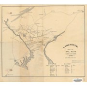
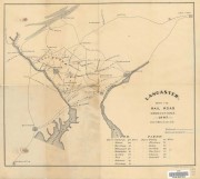
Shows lines for P.W. and B.R.R., B. and O. R.R., Balt. Cent. R.R., P.B.N.G.R.R., C. and P.D.R.R., P.B.R.R., Reading and CHesapeake R.R., CHes. Val. R.R., Lanc. and Del. R.R., Colebrok Valley R.R., and P. and R.R.R.
Subjects
Railroads - Pennsylvania - Lancaster County - Maps.
Mines and mineral resources - Pennsylvania - Lancaster County - Maps.
Location
Lancaster History Library - Map
Call Number
974.815 LACO 151
Documents

map_974.815_LACO_151_.pdf

Read PDF Download PDF
Less detail

[Map of water-powered mills, Lancaster County, Pa.]

https://collections.lancasterhistory.org/en/permalink/lhdo5590
Date of Publication
1960.
Call Number
974.815 LACO 504
Responsibility
made by Chester Paes.
Place of Publication
Lancaster, Pa
Publisher
Charles Paes ,
Date of Publication
1960.
Physical Description
1 map ; 114 x 89 cm.
Notes
Shows names and locations of mills.
Pen and ink.
Subjects
Mills and millwork - Pennsylvania - Lancaster County
Lancaster County (Pa.) - Maps.
Location
Lancaster History Library - Map
Call Number
974.815 LACO 504
Less detail

Map guide to the U.S. federal censuses, 1790-1920

https://collections.lancasterhistory.org/en/permalink/lhdo5641
Author
Thorndale, William.
Date of Publication
1987.
Call Number
312 T398
Responsibility
William Thorndale and William Dollarhide.
ISBN
0806311886 :
Author
Thorndale, William.
Place of Publication
Baltimore
Publisher
Genealogical Pub. Co.,
Date of Publication
1987.
Physical Description
1 atlas : maps ; 23 x 30 cm.
Notes
Shows U.S. county boundary maps for the census decades superimposed on modern county boundaries. Gives background information on each census, including census availability for each county.
Includes index.
Bibliography: p. 399-410.
Subjects
Census districts
United States - Administrative and political divisions - Maps.
Additional Author
Dollarhide, William.
Location
Lancaster History Library - Book
Call Number
312 T398
Less detail

Lancaster City wards and precincts : date 1936 Feb

https://collections.lancasterhistory.org/en/permalink/lhdo7220
Date of Publication
1936.
Call Number
974.815 LACI 127
Place of Publication
s.l
Publisher
s.n. ,
Date of Publication
1936.
Physical Description
1 plan ; blue line ; 54 x 56 cm.
Notes
"vBB-23".
Handwritten on verso : "Lancaster City 1936 3580J".
Subjects
Election districts - Pennsylvania - Lancaster
Lancaster (Pa.) - Administrative and political divisions - maps.
Location
Lancaster History Library - Map
Call Number
974.815 LACI 127
Less detail

Map of Lancaster City, showing boundaries of wards (red) and precincts (blue)

https://collections.lancasterhistory.org/en/permalink/lhdo7483
Date of Publication
190-?]
Call Number
974.815 LACI 126
Responsibility
compliments of E. S. Smeltz, city clerk, Lancaster, Pa.
Place of Publication
[S.l
Publisher
s.n.,
Date of Publication
190-?]
Physical Description
1 map : col. ; 27 x 27 cm.
Notes
Date of situation 1902.
"Total population, 1900, 41;464."
"Total number of acres 2,660."
Subjects
Election districts - Pennsylvania - Lancaster
Lancaster (Pa.) - Administrative and political divisions - Maps.
Location
Lancaster History Library - Map
Call Number
974.815 LACI 126
Less detail

Manuscript map of the Lancaster Turnpike ca. 1790

https://collections.lancasterhistory.org/en/permalink/lhdo7537
Date of Publication
n.d.
Call Number
974.815 SEPA 103
Responsibility
Chester County Historical Society Collection.
Place of Publication
[x.l.]
Publisher
Tinicum Press ,
Date of Publication
n.d.
Physical Description
1 map copy 34 x 39 cm.
Notes
Library has no. 12 and no. 165 of 2500 copies.
Subjects
Philadelphia and Lancaster Turnpike (Pa.)
Toll roads - Pennsylvania
Lancaster County (Pa.) - Maps.
Location
Lancaster History Library - Map
Call Number
974.815 SEPA 103
Less detail

10 records – page 1 of 1.