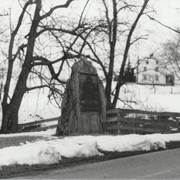
Boulder and bronze tablet at the site of Conestoga Indian Town. The town was located on the road from Letort to Safe Harbor in Manor Township between the years of 1682 and 1763. Monument erected in 1924.
Provenance
Album of historical markers erected by the Lancaster County Historical Society, compiled by George L. Heiges in 1986.
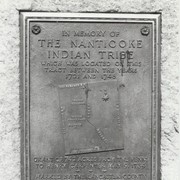
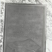
Boulder and bronze tablet at the site of Conoy Indian Town (1718 - 1743) near Bainbridge. It also honored the memory of French trader Peter Bezaillion. He laid out a road from this point to Compass, Chester County. Monument erected in 1933.
Provenance
Album of historical markers erected by the Lancaster County Historical Society, compiled by George L. Heiges in 1986.
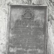
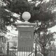
Memorial pillar and tablet at 320 East Ross Street, Lancaster, marking the site of the country home of the Honorable George Ross (1730 - 1779), colonial statesman and a signer of the Declaration of Independence. Erected 1897.
Provenance
Album of historical markers erected by the Lancaster County Historical Society, compiled by George L. Heiges in 1986.
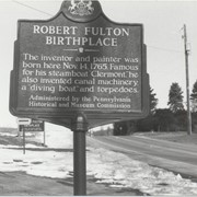
Memorial tablet at the birthplace of Robert Fulton (1765 - 1815) in Fulton Township, honoring him as the first man to apply steam to navigation successfully.
Provenance
Album of historical markers erected by the Lancaster County Historical Society, compiled by George L. Heiges in 1986.