Skip header and navigation

Revise Search

10 records – page 1 of 1.

Collection
General Collection
Title
Photograph- Henry Dering's tavern, Lancaster Township.
Object ID
1-07-02-28
  1 image  
Object Name
Print, Photographic
Collection
General Collection
Title
Photograph- Henry Dering's tavern, Lancaster Township.
Description
Henry Dering's tavern, Lancaster Township.
Storage Location
LancasterHistory, Lancaster, PA
People
Dering, Henry
Subcategory
Documentary Artifact
Search Terms
Taverns
Henry Dering's Tavern
Lancaster Twp.
Place
Lancaster Twp.
Object Name
Print, Photographic
Print Size
5 x 7 inches
Condition
Good
Object ID
1-07-02-28
Images
Less detail
Collection
Covered Bridge Safari Album
Object ID
A-65-01-27
  1 image  
Object Name
Print, Photographic
Collection
Covered Bridge Safari Album
Description
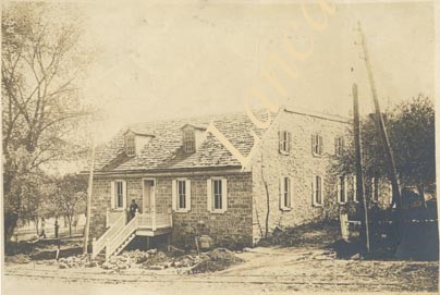
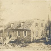
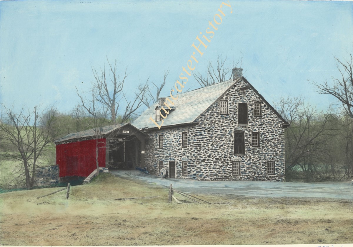
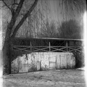
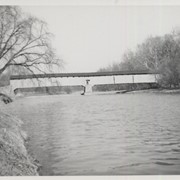
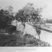
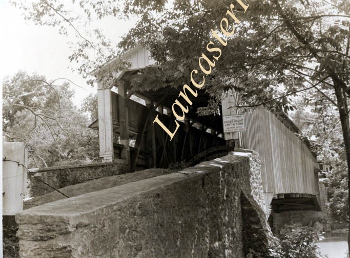
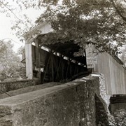
Snavely's Mill covered bridge, also called Second Lock covered bridge, destroyed by fire in 1968. Spanned the Conestoga Creek between Lancaster and Pequea Townships.
Provenance
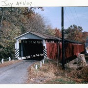
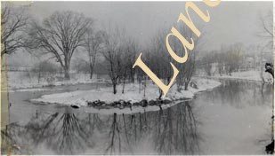
Photographs of a 2003 Theodore Burr Covered Bridge Society bridge safari.
Storage Location
LancasterHistory, Lancaster, PA
Subcategory
Documentary Artifact
Search Terms
Covered bridges
Bridges
Snavely's Mill bridge
Second Lock bridge
Conestoga Creek
Place
Lancaster Twp.
Object Name
Print, Photographic
Object ID
A-65-01-27
Images
Less detail
Collection
Ed Schopf Safe Harbor Collection
Object ID
ES-02-02-02
  1 image  
Object Name
Print, Photographic
Collection
Ed Schopf Safe Harbor Collection
Description
Stoneroads Mill covered bridge, northwest of Bausman. Hand colored.
Provenance
Gift of Amer and Emma Kendig
Creator
Schopf, Edward
Storage Location
LancasterHistory, Lancaster, PA
Subcategory
Documentary Artifact
Search Terms
Covered bridges
Little Conestoga Creek
Bausman, Lancaster Twp.
Place
Lancaster Twp.
Object Name
Print, Photographic
Print Size
4.75 x 6.25 inches
Object ID
ES-02-02-02
Notes
Ed Schopf was plant photographer for the Safe Harbor Water Power Corporation from 1930 to 1954.
Images
Less detail
Collection
Barton Mill Photograph Collection
Object ID
BM-06-114
  1 image  
Object Name
Negative
Collection
Barton Mill Photograph Collection
Description
Barton identifies this as Rohrer's Mill or Field's Mill on Bore Mill Run in Lancaster Township.
Provenance
Photographs from MG-15 Harold R. Barton Collection
Creator
Barton, R. Harold
Storage Location
LancasterHistory, Lancaster, PA
Search Terms
Rohrer's Mill
Field's Mill
Bridges
Place
Lancaster Twp.
Object Name
Negative
Film Size
2.5 x 3.75 inches
Condition
Not Rated
Object ID
BM-06-114
Images
Less detail
Collection
Covered Bridge Album
Object ID
A-11-01-11
Date Range
1950
  1 image  
Object Name
Print, Photographic
Collection
Covered Bridge Album
Description
Wabank, between New Danville and Millersville. State supervised on road LR 36006, built in 1841 (first bridge 1835), double span 246 feet long.
Date Range
1950
Creator
Gaintner, Jay Richard
Storage Location
LancasterHistory, Lancaster, PA
Subcategory
Documentary Artifact
Search Terms
Bridges
Covered bridges
Mills
Conestoga River
Place
Lancaster Twp.
Object Name
Print, Photographic
Print Size
8 x 10 inches
Object ID
A-11-01-11
Images
Less detail
Collection
General Collection
Object ID
1-09-07-31
Date Range
c. 1930
  1 image  
Object Name
Print, Photographic
Collection
General Collection
Description
Little Conestoga Creek at Columbia Pike above West End Park about 1930, now Maple Grove Park. At that time there was an island above the dam.
Date Range
c. 1930
Creator
Einolf, Albert L.
Storage Location
LancasterHistory, Lancaster, PA
Subcategory
Documentary Artifact
Search Terms
Little Conestoga Creek
Columbia Pike
West End Park
Maple Grove
Islands
Place
Lancaster Twp.
Object Name
Print, Photographic
Print Size
2.75 x 4.5 inches
Object ID
1-09-07-31
Images
Less detail
Collection
General Collection
Object ID
1-09-07-51
  1 image  
Object Name
Print, Photographic
Collection
General Collection
Description
Railroad bridge over Conestoga Creek at flood stage. Person standing on pylon.
Creator
Einolf, Albert L.
Storage Location
LancasterHistory, Lancaster, PA
Subcategory
Documentary Artifact
Search Terms
Railroad Bridges
Conestoga Creek
Place
Lancaster Twp.
Object Name
Print, Photographic
Print Size
5 x 7 inches
Object ID
1-09-07-51
Images
Less detail
Collection
General Collection
Object ID
2-07-05-12
  1 image  
Object Name
Print, Photographic
Collection
General Collection
Description
Bridge over Columbia Pike where it crosses over the Little Conestoga Creek near Maple Grove
Storage Location
LancasterHistory, Lancaster, PA
Subcategory
Documentary Artifact
Search Terms
Columbia Pike
Little Conestoga Creek
Bridges
Maple Grove
Place
Lancaster Twp.
Object Name
Print, Photographic
Print Size
10 x 8 inches
Object ID
2-07-05-12
Images
Less detail
Collection
General Collection
Object ID
2-15-05-03
  1 image  
Object Name
Print, Photographic
Collection
General Collection
Description
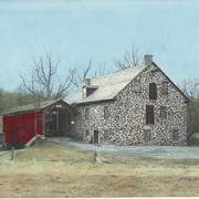
Two millstones from Bucher's Mill near Reamstown, East Cocalico Township. Now on the grounds of the Lancaster County Historical Society. The pair of stones are of Pennsylvania pebble stone and weight approximately 4500 pounds together.
Storage Location
LancasterHistory, Lancaster, PA
Subcategory
Documentary Artifact
Search Terms
Mills
Reamstown, East Cocalico Twp.
Millstones
Lancaster County Historical Society
Place
Lancaster Twp.
Object Name
Print, Photographic
Print Size
8 x 10 inches
Object ID
2-15-05-03
Images
Less detail
Collection
General Collection
Object ID
1-09-05-41
  1 image  
Object Name
Print, Photographic
Collection
General Collection
Description
Israel Groff's Factory bridge at water's edge in Lancaster Township, a half mile south of Eden on the Conestoga River. 158 feet long, built in 1848.
Provenance
digital image only - original owned by Milton Haldeman
Storage Location
LancasterHistory, Lancaster, PA
Subcategory
Documentary Artifact
Search Terms
Groff Factory Bridge
Lancaster Twp.
Conestoga River
Covered bridges
Place
Lancaster Twp.
Object Name
Print, Photographic
Condition
Good
Object ID
1-09-05-41
Images
Less detail

10 records – page 1 of 1.