Vol 1. Balance: the growth management element, April 2006 - vol. 2. Choices: the housing element, April 2006 - vol. 3. Heritage: the cultural heritage element: a strategy for preserving our sense of place, April 2006 - vol 4. Tourism: the strategic tourism development element, June 2005.
Community Map Company ; Mount Joy Township Board of Supervisors [Distributor,
Date of Publication
1993?]
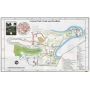
Physical Description
1 map : 4 col. ; 38 x 46 cm. on sheet 49 x 64 cm. folded to 32 x 25 cm.
Notes
Includes indexed advertisements.
"338 89."
Contents
Text on verso: Municipal departments -- Public meetings -- Pa. Senator Noah W. Wenger district office -- Voting districts -- New and revised ordinances -- Permits -- 1993 elected and appointed officials -- Federal officials.
Map showing location and date of the earliest highways leading from the Delaware and Schulkill Rivers to the Susquehanna River and it's branches / by H. Frank Eshleman
A reference map of Lancaster County, Pennsylvania showing the location and distances of the city, townships, boroughs, post-office and villages, together with the main roads (turnpikes), railroads and railroad stations, also the population of each township and borough as per census of 1890