Skip header and navigation

Revise Search

10 records – page 1 of 1.

Bowman Technical School - Information file

https://collections.lancasterhistory.org/en/permalink/lhdo21436
Call Number
Information file - Bowman Technical School
Notes
Information files are created for specific subjects that are associated with Lancaster County, e.g. "Rebman's scrap pile", "Ten-hour house". The files contain newspaper and magazine articles about the subject.
Subjects
Bowman Technical School (Lancaster, Pa.)
Clock and watch making - Pennsylvania - Lancaster County.
Technical education - Pennsylvania - Lancaster County.
Location
Lancaster History Library - Information File
Call Number
Information file - Bowman Technical School
Less detail

Map of greater Lancaster : including maps of Lancaster City & County

https://collections.lancasterhistory.org/en/permalink/lhdo12833
Corporate Author
R.R. Donnelley and Sons Company. Cartographic Services.
Date of Publication
c1988.
Call Number
974.815 LACO 138
Responsibility
all maps prepared by R.R. Donnelley & Sons Co., Cartographic Services.
Corporate Author
R.R. Donnelley and Sons Company. Cartographic Services.
Place of Publication
Lancaster
Publisher
Lancaster Chamber of Commerce and Industry,
Date of Publication
c1988.
Physical Description
6 maps on 1 sheet : both sides, col. ; 56 x 49 cm. or smaller, sheet 56 x 88 cm.
Notes
Panel title.
"Copyright Bizcorp 1988."
Includes notes, indexes, directories, statistical table, location map inset, and col. ill.
Contents
Greater Lancaster -- Lancaster -- [Central business district] -- [Lancaster County showing points of interest, school districts, and historic districts] -- [Regional location map] -- Lancaster County municipal information.
Subjects
Central business districts - Pennsylvania - Lancaster - Maps.
Historic districts - Pennsylvania - Lancaster County - Maps.
School districts - Pennsylvania - Lancaster County - Maps.
Lancaster (Pa.) - Maps.
Lancaster Metropolitan Area (Pa.) - Maps.
Lancaster County (Pa.) - Maps.
Lancaster County (Pa.) - Maps, Tourist.
Additional Corporate Author
Lancaster Chamber of Commerce and Industry (Pa.)
Bizcorp (Firm)
Location
Lancaster History Library - Map
Call Number
974.815 LACO 138
Less detail

Lancaster County bus map

https://collections.lancasterhistory.org/en/permalink/lhdo15531
Corporate Author
Red Rose Transit Authority.
Date of Publication
[1987?]
Call Number
974.815 LACI 152
Alternate Title
Lancaster city bus routes
Lancaster County bus routes
Responsibility
Red Rose Transit Authority.
Corporate Author
Red Rose Transit Authority.
Place of Publication
Lancaster, Pa
Publisher
Red Rose Transit Authority,
Date of Publication
[1987?]
Physical Description
10 maps on 1 sheet : both sides, col. ; 60 x 57 cm. or smaller, on sheet 61 x 82 cm., folded to 21 x 12 cm.
Notes
Ancillary maps (recto): Elizabethtown -- Mount Joy -- Columbia -- Willow Street -- Manheim -- Lititz -- Ephrata -- New Holland.
"This map printed 11/87"--Panel.
Text and col. ill. on verso.
Contents
Lancaster County bus routes -- Lancaster city bus routes.
Subjects
Bus lines - Pennsylvania - Lancaster - Maps.
Bus lines - Pennsylvania - Lancaster County - Maps.
Bus lines - Pennsylvania - Elizabethtown - Maps.
Bus lines - Pennsylvania - Mount Joy - Maps.
Bus lines - Pennsylvania - Columbia - Maps.
Bus lines - Pennsylvania - Willow Street - Maps.
Bus lines - Pennsylvania - Manheim - Maps.
Bus lines - Pennsylvania - Lititz - Maps.
Bus lines - Pennsylvania - Ephrata - Maps.
Bus lines - Pennsylvania - New Holland - Maps.
Lancaster (Pa.) - Maps.
Lancaster County - Maps.
Location
Lancaster History Library - Map
Call Number
974.815 LACI 152
Less detail

Massacre of the Conestogas : on the trail of the Paxton Boys in Lancaster County

https://collections.lancasterhistory.org/en/permalink/lhdo17894
Author
Brubaker, John H.
Date of Publication
2010.
Call Number
974.802 B886
Responsibility
by Jack Brubaker.
ISBN
9781609490614
1609490614
Author
Brubaker, John H.
Place of Publication
Charleston, SC
Publisher
History Press,
Date of Publication
2010.
Physical Description
188 p. : ill., facsims., ports. ; 23 cm.
Notes
Includes index.
Bibliography: p. [177]-188.
Contents
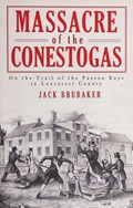
pt. 1. Telling the story -- "Drive the heathen out of the land" -- "Some hot headed ill advised persons" -- "The same spirit & frantic rage" -- "Persons of undoubted probity & veracity" -- pt. 2. Retelling the story -- "I never heard one word of it till it was just over" -- "A mighty noise and hubbub" -- "Shot, scalped, hacked, and cut to pieces" -- "One of those youthful ebullitions of wrath" -- "The innocent were destined to share the fate of the guilty" -- "A zone of vicious racial violence" -- pt. 3. Killers and abettors -- "The most respectable of men" -- "They had possession and would keep it" -- "Eternal shame & reproach" -- pt. 4. Death and reconciliation -- "The remains of the victims of a terrible crime" -- "Slaughter'd, kill'd, and cut off a whole tribe" -- "Who was left to mourn for these people?"
Subjects
Paxton Boys.
Conestoga Indians - Pennsylvania - Lancaster County
Massacres - Pennsylvania - Lancaster County
Lancaster County (Pa.) - History - 18th century.
Lancaster County (Pa.) - Race relations - History - 18th century.
Pennsylvania - History - Colonial period, ca. 1600-1775.
Location
Lancaster History Library - Book
Call Number
974.802 B886
Less detail

Map of greater Lancaster : including maps of Lancaster City & County

https://collections.lancasterhistory.org/en/permalink/lhdo17339
Corporate Author
R.R. Donnelley and Sons Company. Cartographic Services.
Date of Publication
c1988.
Call Number
974.815 LACI 156
Responsibility
compliments of Franklin & Marshall College ; all maps prepared by R.R. Donnelley & Sons Co., Cartographic Services.
Corporate Author
R.R. Donnelley and Sons Company. Cartographic Services.
Place of Publication
Lancaster
Publisher
The College,
Date of Publication
c1988.
Physical Description
5 maps on 1 sheet : both sides, col. ; 56 x 49 cm. or smaller, sheet 56 x 88 cm., folded to 22 x 19 cm.
Notes
Panel title.
Alternate panel title: Franklin & Marshall.
"Copyright Bizcorp 1988."
Includes notes, indexes, directories, statistical table, location map inset, and col. ill.
Contents
Greater Lancaster -- Lancaster -- [Central business district] -- [Lancaster County showing points of interest, school districts, and historic districts] -- [Regional location map] --[Franklin & Marshall College map].
Subjects
Central business districts - Pennsylvania - Lancaster - Maps.
Historic districts - Pennsylvania - Lancaster County - Maps.
School districts - Pennsylvania - Lancaster County - Maps.
Lancaster (Pa.) - Maps.
Lancaster Metropolitan Area (Pa.) - Maps.
Lancaster County (Pa.) - Maps.
Tourist maps.
Additional Corporate Author
Franklin and Marshall College.
Bizcorp (Firm)
Location
Lancaster History Library - Map
Call Number
974.815 LACI 156
Less detail

Champion map of Lancaster, Pennsylvania, including a detailed map of Lancaster County

https://collections.lancasterhistory.org/en/permalink/lhdo15373
Corporate Author
Champion Map Corporation.
Date of Publication
[1977]
Call Number
974.815 LACI 522
Alternate Title
Map of Lancaster, Pennsylvania, city & county
Corporate Author
Champion Map Corporation.
Place of Publication
Charlotte, N.C
Publisher
Champion Map Corp.,
Date of Publication
[1977]
Physical Description
2 maps on 1 sheet : back to back, col. ; 60 x 50 cm. and 48 x 57 cm., folded to 23 x 11 cm.
Notes
City map shows radial distances.
Includes street and location indexes.
On verso: text, location index, location map and ill.
"GG-10-FM."
Scale [ca. 1:31,000] and [ca. 1:200,000].
Subjects
Streets - Pennsylvania - Lancaster - Maps.
Roads - Pennsylvania - Lancaster County - Maps.
Lancaster County (Pa.) - Maps.
Lancaster (Pa.) - Maps.
Location
Lancaster History Library - Map
Call Number
974.815 LACI 522
Less detail

Lancaster Townstead survey for the property the 26th February 1729/30 containing 1000 acre and the allowance of... : land

https://collections.lancasterhistory.org/en/permalink/lhdo7513
Author
Jones, John .
Call Number
974.815 LACI 141
Responsibility
by John Jones.
Author
Jones, John .
Physical Description
1 map : photo reproduction , 16 x 18 cm.
Notes
On verso in pencil: "Orig. map site of Lancaster 1729/30, Hist. Soc. Pa.
Use by permission only S-4".
Original version : details unknown.
Subjects
Land grants - Pennsylvania - Lancaster
Real property - Pennsylvania - Lancaster
Lancaster (Pa.) - Maps.
Location
Lancaster History Library - Map
Call Number
974.815 LACI 141
Less detail

Map of Lancaster County, Pennsylvania

https://collections.lancasterhistory.org/en/permalink/lhdo19200
Corporate Author
National Survey (Firm)
Date of Publication
c1995.
Call Number
974.815 LACO 524
Corporate Author
National Survey (Firm)
Place of Publication
Chester, Vt. : Gordonville, PA
Publisher
National Survey ; Melvin L. Groff [distributor],
Date of Publication
c1995.
Physical Description
1 map : col. ; 66 x 88 cm., folded to 23 x 11 cm.
Notes
Panel title.
Includes road index, inset, col. ill., and bar-code.
Inset borough street maps: Elizabethtown -- Ephrata -- Quarryville -- Columbia.
Street map of Lancaster metro area including Amish Country and blank areas on verso.
Subjects
Roads - Pennsylvania - Lancaster County - Maps.
Lancaster County (Pa.) - Maps.
Lancaster (Pa.) - Maps.
Lancaster Metropolitan Area (Pa.) - Maps.
Elizabethtown (Pa.) - Maps.
Ephrata (Pa.) - Maps.
Quarryville (Pa.) - Maps.
Columbia (Pa.) - Maps.
Amish Country (Pa.) - Maps.
Location
Lancaster History Library - Map
Call Number
974.815 LACO 524
Less detail

The Lancaster County area, street & road map, Pennsylvania : [Lancaster metropolitan area]

https://collections.lancasterhistory.org/en/permalink/lhdo15012
Corporate Author
Atlantic Communications Group.
Date of Publication
c2003.
Call Number
974.815 LACO 518
Alternate Title
Lancaster County area, street and road map, Pennsylvania
Greater Lancaster
Responsibility
Atlantic Communications Group Inc.
Corporate Author
Atlantic Communications Group.
Place of Publication
Flourtown, PA : Lancaster
Publisher
Atlantic Communications Group ; Lancaster Chamber of Commerce & Industry [distributor],
Date of Publication
c2003.
Physical Description
1 map : col. ; 70 x 74 cm., folded to 23 x 11 cm.
Notes
Panel title.
"Published for the Lancaster Chamber of Commerce & Industry ... by the Atlantic Communications Group, Inc."
Includes notes, street index, "Downtown" Lancaster inset, and advertisements.
Notes, indexes, location map (inset), col. ill., and advertisements on verso.
Maps on verso: Lancaster County, Pennsylvania [road map] -- Columbia -- Denver -- Ephrata -- Elizabethtown -- Quarryville -- New Holland.
Subjects
Roads - Pennsylvania - Lancaster County - Maps.
Central business districts - Pennsylvania - Lancaster - Maps.
Lancaster (Pa.) - Maps.
Lancaster Metropolitan Area (Pa.) - Maps.
Columbia (Pa.) - Maps.
Denver (Pa.) - Maps.
Ephrata (Pa.) - Maps.
Elizabethtown (Pa.) - Maps.
Quarryville (Pa.) - Maps.
New Holland (Pa.) - Maps.
Additional Corporate Author
Lancaster Chamber of Commerce and Industry (Pa.)
Location
Lancaster History Library - Map
Call Number
974.815 LACO 518
Less detail

Road map of Lancaster County

https://collections.lancasterhistory.org/en/permalink/lhdo7516
Corporate Author
Lancaster Automobile Club, Inc.
Date of Publication
[1930-1953]
Call Number
974.815 LACO 100
Responsibility
compiled by the Lancaster Automobile Club, Inc.
Corporate Author
Lancaster Automobile Club, Inc.
Place of Publication
Washington, DC
Publisher
American Automobile Association ,
Date of Publication
[1930-1953]
Physical Description
6 maps : col. ; on sheets 42 x 46 cm. folded to 21 x 12 cm.
Notes
8104, 8104 A, 8104 B, 8104 C, 8104 E-1, 8104-D.
Contents
Insets : Columbia, Pa. and Lancaster, Pa.
Subjects
Roads - Pennsylvania - Lancaster County - Maps.
Lancaster County (Pa.) - Maps.
Coumbia (Pa.) - Maps.
Lancaster (Pa.) - Maps.
Additional Corporate Author
American Automobile Association.
Location
Lancaster History Library - Map
Call Number
974.815 LACO 100
Less detail

10 records – page 1 of 1.