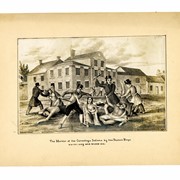
Photograph of the lithograph, "The Murder of the Conestoga Indians by the Paxton Boys. N.W. Cor. King and Prince Sts."
Description
Photograph of the lithograph, "The Murder of the Conestoga Indians by the Paxton Boys" northwest corner of King Street and Prince Street. This lithograph was created by T. Sinclair's Lith., Philadelphia, for the book, "Events in Indian History," by James Witmer which was published in Lancaster by G. Hills & Co. in 1841.
Papers regarding the Paxton Boys and the Conestoga Massacre (MG0614)
George Steinman Papers, Series 1 (MG0184_S01) https://collections.lancasterhistory.org/en/permalink/786b3ffc-7908-40de-9362-817467455650
George Steinman Papers, Series 2 (MG0184_S02) https://collections.lancasterhistory.org/en/permalink/6c7e11c6-f3ca-469c-891a-145832196710
Notes
Preferred Citation: Title or description of item, date (day, month, year), George Steinman Papers (MG0184), Series 2, Object ID, LancasterHistory, Lancaster, Pennsylvania. URL if applicable. Date accessed (day, month, year).
Access Conditions / Restrictions
Please use digital images and transcriptions when available. Original documents may be used by appointment--contact Research@LancasterHistory.org prior to visit.
Copyright
Images have been provided for research purposes only. Please contact Research@LancasterHistory.org for a high-resolution image and permission to publish.
LancasterHistory retains the rights to the digital images and content presented. The doctrine of fair use allows limited use of copyrighted material without permission from the copyright holder. Fair use includes comment, criticism, teaching, and private scholarship. Any images and data downloaded, printed or photocopied for these purposes should provide a citation. All other uses beyond those allowed by fair use require written permission.
Permission for reproduction and/or publication must be obtained in writing from LancasterHistory. Persons wishing to publish any material from this site must assume all responsibility for identifying and satisfying any claimants of copyright or other use restrictions. Publication fees may apply.
Credit
Courtesy of LancasterHistory, Lancaster, Pennsylvania.
Other Numbers
MG-184, Series 2
Other Number
MG-184, Series 2, Folder 16, Item 17
Classification
MG0184
Description Level
Item
Custodial History
Added to database 12 September 2023.
Digitization of this document was funded by the Pennsylvania Historical and Museum Commission, PHMC Appl ID # C980002119, 2021-2024.
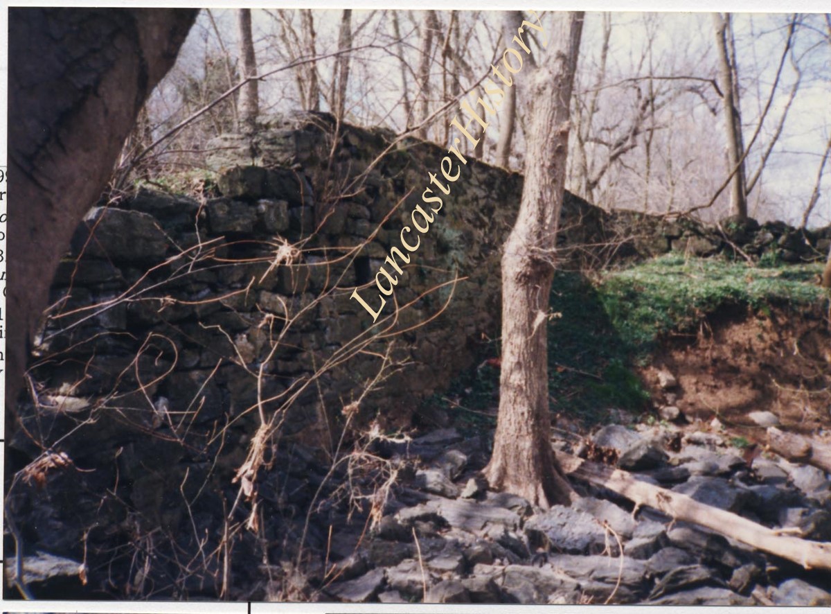
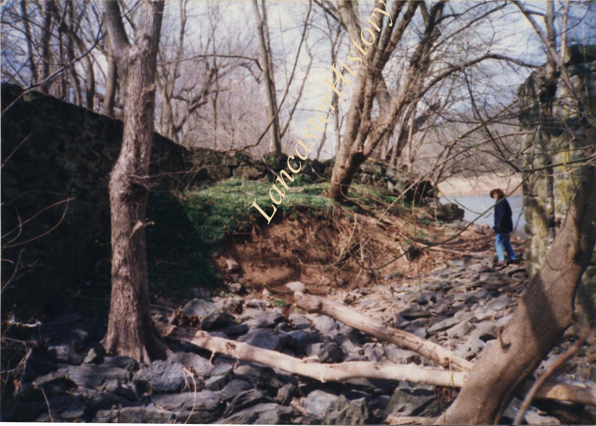
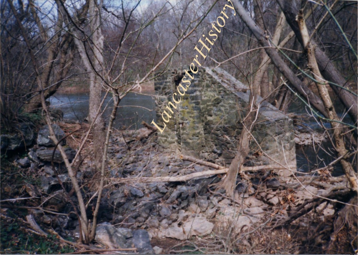
Photograph- This shows the only breakdown that endagesrs the west wall. The prison is filled with rubble stone, fortunately, or flooding would have washed too much away from the eastern portions still standing. The old trolley pylons still stand just southeast of the lock. It is a vital part of Lancaster's history using water to get to down river markets. Lock Number 1 of Conestoga Naviagation Company on the Conestoga River.
Photograph- This shows the only breakdown that endagesrs the west wall. The prison is filled with rubble stone, fortunately, or flooding would have washed too much away from the eastern portions still standing. The old trolley pylons still stand just southeast of the lock. It is a vital part of Lancaster's history using water to get to down river markets. Lock Number 1 of Conestoga Naviagation Company on the Conestoga River.
Description
This shows the only breakdown that endagesrs the west wall. The prison is filled with rubble stone, fortunately, or flooding would have washed too much away from the eastern portions still standing. The old trolley pylons still stand just southeast of the lock. It is a vital part of Lancaster's history using water to get to down river markets. Lock Number 1 of Conestoga Naviagation Company on the Conestoga River.
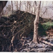
Photograph- This is the other standing portion of the East Wall of Lock Number 1 of the Conestoga Navigation Company canal south of Lancaster on the Conestoga River to Safe Harbor.
Photograph- This is the other standing portion of the East Wall of Lock Number 1 of the Conestoga Navigation Company canal south of Lancaster on the Conestoga River to Safe Harbor.
Description
This is the other standing portion of the East Wall of Lock Number 1 of the Conestoga Navigation Company canal south of Lancaster on the Conestoga River to Safe Harbor.
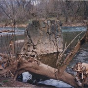
Photograph- This is the boat entrance to the lock and the beginning of the over 100 foot long west wall - all of which seems to be standing except where it is tumbled partely near the lock in the last picture (1-06-04-69). West wall may extend 200 feet. Canal boats were long and narrow, but the lock is really still a good example of the canal works.
Photograph- This is the boat entrance to the lock and the beginning of the over 100 foot long west wall - all of which seems to be standing except where it is tumbled partely near the lock in the last picture (1-06-04-69). West wall may extend 200 feet. Canal boats were long and narrow, but the lock is really still a good example of the canal works.
Description
This is the boat entrance to the lock and the beginning of the over 100 foot long west wall - all of which seems to be standing except where it is tumbled partely near the lock in the last picture (1-06-04-69). West wall may extend 200 feet. Canal boats were long and narrow, but the lock is really still a good example of the canal works.
Photograph- The north gate - east side showing the lock gate groove in the rocks and opposite on west wall of over 100 feet the matching groove and hardware of the gate. This was Lock Number 1 of the Conestoga Navigation Company on the Conestoga River.
Photograph- The north gate - east side showing the lock gate groove in the rocks and opposite on west wall of over 100 feet the matching groove and hardware of the gate. This was Lock Number 1 of the Conestoga Navigation Company on the Conestoga River.
Description
The north gate - east side showing the lock gate groove in the rocks and opposite on west wall of over 100 feet the matching groove and hardware of the gate. This was Lock Number 1 of the Conestoga Navigation Company on the Conestoga River.
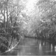
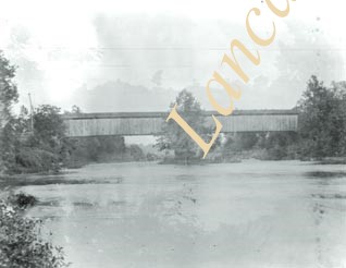
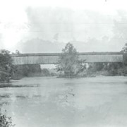
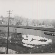
Slackwater, aslo known as Shober's Paper Mill, one mile south of Millersville between Conestoga and Manor Townships. State supervised on road LR 36008, oldest bridge still standing, built 1839, double span 269 feet long.
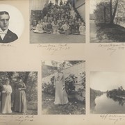
Page 20: Mr. Phil Baker; Large group of children seated on steps, "Conestoga Park, May 8, 1902"; View of the Pennsylvania Railroad bridge over the Conestoga River, "Conestoga Park, May 8, 1902"; Miss Ella Musser, Miss Sondau, and Miss Buckius, Conestoga Park, May 8, 1902; Unidentified Mennonite woman; View of Conestoga River, "Off Witmer's Bridge, May 8, 1902".
Provenance
First of two Diffenderfer family albums. Compiled by Frank Reid Diffenderfer, a former member of LCHS and an editor of a Lancaster city newspaper. Album documents his family as well as that of his neighbors on North Duke Street, Lancaster, between 1901 and 1903. Neighbors include Charles Fondersmith, Robert Slaymaker, and his daughter, Ida, who married Frank Fondersmith.