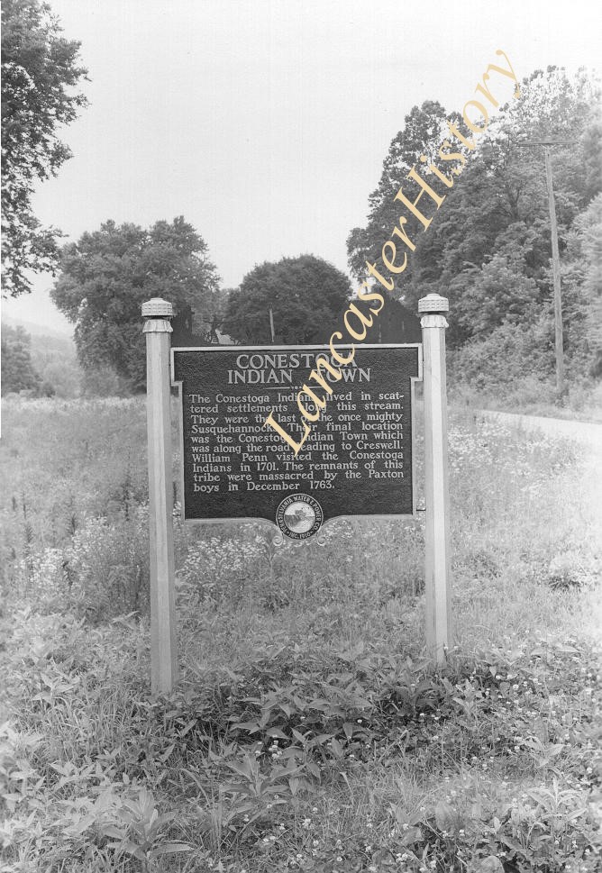
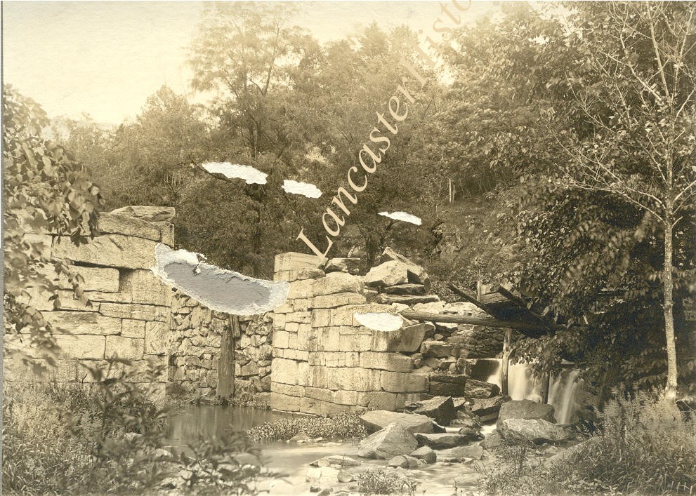
Historic marker placed by Pennsylvania Water and Power Company near Safe Harbor. Conestoga Indian Town. The Conestoga Indians lived in sacttered settlements along this stream. They were the last of the once mighty Susquehannocks. Their f
Historic marker placed by Pennsylvania Water and Power Company near Safe Harbor. Conestoga Indian Town. The Conestoga Indians lived in sacttered settlements along this stream. They were the last of the once mighty Susquehannocks. Their f
Description
Historic marker placed by Pennsylvania Water and Power Company near Safe Harbor. "Conestoga Indian Town. The Conestoga Indians lived in sacttered settlements along this stream. They were the last of the once mighty Susquehannocks. Their final location was the Conestoga Indian Town which was along the road leading to Creswell. William Penn visited the Conestoga indians in 1701. The remnants of this tribe were massacred by the Paxton boys in December 1763."
Photograph- Historic marker placed by Pennsylvania Water and Power Company near Safe Harbor.
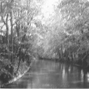
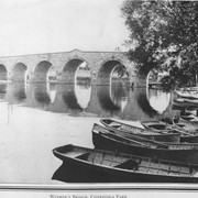
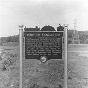
Port of Lancaster. The Conestoga Navigation Company, incorporated 1825, constructed on Conestoga Creek, from lancaster to the Susquehanna River, 9 locks and dams which wer used for slackwater navigation for about 40 years. A rock fill crib dam across the river made possible cargo exchanges with the Susquehanna and Tidewater Canal located on the west shore.
Photograph- Historic marker placed by Pennsylvania Water and Power Company near Safe Harbor.
Port of Lancaster. The Conestoga Navigation Company, incorporated 1825, constructed on Conestoga Creek, from lancaster to the Susquehanna River, 9 locks and dams which wer used for slackwater navigation for about 40 years. A rock fill crib dam across the river made possible cargo exchanges with the Susquehanna and Tidewater Canal located on the west shore.
Description
Historic marker placed by Pennsylvania Water and Power Company near Safe Harbor.
Port of Lancaster. The Conestoga Navigation Company, incorporated 1825, constructed on Conestoga Creek, from lancaster to the Susquehanna River, 9 locks and dams which wer used for slackwater navigation for about 40 years. A rock fill crib dam across the river made possible cargo exchanges with the Susquehanna and Tidewater Canal located on the west shore.
Photograph- Historic marker placed by Pennsylvania Water and Power Company near Safe Harbor.
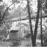
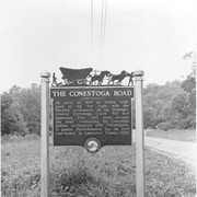
The Conestoga Road. As early as 1638 an Indian trail, used in the fur trade with the Swedish settlements on the Delaware, crossed Conestoga Creek 400 feet upstream. This trail later became the road connecting the Conestoga Indian settlements with Philadelphia. It passes Postlethwaite's Inn, the first courthouse in Lancaster County in 1729.
Photograph- Historic marker placed by Pennsylvania Water and Power Company near Safe Harbor.
The Conestoga Road. As early as 1638 an Indian trail, used in the fur trade with the Swedish settlements on the Delaware, crossed Conestoga Creek 400 feet upstream. This trail later became the road connecting the Conestoga Indian settlements with Philadelphia. It passes Postlethwaite's Inn, the first courthouse in Lancaster County in 1729.
Description
Historic marker placed by Pennsylvania Water and Power Company near Safe Harbor.
The Conestoga Road. As early as 1638 an Indian trail, used in the fur trade with the Swedish settlements on the Delaware, crossed Conestoga Creek 400 feet upstream. This trail later became the road connecting the Conestoga Indian settlements with Philadelphia. It passes Postlethwaite's Inn, the first courthouse in Lancaster County in 1729.