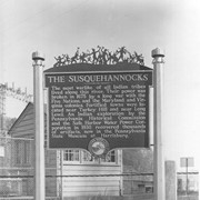
Historic marker placed by the Pennsylvania Water and Power Corporation near Safe Harbor.
The Susquehannocks. The most warlike of all Indian tribes lived along this river. Thier power was broken in 1675 by a long war with the Five Natio
Description
Historic marker placed by the Pennsylvania Water and Power Corporation near Safe Harbor:
"The Susquehannocks. The most warlike of all Indian tribes lived along this river. Thier power was broken in 1675 by a long war with the Five Nations, and the Maryland and Virginia colonies. Fortified towns were located near Turkey Hill and near Long Level. An Indian exploration by the Pennsylvania Historical Commission and the Safe Harbor Water Power Corporation in 1930 recovered thousands of artifacts, now in the Pennsylvania State Museum at Harrisburg."
Historic marker placed by Pennsylvania Water and Power Company near Safe Harbor.
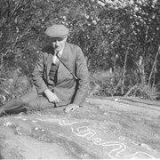
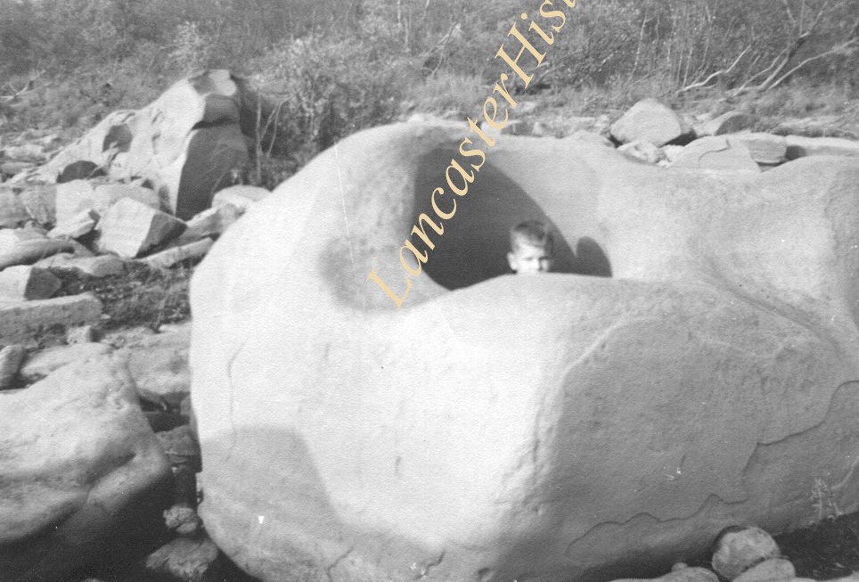
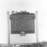
Indian Carvings. Petroglyphs, dating back to the original Algonquin Indians who lovedin this vicinity, can be seen on the Big and Little Indian Rocks in the
Historic marker placed by Pennsylvania Water and Power Company near Safe Harbor.
Indian Carvings. Petroglyphs, dating back to the original Algonquin Indians who lovedin this vicinity, can be seen on the Big and Little Indian Rocks in the
Description
Historic marker placed by Pennsylvania Water and Power Company near Safe Harbor.
"Indian Carvings. Petroglyphs, dating back to the original Algonquin Indians who lovedin this vicinity, can be seen on the Big and Little Indian Rocks in the river bed 800 feet downstream. Other rock carvings, now submerged, were found on Walnut Island and near Creswell above the dam. These were preserved by plaster casts made by the Pennsylvania Historical Commission in 1930."
Photograph- Historic marker placed by Pennsylvania Water and Power Company near Safe Harbor.
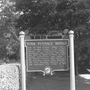
York Furnace Bridge. The last of the wooden bridges to be erected across the Susquehanna between Harrisburg and the tidewater was located about one-half mile downstream. It was built by Black & huber in 1856. During construction four spans of the section between Bair Island and the Lancaster County shore blew down and were promptly replaced. An ice jam destroyed this bridge in 1857.
Photograph- Historic marker placed by Pennsylvania Water and Power Company near Safe Harbor.
York Furnace Bridge. The last of the wooden bridges to be erected across the Susquehanna between Harrisburg and the tidewater was located about one-half mile downstream. It was built by Black & huber in 1856. During construction four spans of the section between Bair Island and the Lancaster County shore blew down and were promptly replaced. An ice jam destroyed this bridge in 1857.
Description
Historic marker placed by Pennsylvania Water and Power Company near Safe Harbor.
York Furnace Bridge. The last of the wooden bridges to be erected across the Susquehanna between Harrisburg and the tidewater was located about one-half mile downstream. It was built by Black & huber in 1856. During construction four spans of the section between Bair Island and the Lancaster County shore blew down and were promptly replaced. An ice jam destroyed this bridge in 1857.
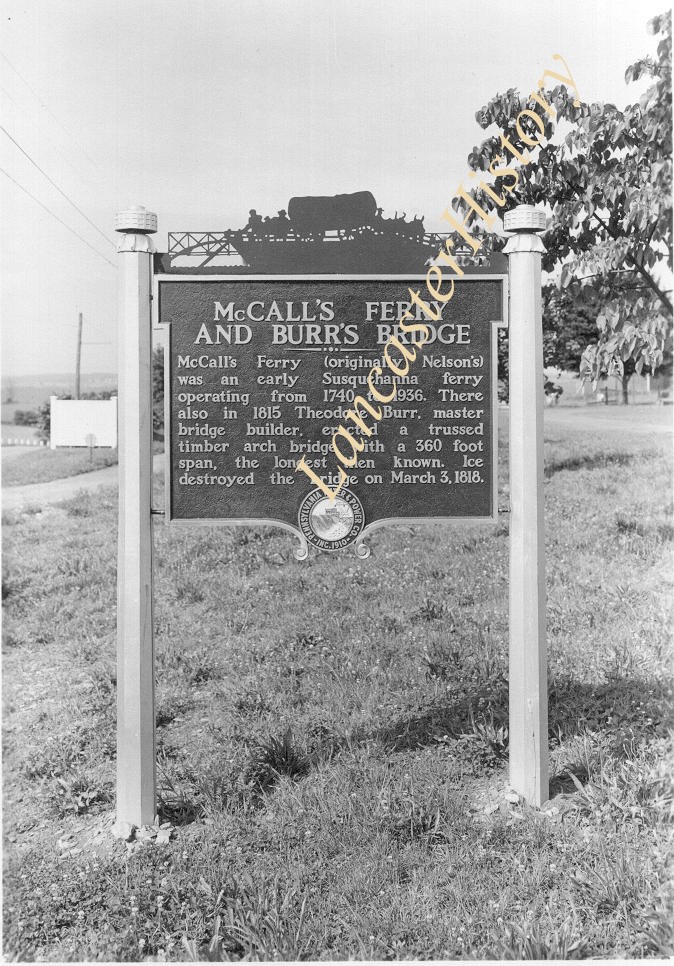
Photograph- Historic marker placed by Pennsylvania Water and Power Company near Safe Harbor.
McCall's Ferry and Burr's Bridge. McCall's Ferry, originally Nelson's, was an early Susquehanna ferry operationg from 1740 to 1936. THere also in 1815 Theodore Burr, master bridge builder, erected a trussed timber arch bridge with a 360 foot span, the longest then known. Ice destoryed the bridge on March 3, 1818.
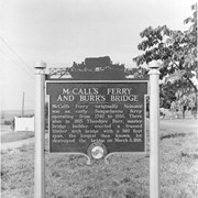
Description
Historic marker placed by Pennsylvania Water and Power Company near Safe Harbor.
McCall's Ferry and Burr's Bridge. McCall's Ferry, originally Nelson's, was an early Susquehanna ferry operationg from 1740 to 1936. THere also in 1815 Theodore Burr, master bridge builder, erected a trussed timber arch bridge with a 360 foot span, the longest then known. Ice destoryed the bridge on March 3, 1818.