Skip header and navigation

Revise Search

10 records – page 1 of 1.

Atlas of the historical geography of the United States

https://collections.lancasterhistory.org/en/permalink/lhdo10545
Author
Paullin, Charles Oscar,
Date of Publication
1932.
Call Number
911.73 P329
Responsibility
by Charles O. Paulin, edited by John K. Wright.
Author
Paullin, Charles Oscar,
Place of Publication
[Washington, D.C., New York]
Publisher
Pub. jointly by Carnegie institution of Washington and the American Geographical Society of New York,
Date of Publication
1932.
Physical Description
2 p. β., iii-xv p., 1 β., 162 p., 1 β., 688 maps (part col.) on 166 pl. (part double) 37 cm.
Series
Carnegie Institution of Washington publication
Notes
A collection of maps, cartograms, and reproductions of early maps on many different scales, illustrating the natural environment of the United States and its demographic, economic, political, and military history. The text explains the maps and lists the sources from which they complied.
Housed on atlas stand in Reading Room.
Subjects
Atlases.
Historical geography.
Cartography - America.
United States - Historical geography - Maps.
Additional Author
Wright, John Kirtland,
Additional Corporate Author
American Geographical Society of New York.
Carnegie Institution of Washington. Division of Historical Research.
Location
Lancaster History Library - Atlas
Call Number
911.73 P329
Less detail

Berks County, Pennsylvania, street map book : includes Wyomissing, Mount Penn, West Reading, Blue Marsh Lake, Lake Ontelaunee

https://collections.lancasterhistory.org/en/permalink/lhdo19186
Corporate Author
ADC (Firm)
Edition
3rd ed.
Date of Publication
c2003.
Call Number
912.74816 A221 3d ed. 2003 Atlas Stand
Responsibility
ADC The Map People.
ISBN
0875303838
9780875303833
Corporate Author
ADC (Firm)
Edition
3rd ed.
Place of Publication
Alexandria, VA
Publisher
ADC,
Date of Publication
c2003.
Physical Description
1 atlas (120 p.) : col. maps ; 32 cm.
Notes
Cover title.
Includes indexes and zip codes.
Subjects
Zip codes - Pennsylvania - Berks County - Maps.
Zip codes.
Berks County (Pa.) - Maps.
Pennsylvania - Berks County.
Maps.
Location
Lancaster History Library - Reference
Call Number
912.74816 A221 3d ed. 2003 Atlas Stand
Less detail

Bicycle map, Lancaster County : a guide to bicycling, walking & transit

https://collections.lancasterhistory.org/en/permalink/lhdo19792
Corporate Author
Steve Spindler Cartography (Firm)
Date of Publication
[2004]
Call Number
974.815 LACO 513
Alternate Title
Lancaster County bicycle map
Responsibility
map produced for Lancaster County, Pennsylvania ; cartography--Steve Spindler Cartography ; design--Peter Volz Design ; project management--Toole Design Group.
Corporate Author
Steve Spindler Cartography (Firm)
Place of Publication
[Lancaster, Pa.]
Publisher
Lancaster County Planning Commission,
Date of Publication
[2004]
Physical Description
1 map : col. ; 64 x 67 cm., folded to 22 x 10 cm.
Notes
Bicycling conditions shown on road-map base.
Relief shown by shading.
"December 2004."
"Information on this map is accurate as of June 2004."
Title from panel.
Includes text, distance/travel-time table, and col. ill.
Text, directory of bicycle shops, and col. ill. on verso.
Maps on verso: City of Lancaster -- Transit map, Lancaster city routes -- County routes.
Subjects
Bicycle trails - Pennsylvania - Lancaster County - Maps.
Bicycle trails - Pennsylvania - Lancaster - Maps.
Bicycle stores - Pennsylvania - Lancaster County - Maps.
Bus lines - Pennsylvania - Lancaster County - Maps.
Bus lines - Pennsylvania - Lancaster - Maps.
Roads - Pennsylvania - Lancaster County - Maps.
Hiking - Pennsylvania - Lancaster County - Maps.
Additional Corporate Author
Peter Volz Design (Firm)
Toole Design Group.
Lancaster County Planning Commission.
Location
Lancaster History Library - Map
Call Number
974.815 LACO 513
Less detail

Cecil County, Maryland : street map book

https://collections.lancasterhistory.org/en/permalink/lhdo19213
Corporate Author
ADC (Firm)
Edition
10th ed.
Date of Publication
[c2000]
Call Number
912.75238 A221 10th ed. 2000 Atlas Stand
Alternate Title
Street map book, Cecil County, Maryland
Responsibility
ADC.
ISBN
0875300480
9780875300481
Corporate Author
ADC (Firm)
Edition
10th ed.
Place of Publication
Alexandria, VA
Publisher
ADC,
Date of Publication
[c2000]
Physical Description
1 atlas (40 p.) : col. maps ; 36 cm.
Notes
Cover title.
"Includes Childs, Colora, Elk Mills, Fredericktown, Elk Neck State Park, Stemmers Run WMA."
Includes indexes.
Subjects
Zip codes - Maryland - Cecil County - Maps.
Zip codes.
Cecil County (Md.) - Maps.
Maryland - Cecil County.
Maps.
Location
Lancaster History Library - Reference
Call Number
912.75238 A221 10th ed. 2000 Atlas Stand
Less detail

City of Lancaster and adjacent suburbs

https://collections.lancasterhistory.org/en/permalink/lhdo1754
Date of Publication
March 1933.
Call Number
974.815 LACI 104
Responsibility
Edward Edgerley
Place of Publication
[S.l.]
Publisher
[s.n.] ,
Date of Publication
March 1933.
Physical Description
1 map ; 53 x 56 cm.
Subjects
Lancaster (Pa.) - Maps.
Location
Lancaster History Library - Map
Call Number
974.815 LACI 104
Less detail

The Comprehensive Plan for Lancaster County, Pennsylvania

https://collections.lancasterhistory.org/en/permalink/lhdo14600
Corporate Author
Lancaster County Planning Commission.
Date of Publication
2006.
Call Number
352.96 L245cp
Corporate Author
Lancaster County Planning Commission.
Place of Publication
Lancaster, Pa
Publisher
Lancaster County Planning Commission,
Date of Publication
2006.
Physical Description
4 vol. : ill., maps ; 28 cm.
Notes
Vol 1. Balance: the growth management element, April 2006 - vol. 2. Choices: the housing element, April 2006 - vol. 3. Heritage: the cultural heritage element: a strategy for preserving our sense of place, April 2006 - vol 4. Tourism: the strategic tourism development element, June 2005.
Cover title.
Subjects
Regional planning - Pennsylvania - Lancaster County - Maps.
Regional planning - Pennsylvania - Lancaster County.
Housing - Pennsylvania - Lancaster County.
Historic preservation - Pennsylvania - Lancaster County.
Location
Lancaster History Library - Book
Call Number
352.96 L245cp
Copy Info
2006
2005
Less detail

Conestoga Memorial Park, Inc., Lancaster, Pa

https://collections.lancasterhistory.org/en/permalink/lhdo2622
Edition
Revised 3-4-59.
Date of Publication
1939.
Call Number
974.815 LACI 707
Responsibility
designed and drawn by P.W. Shenberger.
Edition
Revised 3-4-59.
Place of Publication
[Lancaster, Pa.]
Publisher
[s.n.] ,
Date of Publication
1939.
Physical Description
1 map : photocopy ; 100 x 168 cm.
Notes
Blue line print. Gives lot numbers.
Subjects
Conestoga Memorial Park (Lancaster, Pa.) - Maps.
Cemeteries - Pennsylvania - Lancaster County - Lancaster Township
Lancaster (Lancaster County, Pa. : Township) - Maps.
Location
Lancaster History Library - Map
Call Number
974.815 LACI 707
Less detail

Early landowners of Pennsylvania

https://collections.lancasterhistory.org/en/permalink/lhdo18990
Author
MacInnes, Sharon Cook.
Edition
1st ed.
Date of Publication
c2008.
Call Number
912.74815 M152
Alternate Title
Atlas of township patent maps of Lancaster County, PA
Responsibility
Sharon Cook MacInnes, Angus MacInnes.
ISBN
9781558564978
1558564977
Author
MacInnes, Sharon Cook.
Edition
1st ed.
Place of Publication
Apollo, Pa
Publisher
Closson Press,
Date of Publication
c2008.
Physical Description
1 atlas (xi, 527 p.) : maps ; 28 cm.
Notes
Includes bibliographical references (p. xi) and index.
Subjects
Landowners - Pennsylvania - Lancaster County - Maps.
Landowners - Pennsylvania - Lancaster County - Registers.
Real property - Pennsylvania - Lancaster County - Maps.
Lancaster County (Pa.) - Genealogy.
Additional Author
MacInnes, Angus.
Location
Lancaster History Library - Reference
Call Number
912.74815 M152
Less detail

Elizabethtown ; Lancaster County

https://collections.lancasterhistory.org/en/permalink/lhdo15532
Edition
2005 ed.
Date of Publication
2005.
Call Number
974.815 ELIZ 100
Alternate Title
City of Elizabethtown & Lancaster County
City of Elizabethtown and Lancaster County
Lancaster County
Edition
2005 ed.
Place of Publication
[S.l
Publisher
Hometown Productions],
Date of Publication
2005.
Physical Description
2 maps on 1 sheet : both sides ; 56 x 88 cm. and 56 x 87 cm. on sheet 58 x 89 cm., folded to 11 x 23 cm.
Notes
Panel title.
Includes location map and advertisements.
Elizabethtown map includes index to streets.
Contents
Elizabethtown -- Lancaster County.
Subjects
Roads - Pennsylvania - Elizabethtown - Maps.
Roads - Pennsylvania - Lancaster County - Maps.
Elizabethtown (Pa.) - Maps.
Lancaster County (Pa.) - Maps.
Location
Lancaster History Library - Map
Call Number
974.815 ELIZ 100
Less detail

[Frey Farm landfill and Creswell landfill, Lancaster County, Pennsylvania] map

https://collections.lancasterhistory.org/en/permalink/lhdo15830
Corporate Author
Lancaster County Solid Waste Management Authority.
Date of Publication
2002]
Call Number
974.815 LACO 152
  1 document  
Responsibility
Lancaster County Solid Waste Management Authority.
Corporate Author
Lancaster County Solid Waste Management Authority.
Place of Publication
[Lancaster, Pa
Publisher
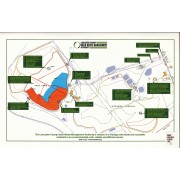
Lancaster County Solid Waste Management Authority,
Date of Publication
2002]
Physical Description
1 map : col. ; 25 x 41 cm.
Notes
Title supplied.
Includes text.
"The Lancaster County Solid Waste Management Authority's mission is to manage solid waste and recyclable materials in an environmentally safe, reliable and efficient manner."
Subjects
Fills (Earthwork) - Pennsylvania - Lancaster County - Maps.
Location
Lancaster History Library - Map
Call Number
974.815 LACO 152
Documents

map_974.815_LACO_152_.pdf

Read PDF Download PDF
Less detail

10 records – page 1 of 1.