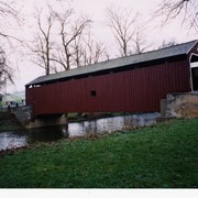
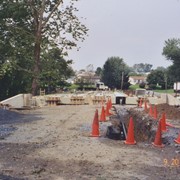
Wenger's Mill covered bridge, also called Rose Hill covered bridge, built in 1849 by Henry Zook. Located on Log Cabin Road, just off of Rose Hill Road.
Provenance
Photographs of a 2003 Theodore Burr Covered Bridge Society bridge safari.
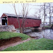
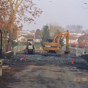
Wenger's Mill covered bridge, also called Rose Hill covered bridge, built in 1849 by Henry Zook. Located on Log Cabin Road, just off of Rose Hill Road.
Provenance
Photographs of a 2003 Theodore Burr Covered Bridge Society bridge safari.
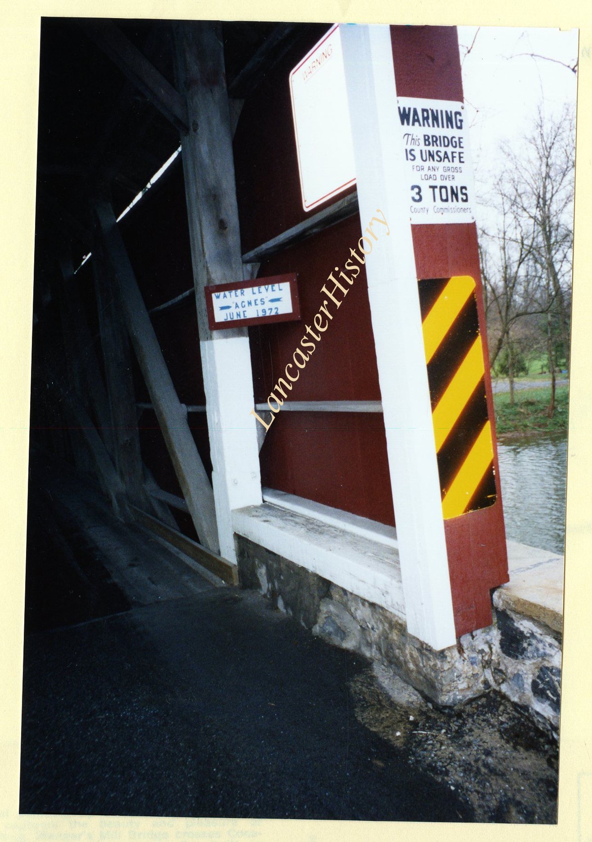
Wenger's Mill covered bridge, also called Rose Hill covered bridge, built in 1849 by Henry Zook. Located on Log Cabin Road, just off of Rose Hill Road. Close of high water mark during Hurricane Agnes, June 1972.
Provenance
Photographs of a 2003 Theodore Burr Covered Bridge Society bridge safari.
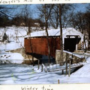
Wenger's Mill covered bridge, also called Rose Hill covered bridge, built in 1849 by Henry Zook. Located on Log Cabin Road, just off of Rose Hill Road. In the snow.
Provenance
Photographs of a 2003 Theodore Burr Covered Bridge Society bridge safari.
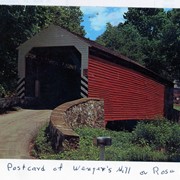
Wenger's Mill covered bridge, also called Rose Hill covered bridge, built in 1849 by Henry Zook. Located on Log Cabin Road, just off of Rose Hill Road. Post card.
Provenance
Photographs of a 2003 Theodore Burr Covered Bridge Society bridge safari.
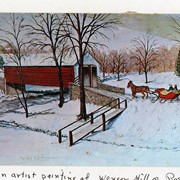
Wenger's Mill covered bridge, also called Rose Hill covered bridge, built in 1849 by Henry Zook. Located on Log Cabin Road, just off of Rose Hill Road. Postcard of painting by Louise Frank.
Provenance
Photographs of a 2003 Theodore Burr Covered Bridge Society bridge safari.
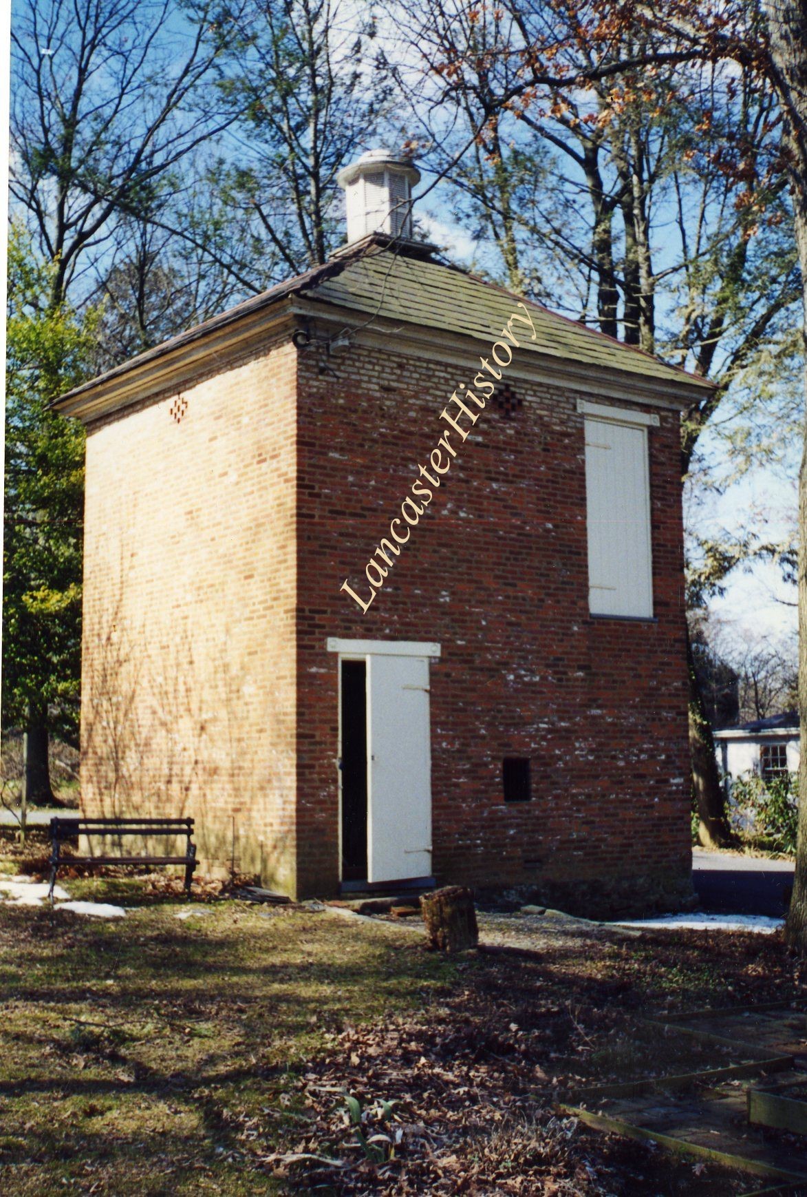
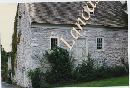
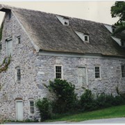
Photograph- Compass Mill at the intersection of Pierson Road and Rothsville Road (Route 772) just outside of Lititz. Built by the Moravian Congregation c. 1755.
Photograph- Compass Mill at the intersection of Pierson Road and Rothsville Road (Route 772) just outside of Lititz. Built by the Moravian Congregation c. 1755.
Description
Compass Mill at the intersection of Pierson Road and Rothsville Road (Route 772) just outside of Lititz. Built by the Moravian Congregation c. 1755.
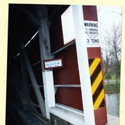
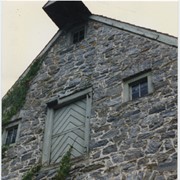
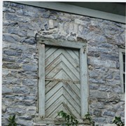
Photograph- Detail of Compass Mill at the intersection of Pierson Road and Rothsville Road (Route 772) just outside of Lititz. Built by the Moravian Congregation c. 1755.
Photograph- Detail of Compass Mill at the intersection of Pierson Road and Rothsville Road (Route 772) just outside of Lititz. Built by the Moravian Congregation c. 1755.
Description
Detail of Compass Mill at the intersection of Pierson Road and Rothsville Road (Route 772) just outside of Lititz. Built by the Moravian Congregation c. 1755.
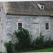
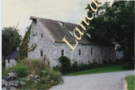
Photograph- Compass Mill at the intersection of Pierson Road and Rothsville Road (Route 772) just outside of Lititz. Built by the Moravian Congregation c. 1755.
Photograph- Compass Mill at the intersection of Pierson Road and Rothsville Road (Route 772) just outside of Lititz. Built by the Moravian Congregation c. 1755.
Description
Compass Mill at the intersection of Pierson Road and Rothsville Road (Route 772) just outside of Lititz. Built by the Moravian Congregation c. 1755.
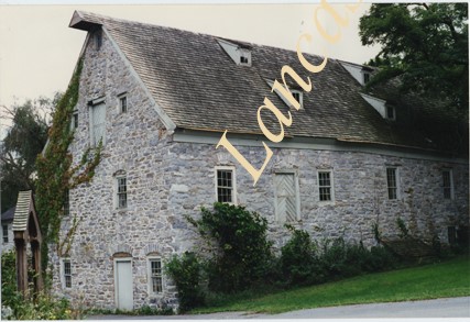
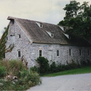
Photograph- Compass Mill at the intersection of Pierson Road and Rothsville Road (Route 772) just outside of Lititz. Built by the Moravian Congregation c. 1755.
Photograph- Compass Mill at the intersection of Pierson Road and Rothsville Road (Route 772) just outside of Lititz. Built by the Moravian Congregation c. 1755.
Description
Compass Mill at the intersection of Pierson Road and Rothsville Road (Route 772) just outside of Lititz. Built by the Moravian Congregation c. 1755.
Photograph- Compass Mill at the intersection of Pierson Road and Rothsville Road (Route 772) just outside of Lititz. Built by the Moravian Congregation c. 1755.
Photograph- Compass Mill at the intersection of Pierson Road and Rothsville Road (Route 772) just outside of Lititz. Built by the Moravian Congregation c. 1755.
Description
Compass Mill at the intersection of Pierson Road and Rothsville Road (Route 772) just outside of Lititz. Built by the Moravian Congregation c. 1755.