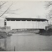
Poole Forge covered bridge, one mile west of Churchtown in Caernarvon Township. State supervised bridge on road LR 36053, built 1859, single span 99 feet long.
Isaac Shearer's Mill covered bridge, one mile north of Goodville in Caernarvon Township. County maintained on road T-773, built 1878, single span 88 feet long.
Isaac Bear's Mill covered bridge, one mile southwest of Martindale in East Earl Township. County maintained on road T-674, built in 1876, single span 94 feet long.
Martin's Mill, also known as Fiences Mill or Eberly's Mill, two miles south of Murrell in West Earl Township. State supervised on road LR 36122, built in 1846, single span 98.5 feet long. Also called Bitzer's Mill.
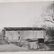
Bushong's Mill, near Oregon between Upper Leacock and Manheim Townships. State supervised on road LR 36009, built in 1843, longest single span in the county, 195 feet long.
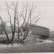
Nolt's Point Mill, close to William Shand's residence, .5 mile south of Oregon between Upper Leacock and Manheim Townships. County maintained on road T-620, built in 1867, single span 133 feet long. A beautiful stone bridge is close by.
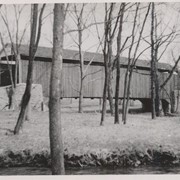
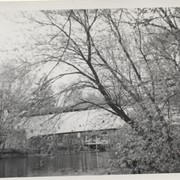
Hunsecker's Mill covered bridge, between Manheim and Upper Leacock Townships. State supervised on road LR 36011, built in 1848, single span 180 feet long. Destroyed during Hurricane Agnes in June 1972, rebuilt.
Isreal Groff's Factory or Umble's Mill at Waters Edge, .5 mile south of Eden between Manheim and East Lampeter Townships. State supervised on road LR 36183, built in 1848, single span 158 feet long.
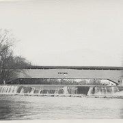
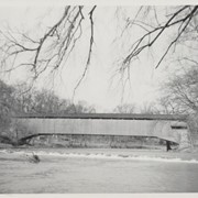
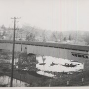
Snavely's Mill, second lock of the Slackwater Canal, south of Lancaster city, between Lancaster and Pequea Townships. County maintained on road T-504, built in 1857 (first bridge 1836, second bridge 1850), longest bridge in Lancaster County, double span 349 feet long. Destroyed by fire in the 1960s.
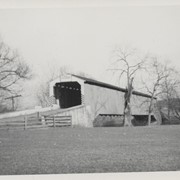
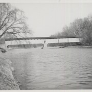
Slackwater, aslo known as Shober's Paper Mill, one mile south of Millersville between Conestoga and Manor Townships. State supervised on road LR 36008, oldest bridge still standing, built 1839, double span 269 feet long.
Good's Sawmill covered bridge, .5 mile south of Fivepointville, between East Earl and Brecknock Townships. State supervised on road LR 30612, built in 1851, single span 82 feet long.
Joseph Oberholtzer's Mill, at Red Bank, 1.5 miles north west of Terre Hill, between Earl and Brecknock Townships. State supervised on LR 36013, built 1866, single span 128 feet long.
Fry's Mill, one mile east of Hahnstown between Ephrata and East Cocalico Townships. County maintained on road T-813, built in 1849, single span 95 feet long.
Gable's Fording, one mile northeast of Hinkletown, near confluence with Conestoga River, between Earl and Ephrata Townships. State supervised on road LR 36052, built in 1872, single span 129 feet long.
Bucher's Mill, .5 mile west of Reamstown in East Cocalico Township. County maintained on road T-955 just off Route 222, built in 1881, single span 60 feet long.
Keller's Mill, .5 mile north of Akron in Ephrata Township. County maintained on road T-656, built in 1891 (first bridge 1873), single span 76 feet long.
Abram Hess's Mill, one mile north of Millway in Ephrata Township. State supervised on road LR 36121, built in 1844 (first bridge 1825), single span 58 feet long.