- Corporate Author
- Lancaster County (Pa.). Dept. of Parks and Recreation.
- Date of Publication
- [2000?]
- Call Number
- 974.815 LACO 148
Border
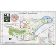
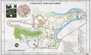
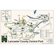
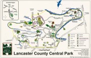
Lancaster County Central Park
Lancaster County
Department of Parks and Recreation
1050 Rockford Rd.
Lancaster, PA 17602-4624
Telephone: 717-299-8215
Fax: 717-295-5942
Web Page: www.co.lancaster.pa.us/parks.htm
--...~~~~~~~~~~~~~~~~~~~~~~~~~~~~~~~~~~~~~~~~~~~~~~~~~~~~~---' 1·/
�