"This lovingly written book, accompanied by more than 75 of the author's own sketches, provides a reliable record of those vanishing forms of architecture. Accurate line drawings depict a variety of barns, such as those in Maine, attached to houses; an 'open' log barn in Virginia, and a 'top hat' barn in North Carolina. Covered bridges - like barns, built for soundness and endurance - are also illustrated, among them a saltbox structure in New England, a bridge with a pedestrian walkway in rural New York State, and a 10-span-long bridge at Clark's Ferry, Pennsylvania." [from the publisher]
111 p. : chiefly ill. (chiefly col.) , maps ; 23 x 29 cm.
Summary
"226 color photos show Lancaster County, Pennsylvania's, historic covered bridges in every season. The images and text are arranged in five groups, creating five separate regional tours. Providing GPS coordinates for each bridge makes every bridge easy to find using a GPS satellite navigation device. If you prefer you may also use a local tour map of course"--Publisher's description.
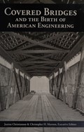
editors Justine Christianson [and three others] ; authors James Barker [and seven others].
ISBN
9780578171067
0578171066
Place of Publication
Washington, DC
Publisher
National Park Service, Historic American Engineering Record,
Date of Publication
2015.
Physical Description
234 pages : color illustrations
Notes
"This study is conducted under a joint agreement between the Federal Highway Administration -- Turner Fairbank Highway Research Center, and the National Park Service -- Historic American Engineering Record (HAER)."
List of Pennsylvania bridges in the study listed on pages 224-225.