Skip header and navigation

Revise Search

60 records – page 1 of 6.

Collection
Barton Mill Photograph Collection
Object ID
BM-06-006
Date Range
c. 1969
  1 image  
Object Name
Negative
Collection
Barton Mill Photograph Collection
Description
Barton identifies this as Rock Hill Mill. Built by Philip Von Neida in 1818 on Liest Creek, one mile south of Adamstown.
Provenance
Photographs from MG-15 Harold R. Barton Collection
Date Range
c. 1969
Creator
Barton, R. Harold
Storage Location
LancasterHistory, Lancaster, PA
People
Von Neida, Philip
Search Terms
Rock Hill Mill
Liest Creek
Place
East Cocalico Twp.
Object Name
Negative
Film Size
2.5 x 3.5 inches
Condition
Not Rated
Object ID
BM-06-006
Images
Less detail
Collection
Barton Mill Photograph Collection
Object ID
BM-06-007
Date Range
c. 1969
  1 image  
Object Name
Negative
Collection
Barton Mill Photograph Collection
Description
Barton identifies this as Rock Hill Mill. Built by Philip Von Neida in 1818 on Liest Creek, one mile south of Adamstown.
Provenance
Photographs from MG-15 Harold R. Barton Collection
Date Range
c. 1969
Creator
Barton, R. Harold
Storage Location
LancasterHistory, Lancaster, PA
People
Von Neida, Philip
Search Terms
Rock Hill Mill
Liest Creek
Place
East Cocalico Twp.
Object Name
Negative
Film Size
2.5 x 3.5 inches
Condition
Not Rated
Object ID
BM-06-007
Images
Less detail
Collection
Barton Mill Photograph Collection
Object ID
BM-06-018
Date Range
c. 1969
  1 image  
Object Name
Negative
Collection
Barton Mill Photograph Collection
Description
Union Mill on Cocalico Creek.
Provenance
Photographs from MG-15 Harold R. Barton Collection
Date Range
c. 1969
Creator
Barton, R. Harold
Storage Location
LancasterHistory, Lancaster, PA
Search Terms
Union Mill
Mills
East Cocalico Twp.
Cocalico Creek
Place
East Cocalico Twp.
Object Name
Negative
Film Size
2.5 x 3.5 inches
Condition
Not Rated
Object ID
BM-06-018
Images
Less detail
Collection
Barton Mill Photograph Collection
Object ID
BM-06-056
  1 image  
Object Name
Negative
Collection
Barton Mill Photograph Collection
Description
Marietta Roller Mill or Chickies Rock Saw Mill on Big Chickies Creek.
Provenance
Photographs from MG-15 Harold R. Barton Collection
Creator
Barton, R. Harold
Storage Location
LancasterHistory, Lancaster, PA
Search Terms
Marietta Roller Mill
Chickies Creek Saw Mill
Place
East Donegal Twp.
Object Name
Negative
Film Size
2.5 x 3.75 inches
Condition
Not Rated
Object ID
BM-06-056
Images
Less detail
Collection
Barton Mill Photograph Collection
Object ID
BM-06-154
  1 image  
Object Name
Negative
Collection
Barton Mill Photograph Collection
Description
Pine Grove Covered Bridge over Octoraro Creek
Provenance
Photographs from MG-15 Harold R. Barton Collection
Creator
Barton, R. Harold
Storage Location
LancasterHistory, Lancaster, PA
Search Terms
Pine Grove Covered Bridge
Octoraro Creek
Place
Little Britain Twp.
Object Name
Negative
Film Size
2.5 x 3.75 inches
Condition
Not Rated
Object ID
BM-06-154
Images
Less detail
Collection
Barton Mill Photograph Collection
Object ID
BM-06-155
  1 image  
Object Name
Negative
Collection
Barton Mill Photograph Collection
Description
Pine Grove Covered Bridge over Octoraro Creek
Provenance
Photographs from MG-15 Harold R. Barton Collection
Creator
Barton, R. Harold
Storage Location
LancasterHistory, Lancaster, PA
Search Terms
Pine Grove Covered Bridge
Octoraro Creek
Place
Little Britain Twp.
Object Name
Negative
Film Size
2.5 x 3.75 inches
Condition
Not Rated
Object ID
BM-06-155
Images
Less detail
Collection
Covered Bridge Album
Object ID
A-11-01-13
Date Range
1950
  1 image  
Object Name
Print, Photographic
Collection
Covered Bridge Album
Description
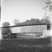
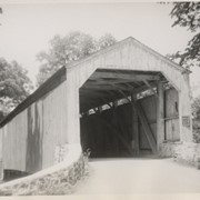
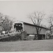
Good's Sawmill covered bridge, .5 mile south of Fivepointville, between East Earl and Brecknock Townships. State supervised on road LR 30612, built in 1851, single span 82 feet long.
Date Range
1950
Creator
Gaintner, Jay Richard
Storage Location
LancasterHistory, Lancaster, PA
Subcategory
Documentary Artifact
Search Terms
Bridges
Covered bridges
Mills
Muddy Creek
Object Name
Print, Photographic
Print Size
8 x 10 inches
Object ID
A-11-01-13
Images
Less detail
Collection
Covered Bridge Album
Object ID
A-11-01-14
Date Range
1950
  1 image  
Object Name
Print, Photographic
Collection
Covered Bridge Album
Description
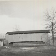
Joseph Oberholtzer's Mill, at Red Bank, 1.5 miles north west of Terre Hill, between Earl and Brecknock Townships. State supervised on LR 36013, built 1866, single span 128 feet long.
Date Range
1950
Creator
Gaintner, Jay Richard
Storage Location
LancasterHistory, Lancaster, PA
People
Oberholtzer, Jacob
Subcategory
Documentary Artifact
Search Terms
Bridges
Covered bridges
Mills
Muddy Creek
Object Name
Print, Photographic
Print Size
8 x 10 inches
Object ID
A-11-01-14
Images
Less detail
Collection
Covered Bridge Album
Object ID
A-11-01-15
Date Range
1950
  1 image  
Object Name
Print, Photographic
Collection
Covered Bridge Album
Description
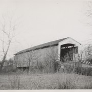
Fry's Mill, one mile east of Hahnstown between Ephrata and East Cocalico Townships. County maintained on road T-813, built in 1849, single span 95 feet long.
Date Range
1950
Creator
Gaintner, Jay Richard
Storage Location
LancasterHistory, Lancaster, PA
People
Oberholtzer, Jacob
Subcategory
Documentary Artifact
Search Terms
Bridges
Covered bridges
Mills
Muddy Creek
Hahnstown, Ephrata Twp.
Object Name
Print, Photographic
Print Size
8 x 10 inches
Object ID
A-11-01-15
Images
Less detail
Collection
Covered Bridge Album
Object ID
A-11-01-16
Date Range
1950
  1 image  
Object Name
Print, Photographic
Collection
Covered Bridge Album
Description
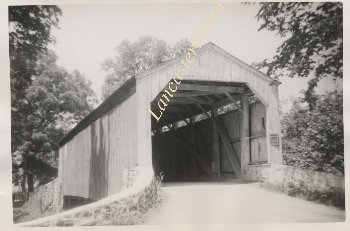
Gable's Fording, one mile northeast of Hinkletown, near confluence with Conestoga River, between Earl and Ephrata Townships. State supervised on road LR 36052, built in 1872, single span 129 feet long.
Date Range
1950
Creator
Gaintner, Jay Richard
Storage Location
LancasterHistory, Lancaster, PA
Subcategory
Documentary Artifact
Search Terms
Bridges
Covered bridges
Mills
Hinkletown, Earl Twp.
Muddy Creek
Object Name
Print, Photographic
Print Size
8 x 10 inches
Object ID
A-11-01-16
Images
Less detail

60 records – page 1 of 6.