Skip header and navigation

Revise Search

4 records – page 1 of 1.

History of Lancaster County's highway system (from 1714 to 1760)

https://collections.lancasterhistory.org/en/permalink/lhdo4185
Author
Eshleman, Henry Frank,
Date of Publication
1922
  1 document  
Responsibility
by H. Frank Eshleman.
Author
Eshleman, Henry Frank,
Place of Publication
Lancaster, Pa
Publisher
Lancaster County Historical Society,
Date of Publication
1922
Physical Description
37-80 p. : ill. ; 23 cm.
Series
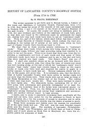
Journal of the Lancaster County Historical Society ; v. 26, no. 3
Notes
The author of this article states that the purpose of most early roads was to provide access to churches and to mills. Many of the roads profiled in this article refer to specific mills. Although information about the mills is limited, this article could prove fruitful for some researchers.
Subjects
Roads - Pennsylvania - Lancaster County.
Lancaster County (Pa.) - Maps.
Contained In
Journal of the Lancaster County Historical Society. Volume 26, number 3 (1922), p. 37-80Lancaster History Library - Journal974.9 L245 v.26
Documents

vol26no3pp37_80_2246734.pdf

Read PDF Download PDF
Less detail

Map of the early roads of Lancaster County, Pa. 1714 to 1760

https://collections.lancasterhistory.org/en/permalink/lhdo15379
Author
Eshleman, H. Frank
Date of Publication
1922]
Call Number
974.815 LACO 158
974.815 LACO 506
  1 document  
Alternate Title
Outline of Lancaster County Penna., townships, streams, etc.
Responsibility
compiled from the records of the courts by H. Frank Eshleman.
Author
Eshleman, H. Frank
Place of Publication
[S.l
Publisher
s.n.,
Date of Publication
1922]
Physical Description
1 map : photoreproduction, 2 col. ; 23 x 24 cm.
Notes
Scale of original map: [ca. 1:316,800]. 1 in. - 5 mi.
Map of early roads of Lancaster County depicted in red outline; Outline of Lancaster County, Penna. townships, streams, etc. depicted in blue outline.
LCHS has 2 copies 60 x 60 cm. with scale 1in.=2mi.
LCHS has 4 copies 23 x 24 cm. with scale 1in.=5mi.
The figures show number and page of Road Docket.
Appears in LCHS Journal, v. 26, no. 3.
Subjects
Roads - Pennsylvania - Lancaster County - Maps.
Rivers - Pennsylvania - Lancaster County - Maps.
Lancaster County (Pa.) - Maps.
Location
Lancaster History Library - Map
Call Number
974.815 LACO 158
974.815 LACO 506
Documents

map_974.815_LACO_158_.pdf

Read PDF Download PDF
Less detail

Map of the public roads in Lancaster County, Pennsylvania : constructed from actual surveys made under direction of the State Highway Department by authority of an Act of Assembly approved May 1, 1905

https://collections.lancasterhistory.org/en/permalink/lhdo14598
Corporate Author
A. Hoen and Company.
Date of Publication
[1923?]
Call Number
974.815 LACO 517 Oversize
Corporate Author
A. Hoen and Company.
Place of Publication
Baltimore, Md
Publisher
H. Hoen & Co. Lith.,
Date of Publication
[1923?]
Physical Description
1 map : col. ; 99 x 105 cm.
Notes
"April 1, 1923."
Includes table of township road mileages and distance table.
Subjects
Post office buildings - Pennsylvania - Lancaster County - Maps.
Roads - Pennsylvania - Lancaster County - Maps.
Lancaster County (Pa.) - Maps.
Additional Corporate Author
Pennsylvania. Highway Dept.
Location
Lancaster History Library - Map
Call Number
974.815 LACO 517 Oversize
Less detail

Map showing location of islands in Susquehanna River between Safe Harbor and Columbia

https://collections.lancasterhistory.org/en/permalink/lhdo5480
Date of Publication
1929.
Call Number
974.80091 501 sheet 1, 2 Oversize
Place of Publication
Baltimore, Md
Publisher
Pennsylvania Water & Power Co. ,
Date of Publication
1929.
Physical Description
1 map on 2 sheets ; 71 x 238 cm.
Notes
Shows landowners.
Blueprint.
"100/110-A-130073".
Oriented with north toward the upper left.
Subjects
Susquehanna River
Landowners - Pennsylvania - Lancaster County
Lancaster County (Pa.) - Maps.
Location
Lancaster History Library - Map
Call Number
974.80091 501 sheet 1, 2 Oversize
Less detail