It appears no script is enabled within your browser. Please enable JavaScript to use this site.
Skip header and navigation
Toggle navigation
Collections
Search
Help
Privacy
Your Selections:
0
Items
Staff Login
Revise Search
Revise Search
Revise search
Search
Data Source
Photographs
3
×
Data Source
All
A
B
C
D
E
F
G
H
I
J
K
L
M
N
O
P
Q
R
S
T
U
V
W
X
Y
Z
Sort
By Count
Alphabetical
Filtered by
Filter
Loading...
Collection
Leon Landis Album 1
2
General Collection
1
×
Collection
All
A
B
C
D
E
F
G
H
I
J
K
L
M
N
O
P
Q
R
S
T
U
V
W
X
Y
Z
Sort
By Count
Alphabetical
Filtered by
Filter
Loading...
Subject
Documentary Artifact
3
Roads
3
Turnpikes
3
Highways
2
Tollgates
2
Tollhouses
2
Aerial photographs
1
Dunlap Farm
1
Farms
1
Grofftown Road
1
Horseshoe Pike
1
Lititz Pike
1
More
×
Subject
All
A
B
C
D
E
F
G
H
I
J
K
L
M
N
O
P
Q
R
S
T
U
V
W
X
Y
Z
Sort
By Count
Alphabetical
Filtered by
Filter
Loading...
Place
East Lampeter Twp.
1
Ephrata Twp.
1
Manheim Twp.
1
×
Place
All
A
B
C
D
E
F
G
H
I
J
K
L
M
N
O
P
Q
R
S
T
U
V
W
X
Y
Z
Sort
By Count
Alphabetical
Filtered by
Filter
Loading...
Decade
1920s
1
×
Decade
All
A
B
C
D
E
F
G
H
I
J
K
L
M
N
O
P
Q
R
S
T
U
V
W
X
Y
Z
Sort
By Count
Alphabetical
Filtered by
Filter
Loading...
Material
Petition
50
Report
10
Specification
10
Record, Judicial
5
Proposal
4
Archive
3
Print, Photographic
Certificate
2
Contract
2
Negative
2
Certificate, Stock
1
Drawing
1
More
×
Material
All
A
B
C
D
E
F
G
H
I
J
K
L
M
N
O
P
Q
R
S
T
U
V
W
X
Y
Z
Sort
By Count
Alphabetical
Filtered by
Filter
Loading...
Online Media
Image
3
×
Online Media
All
A
B
C
D
E
F
G
H
I
J
K
L
M
N
O
P
Q
R
S
T
U
V
W
X
Y
Z
Sort
By Count
Alphabetical
Filtered by
Filter
Loading...
Advanced Search
Help
topic:"Turnpikes"
Print, Photographic
Sorted by
Title
Sort by Relevance
Expand All
Collapse All
List View
Gallery View
Print
3 records – page 1 of 1.
Prev
Next
Toggle Full Record
Print, Photographic
https://collections.lancasterhistory.org/en/permalink/6e308133-c672-498c-9e11-138635161715
Collection
General Collection
Title
Aerial view of the junction of the Lititz Pike and the Oregon Pike
Object ID
1-05-06-51
Date Range
c. 1929
More detail
1 image
Object Name
Print, Photographic
Collection
General Collection
Title
Aerial view of the junction of the Lititz Pike and the Oregon Pike
Description
Aerial view of the junction of the Lititz Pike (Route 501) and the Oregon Pike (Route 272) showing Glen Moore Circle and the Dunlap farm.
Provenance
Donated by Jessie Jones Eckhart, daughter of pilot Jesse Jones of Lancaster.
Date Range
c. 1929
Storage Location
LancasterHistory, Lancaster, PA
Subcategory
Documentary Artifact
Search Terms
Dunlap Farm
Farms
Lititz Pike
Oregon Pike
Roads
Turnpikes
Aerial photographs
Place
Manheim Twp.
Object Name
Print, Photographic
Condition
Good
Object ID
1-05-06-51
Images
Less detail
More Like This
Permalink
Toggle Full Record
Print, Photographic
https://collections.lancasterhistory.org/en/permalink/82ee0137-64ef-4f14-9494-075234456830
Collection
Leon Landis Album 1
Object ID
A-01-01-21
More detail
1 image
Object Name
Print, Photographic
Collection
Leon Landis Album 1
Description
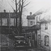
Horseshoe Pike toll gate. Reprint of postcard. Horseshoe Pike is Route 322. Photo is possibly taken near Ephrata.
Storage Location
LancasterHistory, Lancaster, PA
Subcategory
Documentary Artifact
Search Terms
Highways
Horseshoe Pike
Roads
Tollgates
Tollhouses
Turnpikes
Place
Ephrata Twp.
Object Name
Print, Photographic
Print Size
8 x 10 inches
Object ID
A-01-01-21
Images
Less detail
More Like This
Permalink
Toggle Full Record
Print, Photographic
https://collections.lancasterhistory.org/en/permalink/a68db769-7f97-44e3-91a7-796379275652
Collection
Leon Landis Album 1
Object ID
A-01-01-22
More detail
1 image
Object Name
Print, Photographic
Collection
Leon Landis Album 1
Description
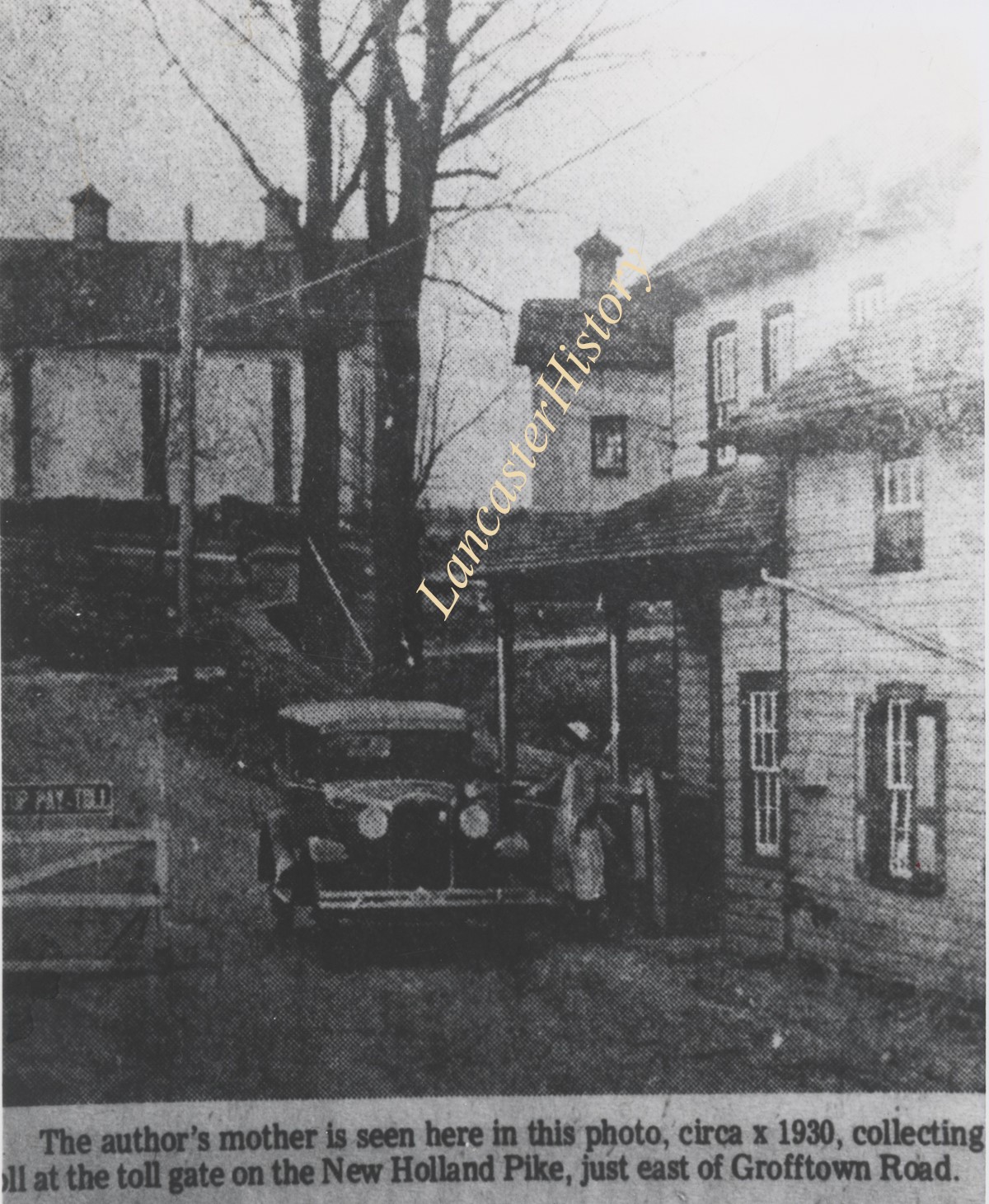
Newspaper photo of the toll house and toll gate on New Holland Pike near Grofftown Road, just east of Lancaster.
Storage Location
LancasterHistory, Lancaster, PA
Subcategory
Documentary Artifact
Search Terms
Grofftown Road
Highways
New Holland Pike
Roads
Tollgates
Tollhouses
Turnpikes
Place
East Lampeter Twp.
Object Name
Print, Photographic
Print Size
8 x 10 inches
Object ID
A-01-01-22
Images
Less detail
More Like This
Permalink