Original annotated in margin: Copied from the original under the direction of the Surveyor General the 29th of July 1819, Dan Small.
Relief shown by hachures.
Shows churches, schools, mills, factories, and forges.
Accompanied by certificate with seal attesting that "this is a photo copy of a map of Lancaster County used by John Melish in constructing his state map. Reproduced from film of an original remaining on file in the Land Office of the Department of Internal Affairs" of Pennsylvania. 1 leaf.
Sometimes referred to as a "Whiteside" map. See Munger's Pennsylvania Land Records, p. 129-130.
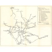
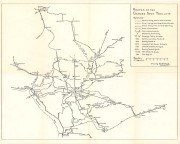
Folded title: Official Pennsylvania Dutch guide map.
Includes descriptive index of "Pennsylvania Dutch Tourist Bureau members," index to points of interest, calendar of annual events, and diagr. of visitors' center area.
Descriptive index, indexed map of "City of Lancaster," tourist information, and illus. (part col.) on verso.