Original annotated in margin: Copied from the original under the direction of the Surveyor General the 29th of July 1819, Dan Small.
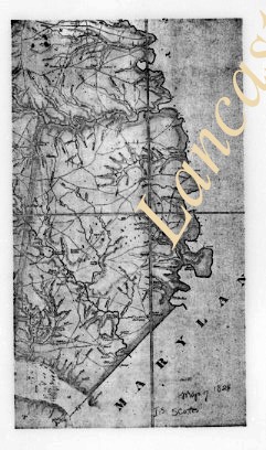
Relief shown by hachures.
Shows churches, schools, mills, factories, and forges.
Accompanied by certificate with seal attesting that "this is a photo copy of a map of Lancaster County used by John Melish in constructing his state map. Reproduced from film of an original remaining on file in the Land Office of the Department of Internal Affairs" of Pennsylvania. 1 leaf.
Sometimes referred to as a "Whiteside" map. See Munger's Pennsylvania Land Records, p. 129-130.
Graphic scale in miles and perches represented on map.
Relief shown by hill shading.
Irregularly shaped.
Inset: Statistical table (Inhabitants 1820, Taxables 1821, Acres of land, Value of land per acre 1st rate, Taverns, stores, mills and manufactories).
Date of situation 1820-1821.
Original was published in Lancaster, PA January 1st 1824.
Summary
"This map is constructed under a series of TRIANGLES whose Angles have been minutely ascertained to preserve Latitude and Longitude on a Scale of ONE INCH to a MILE from actual City and Borough boundaries. The Roads The Millstreams noting all their improvements. The River Susquehanna on both sides keeping its breadth by intersections. The Islands, their respective distances from each other and from the Shores. The whole carefully protracted. Also a correct Topographical representation of the mountains, Ridges and Vallies."
This record group contains canceled orders that were issued by the county commissioners for payment to be made by the county treasurer. The orders show date, order number, amount, name of payee, purpose, and signatures of the county commissioners. In the case of "poor children," teachers were reimbursed by the county for tuition and/or the supplies purchased for students whose parents were unable to pay. Orders include: Poor Children, Almshouse, Bridges, Coroners' Inquests, Prisons, Roads, Court House, and Tax Exonerations.
System of Arrangement
The record group is organized chronologically, then arranged by order number within each year.