It appears no script is enabled within your browser. Please enable JavaScript to use this site.
Skip header and navigation
Toggle navigation
Collections
Search
Help
Privacy
Your Selections:
0
Items
Staff Login
Revise Search
Revise Search
Revise search
Search
Data Source
Photographs
7835
Archives
2970
×
Data Source
All
A
B
C
D
E
F
G
H
I
J
K
L
M
N
O
P
Q
R
S
T
U
V
W
X
Y
Z
Sort
By Count
Alphabetical
Filtered by
Filter
Loading...
Collection
Estate Inventories
2970
Henry Kauffman Photograph Collection
2884
Darmstaetter Collection
1329
General Collection
1103
Lancaster Recreation Commission Photograph Collection
957
Johnny Hauck Photograph Collection
549
Brown Family Photograph Collection
374
DeWalt Products Collection
189
Bruce Ryder Photograph Collection
88
Paul Shaub - United Steel Workers Local 285 Photograph Collection
67
Slaymaker Family Photograph Collection
65
Samuel Dyke Photograph Collection
55
More
×
Collection
All
A
B
C
D
E
F
G
H
I
J
K
L
M
N
O
P
Q
R
S
T
U
V
W
X
Y
Z
Sort
By Count
Alphabetical
Filtered by
Filter
Loading...
Subject
Documentary Artifact
10805
Sports
560
Boxing
509
Pugilism
509
Estate Inventories
361
House
310
Probate Records
248
Firearms
234
Playgrounds
234
Probate records
204
Rifles
192
Churches
163
More
×
Subject
All
A
B
C
D
E
F
G
H
I
J
K
L
M
N
O
P
Q
R
S
T
U
V
W
X
Y
Z
Sort
By Count
Alphabetical
Filtered by
Filter
Loading...
Name
Darmstaetter's
1426
Heiges, George L.
164
Hostetter, Harry B.
63
Ryder, Bruce
54
Hauck, Johnny
19
Ryder, Elizabeth
17
Warfel, Mary
14
Heiges, Emma S. Dissinger Zug
13
Slaymaker, Amos
11
Slaymaker, Henry
10
Zook, Walter
10
Gara, Elizabeth
9
More
×
Name
All
A
B
C
D
E
F
G
H
I
J
K
L
M
N
O
P
Q
R
S
T
U
V
W
X
Y
Z
Sort
By Count
Alphabetical
Filtered by
Filter
Loading...
Place
Lancaster
1965
None
1404
Salisbury Twp.
406
none
187
Manheim
121
Manheim Twp.
78
Donegal Twp.
69
Lancaster Twp.
64
Rapho Twp.
60
Warwick Twp.
57
East Hempfield Twp.
54
Conestoga Twp.
52
More
×
Place
All
A
B
C
D
E
F
G
H
I
J
K
L
M
N
O
P
Q
R
S
T
U
V
W
X
Y
Z
Sort
By Count
Alphabetical
Filtered by
Filter
Loading...
Decade
1720s
4
1730s
218
1740s
890
1750s
790
1760s
511
1770s
53
1780s
12
1790s
1
1800s
2
1810s
1
1820s
19
1830s
1
1840s
5
1850s
71
1860s
30
1870s
79
1880s
83
1890s
86
1900s
98
1910s
86
1920s
856
1930s
451
1940s
30
1950s
30
1960s
191
1970s
51
1980s
21
1990s
1
×
Decade
All
A
B
C
D
E
F
G
H
I
J
K
L
M
N
O
P
Q
R
S
T
U
V
W
X
Y
Z
Sort
By Count
Alphabetical
Filtered by
Filter
Loading...
Material
Print, Photographic
57528
Statement, Financial
32308
Indictment
29667
Record, Judicial
26008
Documents
15384
Transparency, Slide
10634
Negative
Probate
6671
Petition
5220
Record, Marriage
3095
Estate Inventory
Negative, Glass Plate
2264
More
×
Material
All
A
B
C
D
E
F
G
H
I
J
K
L
M
N
O
P
Q
R
S
T
U
V
W
X
Y
Z
Sort
By Count
Alphabetical
Filtered by
Filter
Loading...
Archival Hierarchy
Item
2777
Fonds
1
×
Archival Hierarchy
All
A
B
C
D
E
F
G
H
I
J
K
L
M
N
O
P
Q
R
S
T
U
V
W
X
Y
Z
Sort
By Count
Alphabetical
Filtered by
Filter
Loading...
Online Media
Image
7830
PDF
63
×
Online Media
All
A
B
C
D
E
F
G
H
I
J
K
L
M
N
O
P
Q
R
S
T
U
V
W
X
Y
Z
Sort
By Count
Alphabetical
Filtered by
Filter
Loading...
Advanced Search
Help
more like: 03CD0048-785F-4268-B5C6-277917256926
Estate Inventory
Negative
Sorted by
Relevance
Sort by Title
Expand All
Collapse All
List View
Gallery View
Print
10 records – page 1 of 1.
Prev
Next
Toggle Full Record
Estate Inventory
https://collections.lancasterhistory.org/en/permalink/a2362f2d-b2aa-4a9c-90b9-969932229538
Collection
Estate Inventories
Title
Estate inventory of Abraham Mackey
Object ID
Inv 1760 F001 M
Date Range
1760
More detail
Collection
Estate Inventories
Title
Estate inventory of Abraham Mackey
Admin/Biographical History
An estate inventory is a list of the assets and liabilities of a decedent's estate with the appraised value of those items, with the exception of real estate.
Date Range
1760
Year
1760
Storage Location
LancasterHistory, Lancaster, PA
Storage Room
Archives West
Storage Container
Box 0080
People
Mackey, Abraham
Subcategory
Documentary Artifact
Subjects
Probate records
Search Terms
Estate inventories
Probate records
Administrators' bonds
Renunciation
Administrators' accounts
Place
Strasburg Twp.
Object Name
Estate Inventory
Language
English
Object ID
Inv 1760 F001 M
Location of Originals
LancasterHistory, Lancaster, Pennsylvania
Box Number
080
Additional Notes
Also administrators' bond, administrators' account, renunciation.
Please use photocopy.
4 items, 4 pieces
Access Conditions / Restrictions
Please request a photocopy or PDF at the Reference Desk or by email at Research@LancasterHistory.org.
Copyright
Please contact Research@LancasterHistory.org for a
high-resolution image and permission to publish. There is no fee for
publication.
Credit
Courtesy of the Lancaster County Archives and LancasterHistory, Lancaster, Pennsylvania.
Classification
RG-03-00-0133
Description Level
Item
Less detail
More Like This
Permalink
Toggle Full Record
Negative
https://collections.lancasterhistory.org/en/permalink/c646568d-8c52-406a-ba0e-558305303232
Collection
Darmstaetter Collection
Title
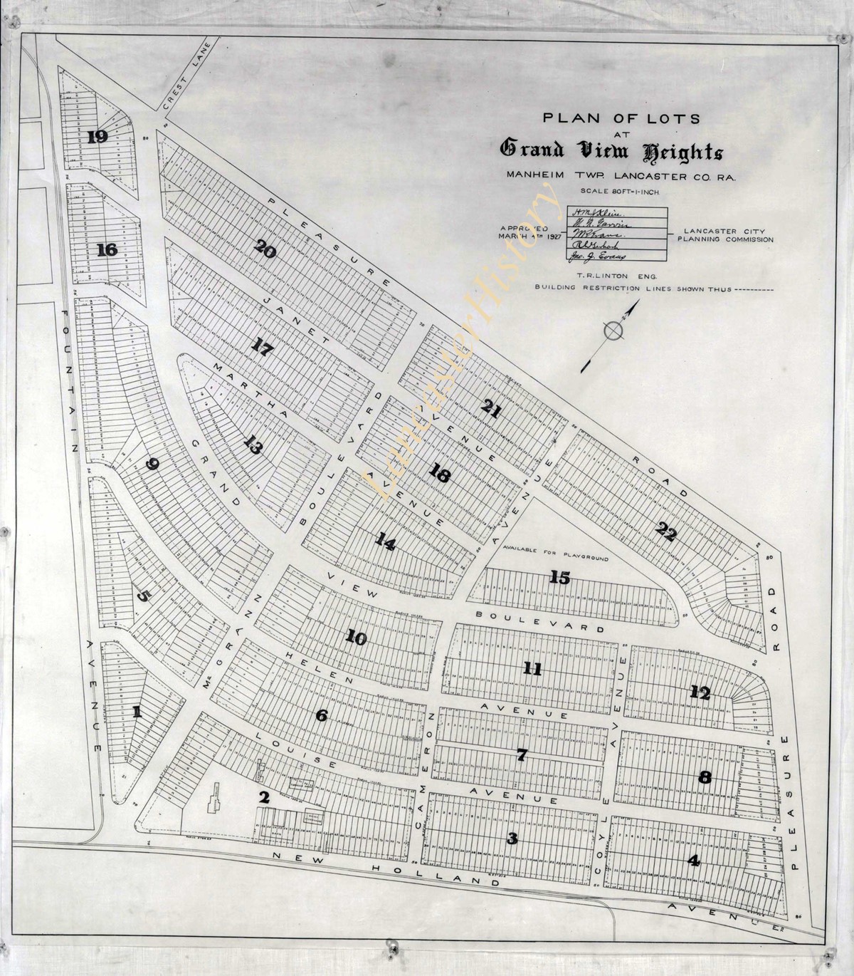
Photograph- Plan for lots in Grandview Heights.
Object ID
D-07-03-56
More detail
1 image
Object Name
Negative
Collection
Darmstaetter Collection
Title
Photograph- Plan for lots in Grandview Heights.
Description
Plan for lots in Grandview Heights. 1 print only
Storage Location
LancasterHistory, Lancaster, PA
Studio
Darmstaetter's
Subcategory
Documentary Artifact
Classification
Maps
Place
Manheim Twp.
Object Name
Negative
Film Size
8 x 10 inches
Object ID
D-07-03-56
Negative Number
yes
Other Number
660-870
Images
Less detail
More Like This
Permalink
Toggle Full Record
Negative
https://collections.lancasterhistory.org/en/permalink/7723bebb-3aa3-432f-abec-170944938900
Collection
Darmstaetter Collection
Title
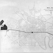
Photograph- Plan for Greater Lancaster showing Wheatland Hills.
Object ID
D-07-03-55
Date Range
January 24, 1927
More detail
1 image
Object Name
Negative
Collection
Darmstaetter Collection
Title
Photograph- Plan for Greater Lancaster showing Wheatland Hills.
Description
Plan for Greater Lancaster showing Wheatland Hills. 1 print only
Date Range
January 24, 1927
Storage Location
LancasterHistory, Lancaster, PA
Studio
Darmstaetter's
Subcategory
Documentary Artifact
Classification
Maps
Place
East Hempfield Twp.
Object Name
Negative
Film Size
10 x 8 inches
Object ID
D-07-03-55
Negative Number
yes
Other Number
660-257
Images
Less detail
More Like This
Permalink
Toggle Full Record
Negative
https://collections.lancasterhistory.org/en/permalink/7b4479be-5ce0-4aed-b9d1-296882065808
Collection
Darmstaetter Collection
Title
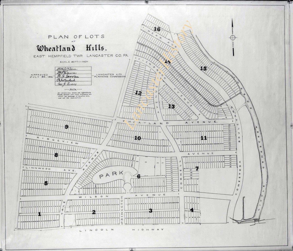
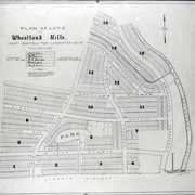
Photograph- Plan of lots at Wheatland Hills.
Object ID
D-07-03-54
More detail
1 image
Object Name
Negative
Collection
Darmstaetter Collection
Title
Photograph- Plan of lots at Wheatland Hills.
Description
Plan of lots at Wheatland Hills. 1 print only
Storage Location
LancasterHistory, Lancaster, PA
Studio
Darmstaetter's
Subcategory
Documentary Artifact
Classification
Maps
Place
East Hempfield Twp.
Object Name
Negative
Film Size
10 x 8 inches
Object ID
D-07-03-54
Negative Number
yes
Other Number
660-180
Images
Less detail
More Like This
Permalink
Toggle Full Record
Negative
https://collections.lancasterhistory.org/en/permalink/cfeaaee4-cdc4-4b21-aef9-829150874936
Collection
Darmstaetter Collection
Title
Photograph- Map of Lancaster County.
Object ID
D-07-03-53
Date Range
1926/02/22
More detail
1 image
Object Name
Negative
Collection
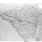
Darmstaetter Collection
Title
Photograph- Map of Lancaster County.
Description
Map of Lancaster County. 1 print only
Date Range
1926/02/22
Year Range From
1926
Storage Location
LancasterHistory, Lancaster, PA
Studio
Darmstaetter's
Subcategory
Documentary Artifact
Classification
Maps
Place
Lancaster County
Object Name
Negative
Film Size
10 x 8 inches
Object ID
D-07-03-53
Negative Number
yes
Other Number
642-435
Images
Less detail
More Like This
Permalink
Toggle Full Record
Negative
https://collections.lancasterhistory.org/en/permalink/23988159-db5d-4ca5-b01e-153188656558
Collection
Darmstaetter Collection
Title
Photograph- Map showing Berks, Lebanon, York, Chester, and Lancaster Counties.
Object ID
D-07-03-52
Date Range
1928/10/01
More detail
1 image
Object Name
Negative
Collection
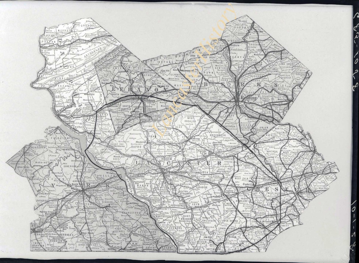
Darmstaetter Collection
Title
Photograph- Map showing Berks, Lebanon, York, Chester, and Lancaster Counties.
Description
Map showing Berks, Lebanon, York, Chester, and Lancaster Counties. 1 print only
Date Range
1928/10/01
Year Range From
1928
Storage Location
LancasterHistory, Lancaster, PA
Studio
Darmstaetter's
Subcategory
Documentary Artifact
Classification
Maps
Object Name
Negative
Film Size
6.5 x 5 inches
Object ID
D-07-03-52
Negative Number
yes
Other Number
685-1058
Images
Less detail
More Like This
Permalink
Toggle Full Record
Negative
https://collections.lancasterhistory.org/en/permalink/7bf4d352-83bc-411e-b713-389752566549
Collection
Darmstaetter Collection
Title
Photograph- Map showing county system of highways as adopted by the Lancaster Automobile Club, May 1924.
Object ID
D-07-03-51
Date Range
1924/05/19
More detail
1 image
Object Name
Negative
Collection
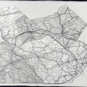
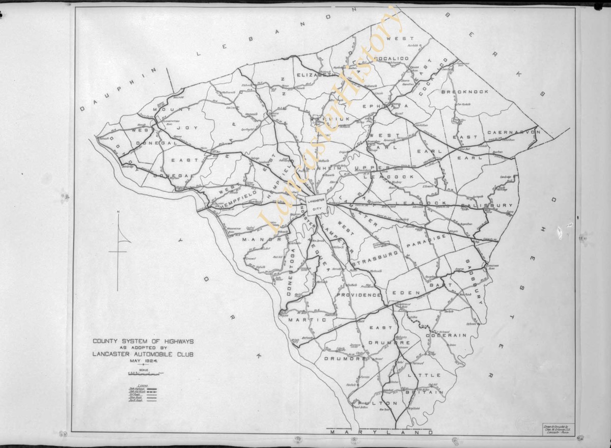
Darmstaetter Collection
Title
Photograph- Map showing county system of highways as adopted by the Lancaster Automobile Club, May 1924.
Description
Map showing county system of highways as adopted by the Lancaster Automobile Club, May 1924. 1 print only
Date Range
1924/05/19
Year Range From
1924
Storage Location
LancasterHistory, Lancaster, PA
Studio
Darmstaetter's
Subcategory
Documentary Artifact
Classification
Maps
Place
Lancaster County
Object Name
Negative
Film Size
6.5 x 5 inches
Object ID
D-07-03-51
Negative Number
yes
Other Number
613-1493
Images
Less detail
More Like This
Permalink
Toggle Full Record
Negative
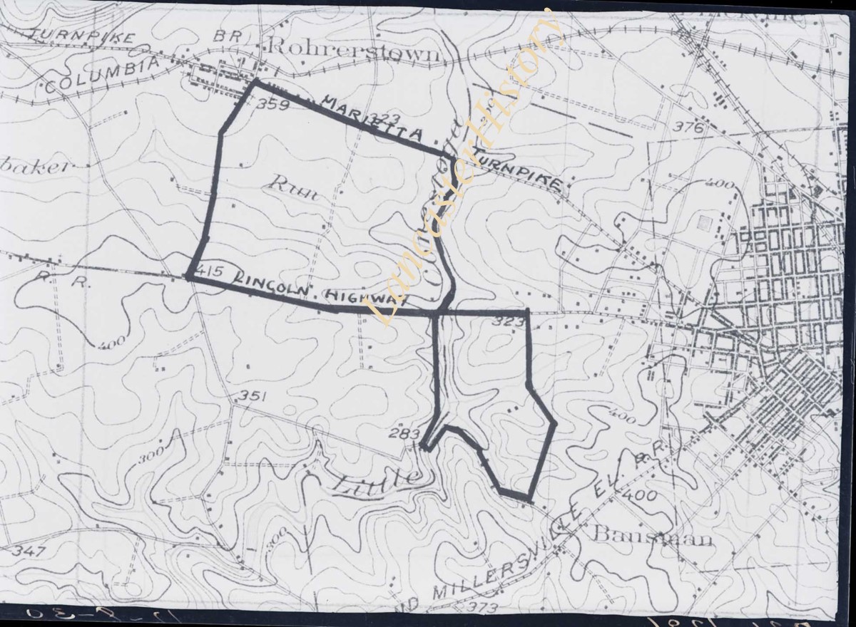
https://collections.lancasterhistory.org/en/permalink/970653d0-e548-4cad-a0d2-755934254994
Collection
Darmstaetter Collection
Title
Photograph- Map showing topography and Lincoln Highway and Marietta Turnpike.
Object ID
D-07-03-50
Date Range
1930/17/09
More detail
1 image
Object Name
Negative
Collection
Darmstaetter Collection
Title
Photograph- Map showing topography and Lincoln Highway and Marietta Turnpike.
Description
Map showing topography and Lincoln Highway and Marietta Turnpike. 1 print only
Date Range
1930/17/09
Year Range From
1930
Storage Location
LancasterHistory, Lancaster, PA
Studio
Darmstaetter's
Subcategory
Documentary Artifact
Classification
Maps
Place
Lancaster County
Object Name
Negative
Film Size
6.5 x 5 inches
Object ID
D-07-03-50
Negative Number
yes
Other Number
721-1796
Images
Less detail
More Like This
Permalink
Toggle Full Record
Negative
https://collections.lancasterhistory.org/en/permalink/5f58e4ef-9540-4971-874d-011722330483
Collection
Darmstaetter Collection
Title
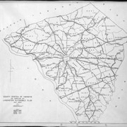
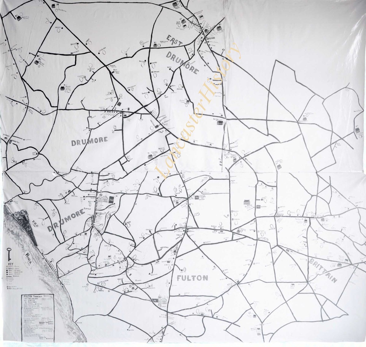
Photograph- Map showing Martic, Fulton, and Drumore Townships.
Object ID
D-07-03-49
Date Range
1927/08/29
More detail
1 image
Object Name
Negative
Collection
Darmstaetter Collection
Title
Photograph- Map showing Martic, Fulton, and Drumore Townships.
Description
Map showing Martic, Fulton, and Drumore Townships. 1 print only
Date Range
1927/08/29
Year Range From
1927
Storage Location
LancasterHistory, Lancaster, PA
Studio
Darmstaetter's
Subcategory
Documentary Artifact
Classification
Maps
Object Name
Negative
Film Size
10 x 8 inches
Object ID
D-07-03-49
Negative Number
yes
Other Number
670-910
Images
Less detail
More Like This
Permalink
Toggle Full Record
Negative
https://collections.lancasterhistory.org/en/permalink/b8877825-0ed6-4461-a4da-234099163642
Collection
Darmstaetter Collection
Title
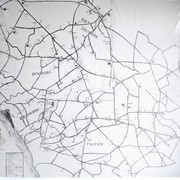
Photograph- Map showing Fulton and Drumore Townships.
Object ID
D-07-03-48
Date Range
1924/07/21
More detail
1 image
Object Name
Negative
Collection
Darmstaetter Collection
Title
Photograph- Map showing Fulton and Drumore Townships.
Description
Map showing Fulton and Drumore Townships. 1 print only
Date Range
1924/07/21
Year Range From
1924
Storage Location
LancasterHistory, Lancaster, PA
Studio
Darmstaetter's
Subcategory
Documentary Artifact
Classification
Maps
Object Name
Negative
Film Size
11 x 7 inches
Object ID
D-07-03-48
Negative Number
yes
Other Number
614-1666
Images
Less detail
More Like This
Permalink
10 records – page 1 of 1.
Prev
Next