It appears no script is enabled within your browser. Please enable JavaScript to use this site.
Skip header and navigation
Toggle navigation
Collections
Search
Help
Privacy
Your Selections:
0
Items
Staff Login
Print
Toggle Full Record
Negative
https://collections.lancasterhistory.org/en/permalink/970653d0-e548-4cad-a0d2-755934254994
Collection
Darmstaetter Collection
Title
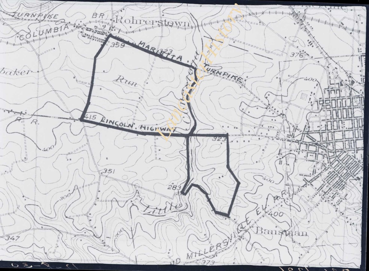
Photograph- Map showing topography and Lincoln Highway and Marietta Turnpike.
Object ID
D-07-03-50
Date Range
1930/17/09
More detail
1 image
Object Name
Negative
Collection
Darmstaetter Collection
Title
Photograph- Map showing topography and Lincoln Highway and Marietta Turnpike.
Description
Map showing topography and Lincoln Highway and Marietta Turnpike. 1 print only
Date Range
1930/17/09
Year Range From
1930
Storage Location
LancasterHistory, Lancaster, PA
Studio
Darmstaetter's
Subcategory
Documentary Artifact
Classification
Maps
Place
Lancaster County
Object Name
Negative
Film Size
6.5 x 5 inches
Object ID
D-07-03-50
Negative Number
yes
Other Number
721-1796
Images
Less detail
More Like This
Permalink