It appears no script is enabled within your browser. Please enable JavaScript to use this site.
Skip header and navigation
Toggle navigation
Collections
Search
Help
Privacy
Your Selections:
0
Items
Staff Login
Revise Search
Revise Search
Revise search
Search
Data Source
Archives
48501
Photographs
24121
Artifacts
17
×
Data Source
All
A
B
C
D
E
F
G
H
I
J
K
L
M
N
O
P
Q
R
S
T
U
V
W
X
Y
Z
Sort
By Count
Alphabetical
Filtered by
Filter
Loading...
Collection
Administrators Accounts
Indictments
29668
Quarter Sessions
27254
General Collection
Liquor License Papers
10185
Lancaster Recreation Commission Photograph Collection
9102
Henry Kauffman Photograph Collection
7170
Darmstaetter Collection
Renunciations
Heritage Center Collection
5271
Commissioners' Orders for Payment
4666
Mayor's Court
3550
More
×
Collection
All
A
B
C
D
E
F
G
H
I
J
K
L
M
N
O
P
Q
R
S
T
U
V
W
X
Y
Z
Sort
By Count
Alphabetical
Filtered by
Filter
Loading...
Subject
Documentary Artifact
72105
Renunciation
6630
Collateral appraisement
2150
Lancaster
1258
Military
681
Railroads
616
Portraits
608
Construction
544
Education
512
Houses
505
Women
501
Agriculture
483
More
×
Subject
All
A
B
C
D
E
F
G
H
I
J
K
L
M
N
O
P
Q
R
S
T
U
V
W
X
Y
Z
Sort
By Count
Alphabetical
Filtered by
Filter
Loading...
Name
Register of Wills
8784
Darmstaetter's
7011
Orphans' Court
676
Heiges, George L.
423
Merchant, Robert
395
Rothwell, Gerald
379
Hostetter, Harry B.
335
Thompson, Robert Hugh Sr.
323
Bond, George Ross
223
Saylor, B. Frank
206
Einolf, Albert L.
188
Schwebel, John F.
171
More
×
Name
All
A
B
C
D
E
F
G
H
I
J
K
L
M
N
O
P
Q
R
S
T
U
V
W
X
Y
Z
Sort
By Count
Alphabetical
Filtered by
Filter
Loading...
Place
Lancaster
13043
None
3320
Manor Twp.
1953
Columbia
1733
Earl Twp.
1558
none
1464
Manheim Twp.
1453
Warwick Twp.
1425
Rapho Twp.
1353
Salisbury Twp.
1163
East Hempfield Twp.
1150
Leacock Twp.
1086
More
×
Place
All
A
B
C
D
E
F
G
H
I
J
K
L
M
N
O
P
Q
R
S
T
U
V
W
X
Y
Z
Sort
By Count
Alphabetical
Filtered by
Filter
Loading...
Decade
1020s
1
1070s
1
1190s
4
1720s
4
1730s
220
1740s
906
1750s
805
1760s
7107
1770s
6825
1780s
7469
1790s
7422
1800s
7640
1810s
7742
1820s
8424
1830s
8712
1840s
11498
1850s
6352
1860s
6651
1870s
7438
1880s
13813
1890s
16694
1900s
10841
1910s
3321
1920s
3926
1930s
2198
1940s
842
1950s
843
1960s
918
1970s
1074
1980s
559
1990s
870
2000s
922
2010s
13
×
Decade
All
A
B
C
D
E
F
G
H
I
J
K
L
M
N
O
P
Q
R
S
T
U
V
W
X
Y
Z
Sort
By Count
Alphabetical
Filtered by
Filter
Loading...
Material
Statement, Financial
32305
Print, Photographic
20575
Probate
6633
Record, Marriage
3095
Estate Inventory
2970
Negative
2434
Appraisal
2150
Transparency, Slide
542
Negative, Glass Plate
454
Documents
348
Record, Sales
345
Voucher
332
More
×
Material
All
A
B
C
D
E
F
G
H
I
J
K
L
M
N
O
P
Q
R
S
T
U
V
W
X
Y
Z
Sort
By Count
Alphabetical
Filtered by
Filter
Loading...
Archival Hierarchy
Item
48297
Fonds
8
×
Archival Hierarchy
All
A
B
C
D
E
F
G
H
I
J
K
L
M
N
O
P
Q
R
S
T
U
V
W
X
Y
Z
Sort
By Count
Alphabetical
Filtered by
Filter
Loading...
Online Media
Image
23926
PDF
186
×
Online Media
All
A
B
C
D
E
F
G
H
I
J
K
L
M
N
O
P
Q
R
S
T
U
V
W
X
Y
Z
Sort
By Count
Alphabetical
Filtered by
Filter
Loading...
Advanced Search
Help
more like: 15E2670C-EE30-44BD-8A4D-141829257745
Administrators Accounts
Collateral Appraisements
Darmstaetter Collection
Estate Inventories
Estate Vouchers
General Collection
Marriage Applications and Consent Forms
Marriage Licenses
Renunciations
Vendue Lists
Sorted by
Relevance
Sort by Title
Expand All
Collapse All
List View
Gallery View
Print
20 records – page 1 of 1.
Prev
Next
Toggle Full Record
Transparency, Slide
https://collections.lancasterhistory.org/en/permalink/0efa3f9b-65b4-4f17-814d-106101825051
Collection
General Collection
Object ID
1-16-02-58
More detail
1 image
Object Name
Transparency, Slide
Collection
General Collection
Description
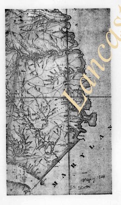
Southern portion of Joshua Scott's 1824 map of Lancaster County.
Storage Location
LancasterHistory, Lancaster, PA
People
Scott, Joshua
Subcategory
Documentary Artifact
Search Terms
Maps
Object Name
Transparency, Slide
Film Size
1 x 1.5 inches
Object ID
1-16-02-58
Images
Less detail
More Like This
Permalink
Toggle Full Record
Transparency, Slide
https://collections.lancasterhistory.org/en/permalink/3a58b7e0-496d-4b86-9a39-735122288599
Collection
General Collection
Object ID
1-16-02-65
More detail
1 image
Object Name
Transparency, Slide
Collection
General Collection
Description
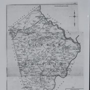
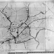
Map of Little Britain Township
Storage Location
LancasterHistory, Lancaster, PA
Subcategory
Documentary Artifact
Search Terms
Maps
Place
Little Britain Twp.
Object Name
Transparency, Slide
Film Size
1 x 1.5 inches
Object ID
1-16-02-65
Images
Less detail
More Like This
Permalink
Toggle Full Record
Transparency, Slide
https://collections.lancasterhistory.org/en/permalink/ea6b6514-e6cb-4415-828b-311047353540
Collection
General Collection
Object ID
1-16-02-67
More detail
1 image
Object Name
Transparency, Slide
Collection
General Collection
Description
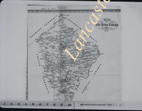
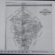
Map of Little Britain Township
Storage Location
LancasterHistory, Lancaster, PA
Subcategory
Documentary Artifact
Search Terms
Maps
Place
Little Britain Twp.
Object Name
Transparency, Slide
Film Size
1 x 1.5 inches
Object ID
1-16-02-67
Images
Less detail
More Like This
Permalink
Toggle Full Record
Transparency, Slide
https://collections.lancasterhistory.org/en/permalink/87e35ec0-ab87-4297-bd76-161212170594
Collection
General Collection
Object ID
1-16-02-68
More detail
1 image
Object Name
Transparency, Slide
Collection
General Collection
Description
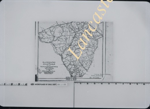
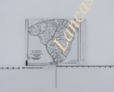
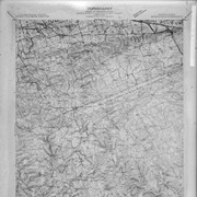
Map of Lancaster County showing creeks and streams.
Storage Location
LancasterHistory, Lancaster, PA
Subcategory
Documentary Artifact
Search Terms
Maps
Object Name
Transparency, Slide
Film Size
1 x 1.5 inches
Object ID
1-16-02-68
Images
Less detail
More Like This
Permalink
Toggle Full Record
Transparency, Slide
https://collections.lancasterhistory.org/en/permalink/01621032-cd27-4e53-903e-238063839851
Collection
General Collection
Object ID
1-16-02-75
More detail
1 image
Object Name
Transparency, Slide
Collection
General Collection
Description
Map of Lancaster County showing creeks and streams
Storage Location
LancasterHistory, Lancaster, PA
Subcategory
Documentary Artifact
Search Terms
Maps
Object Name
Transparency, Slide
Film Size
1 x 1.5 inches
Object ID
1-16-02-75
Images
Less detail
More Like This
Permalink
Toggle Full Record
Transparency, Slide
https://collections.lancasterhistory.org/en/permalink/b33ed588-a1bd-470a-a07e-086348378136
Collection
General Collection
Object ID
1-16-02-76
More detail
1 image
Object Name
Transparency, Slide
Collection
General Collection
Description
Plot map
Storage Location
LancasterHistory, Lancaster, PA
Subcategory
Documentary Artifact
Search Terms
Maps
Object Name
Transparency, Slide
Film Size
1 x 1.5 inches
Object ID
1-16-02-76
Images
Less detail
More Like This
Permalink
Toggle Full Record
Print, Photographic
https://collections.lancasterhistory.org/en/permalink/c6013246-45c4-4bcf-b161-856804965559
Collection
General Collection
Title
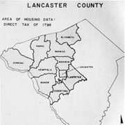
Photograph- Map of Lancaster County showing area of housing data, direct tax of 1798.
Object ID
1-03-02-76
More detail
1 image
Object Name
Print, Photographic
Collection
General Collection
Title
Photograph- Map of Lancaster County showing area of housing data, direct tax of 1798.
Description
Map of Lancaster County showing area of housing data, direct tax of 1798.
Storage Location
LancasterHistory, Lancaster, PA
Subcategory
Documentary Artifact
Search Terms
Maps
Government
Taxes
Object Name
Print, Photographic
Print Size
5 x 7 inches
Related Publications
LCHS Journal Vol. 85, No. 4, article by Art Lord
Object ID
1-03-02-76
Images
Less detail
More Like This
Permalink
Toggle Full Record
Print, Photographic
https://collections.lancasterhistory.org/en/permalink/86540c45-d2db-4c88-8a2b-429040204926
Collection
General Collection
Title
Photograph- Map of Lancaster County showing area of housing data, direct tax of 1798.
Object ID
1-03-02-77
Date Range
1852
More detail
1 image
Object Name
Print, Photographic
Collection
General Collection
Title
Photograph- Map of Lancaster County showing area of housing data, direct tax of 1798.
Description
Map of Safe Harbor by R. S. Bridges.
Date Range
1852
Storage Location
LancasterHistory, Lancaster, PA
Subcategory
Documentary Artifact
Search Terms
Maps
Safe Harbor, Conestoga Twp.
Object Name
Print, Photographic
Print Size
5 x 7 inches
Related Publications
LCHS Journal, vol. 85, No. 3 p. 91
Object ID
1-03-02-77
Images
Less detail
More Like This
Permalink
Toggle Full Record
Negative
https://collections.lancasterhistory.org/en/permalink/b18ed97b-4b04-4d95-bc08-223563372348
Collection
General Collection
Title
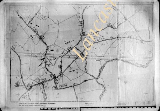
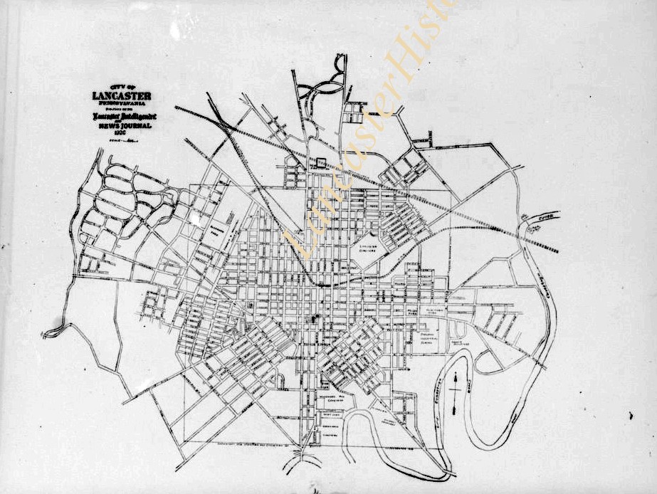
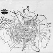
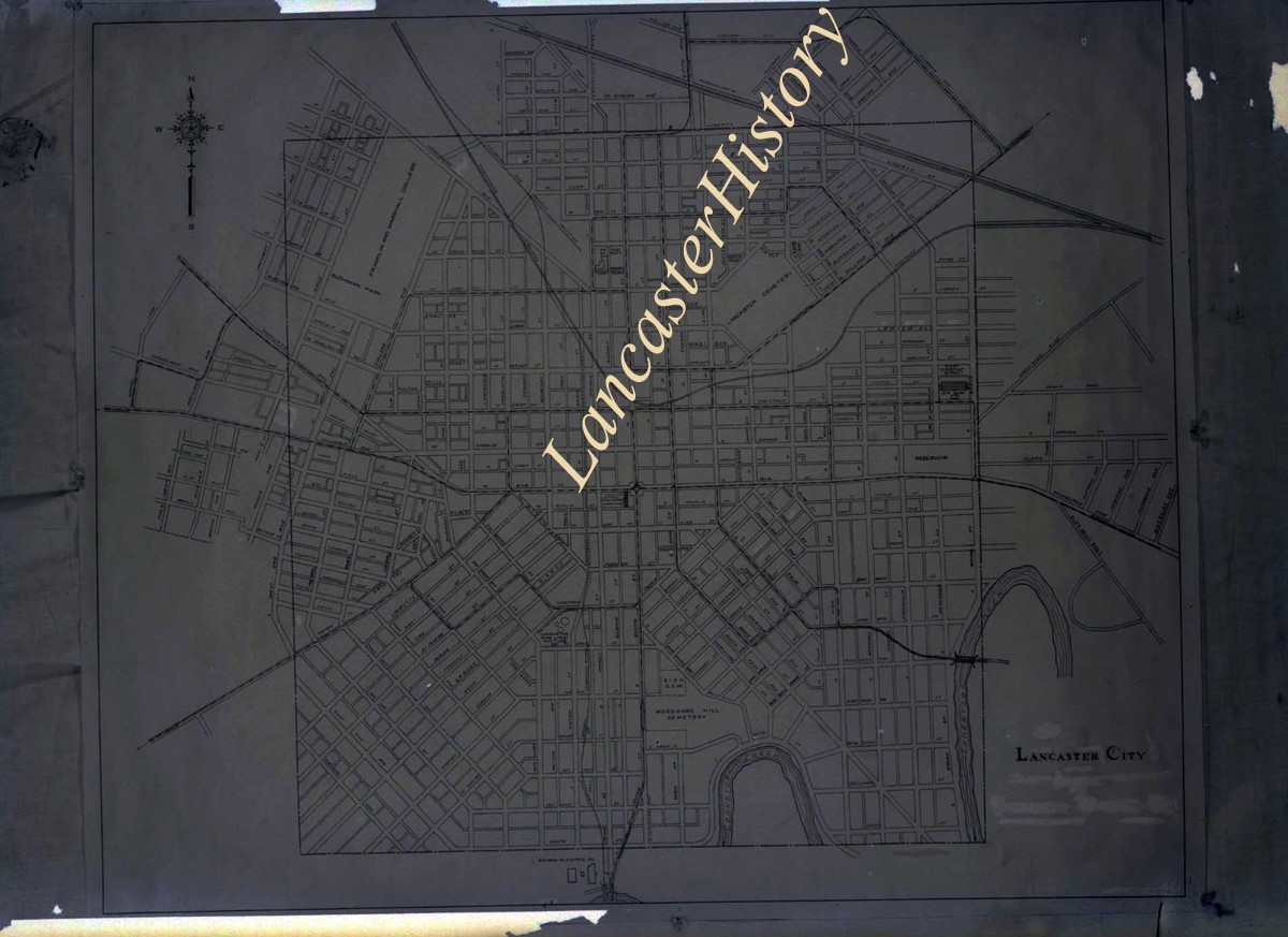
Photograph- Map of Lancaster city.
Object ID
1-18-01-17
Date Range
January 3, 1927
More detail
1 image
Object Name
Negative
Collection
General Collection
Title
Photograph- Map of Lancaster city.
Description
Map of Lancaster city. Customer: Intelligencer
Date Range
January 3, 1927
Storage Location
LancasterHistory, Lancaster, PA
Studio
Darmstaetter's
Subcategory
Documentary Artifact
Search Terms
Maps
Lancaster
Object Name
Negative
Object ID
1-18-01-17
Negative Number
3 1/2" x 2 1/2"
Other Number
646-199
Images
Less detail
More Like This
Permalink
Toggle Full Record
Negative
https://collections.lancasterhistory.org/en/permalink/c646568d-8c52-406a-ba0e-558305303232
Collection
Darmstaetter Collection
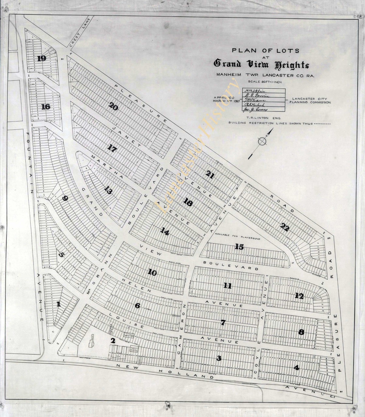
Title
Photograph- Plan for lots in Grandview Heights.
Object ID
D-07-03-56
More detail
1 image
Object Name
Negative
Collection
Darmstaetter Collection
Title
Photograph- Plan for lots in Grandview Heights.
Description
Plan for lots in Grandview Heights. 1 print only
Storage Location
LancasterHistory, Lancaster, PA
Studio
Darmstaetter's
Subcategory
Documentary Artifact
Classification
Maps
Place
Manheim Twp.
Object Name
Negative
Film Size
8 x 10 inches
Object ID
D-07-03-56
Negative Number
yes
Other Number
660-870
Images
Less detail
More Like This
Permalink
Toggle Full Record
Negative
https://collections.lancasterhistory.org/en/permalink/7723bebb-3aa3-432f-abec-170944938900
Collection
Darmstaetter Collection
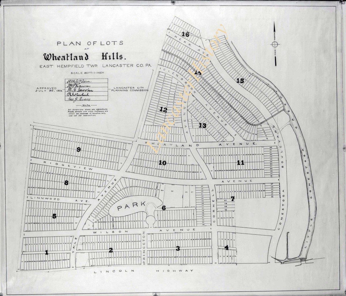
Title
Photograph- Plan for Greater Lancaster showing Wheatland Hills.
Object ID
D-07-03-55
Date Range
January 24, 1927
More detail
1 image
Object Name
Negative
Collection
Darmstaetter Collection
Title
Photograph- Plan for Greater Lancaster showing Wheatland Hills.
Description
Plan for Greater Lancaster showing Wheatland Hills. 1 print only
Date Range
January 24, 1927
Storage Location
LancasterHistory, Lancaster, PA
Studio
Darmstaetter's
Subcategory
Documentary Artifact
Classification
Maps
Place
East Hempfield Twp.
Object Name
Negative
Film Size
10 x 8 inches
Object ID
D-07-03-55
Negative Number
yes
Other Number
660-257
Images
Less detail
More Like This
Permalink
Toggle Full Record
Negative
https://collections.lancasterhistory.org/en/permalink/7b4479be-5ce0-4aed-b9d1-296882065808
Collection
Darmstaetter Collection
Title
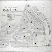
Photograph- Plan of lots at Wheatland Hills.
Object ID
D-07-03-54
More detail
1 image
Object Name
Negative
Collection
Darmstaetter Collection
Title
Photograph- Plan of lots at Wheatland Hills.
Description
Plan of lots at Wheatland Hills. 1 print only
Storage Location
LancasterHistory, Lancaster, PA
Studio
Darmstaetter's
Subcategory
Documentary Artifact
Classification
Maps
Place
East Hempfield Twp.
Object Name
Negative
Film Size
10 x 8 inches
Object ID
D-07-03-54
Negative Number
yes
Other Number
660-180
Images
Less detail
More Like This
Permalink
Toggle Full Record
Negative
https://collections.lancasterhistory.org/en/permalink/cfeaaee4-cdc4-4b21-aef9-829150874936
Collection
Darmstaetter Collection
Title
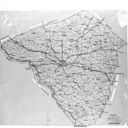
Photograph- Map of Lancaster County.
Object ID
D-07-03-53
Date Range
1926/02/22
More detail
1 image
Object Name
Negative
Collection
Darmstaetter Collection
Title
Photograph- Map of Lancaster County.
Description
Map of Lancaster County. 1 print only
Date Range
1926/02/22
Year Range From
1926
Storage Location
LancasterHistory, Lancaster, PA
Studio
Darmstaetter's
Subcategory
Documentary Artifact
Classification
Maps
Place
Lancaster County
Object Name
Negative
Film Size
10 x 8 inches
Object ID
D-07-03-53
Negative Number
yes
Other Number
642-435
Images
Less detail
More Like This
Permalink
Toggle Full Record
Negative
https://collections.lancasterhistory.org/en/permalink/23988159-db5d-4ca5-b01e-153188656558
Collection
Darmstaetter Collection
Title
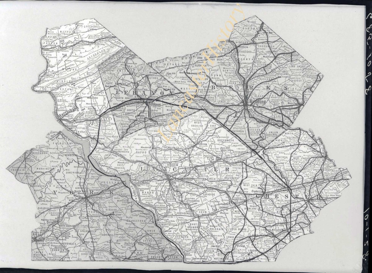
Photograph- Map showing Berks, Lebanon, York, Chester, and Lancaster Counties.
Object ID
D-07-03-52
Date Range
1928/10/01
More detail
1 image
Object Name
Negative
Collection
Darmstaetter Collection
Title
Photograph- Map showing Berks, Lebanon, York, Chester, and Lancaster Counties.
Description
Map showing Berks, Lebanon, York, Chester, and Lancaster Counties. 1 print only
Date Range
1928/10/01
Year Range From
1928
Storage Location
LancasterHistory, Lancaster, PA
Studio
Darmstaetter's
Subcategory
Documentary Artifact
Classification
Maps
Object Name
Negative
Film Size
6.5 x 5 inches
Object ID
D-07-03-52
Negative Number
yes
Other Number
685-1058
Images
Less detail
More Like This
Permalink
Toggle Full Record
Negative
https://collections.lancasterhistory.org/en/permalink/7bf4d352-83bc-411e-b713-389752566549
Collection
Darmstaetter Collection
Title
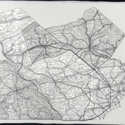
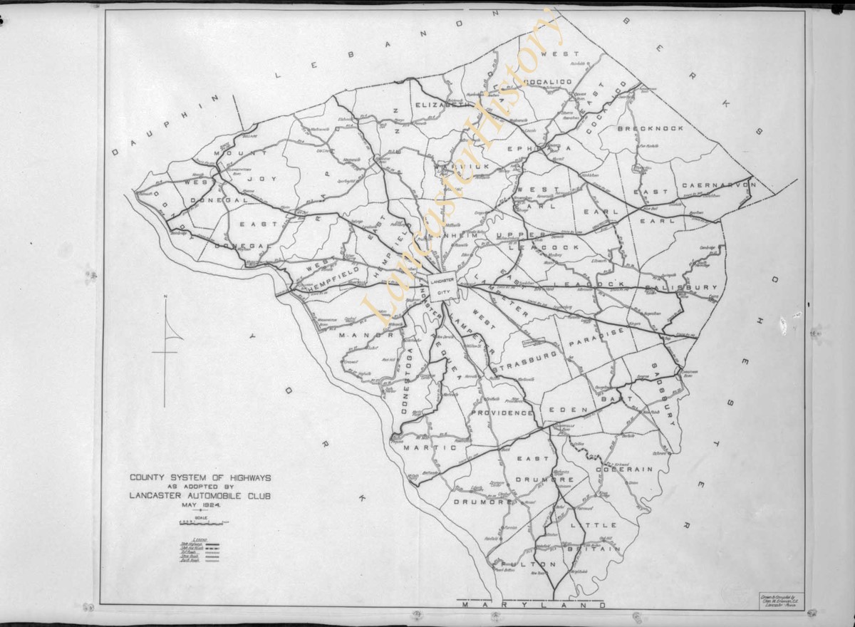
Photograph- Map showing county system of highways as adopted by the Lancaster Automobile Club, May 1924.
Object ID
D-07-03-51
Date Range
1924/05/19
More detail
1 image
Object Name
Negative
Collection
Darmstaetter Collection
Title
Photograph- Map showing county system of highways as adopted by the Lancaster Automobile Club, May 1924.
Description
Map showing county system of highways as adopted by the Lancaster Automobile Club, May 1924. 1 print only
Date Range
1924/05/19
Year Range From
1924
Storage Location
LancasterHistory, Lancaster, PA
Studio
Darmstaetter's
Subcategory
Documentary Artifact
Classification
Maps
Place
Lancaster County
Object Name
Negative
Film Size
6.5 x 5 inches
Object ID
D-07-03-51
Negative Number
yes
Other Number
613-1493
Images
Less detail
More Like This
Permalink
Toggle Full Record
Negative
https://collections.lancasterhistory.org/en/permalink/970653d0-e548-4cad-a0d2-755934254994
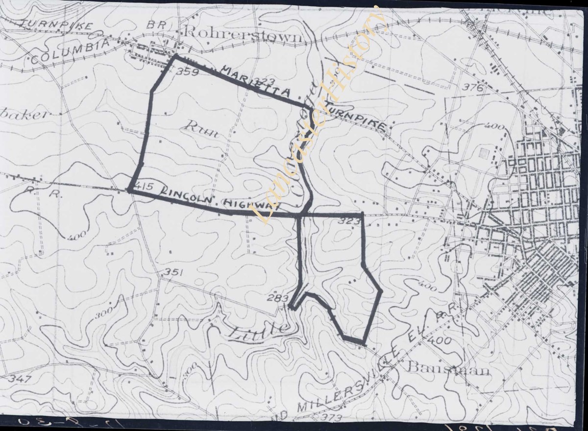
Collection
Darmstaetter Collection
Title
Photograph- Map showing topography and Lincoln Highway and Marietta Turnpike.
Object ID
D-07-03-50
Date Range
1930/17/09
More detail
1 image
Object Name
Negative
Collection
Darmstaetter Collection
Title
Photograph- Map showing topography and Lincoln Highway and Marietta Turnpike.
Description
Map showing topography and Lincoln Highway and Marietta Turnpike. 1 print only
Date Range
1930/17/09
Year Range From
1930
Storage Location
LancasterHistory, Lancaster, PA
Studio
Darmstaetter's
Subcategory
Documentary Artifact
Classification
Maps
Place
Lancaster County
Object Name
Negative
Film Size
6.5 x 5 inches
Object ID
D-07-03-50
Negative Number
yes
Other Number
721-1796
Images
Less detail
More Like This
Permalink
Toggle Full Record
Negative
https://collections.lancasterhistory.org/en/permalink/5f58e4ef-9540-4971-874d-011722330483
Collection
Darmstaetter Collection
Title
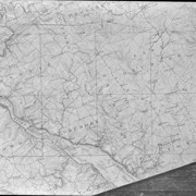
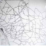
Photograph- Map showing Martic, Fulton, and Drumore Townships.
Object ID
D-07-03-49
Date Range
1927/08/29
More detail
1 image
Object Name
Negative
Collection
Darmstaetter Collection
Title
Photograph- Map showing Martic, Fulton, and Drumore Townships.
Description
Map showing Martic, Fulton, and Drumore Townships. 1 print only
Date Range
1927/08/29
Year Range From
1927
Storage Location
LancasterHistory, Lancaster, PA
Studio
Darmstaetter's
Subcategory
Documentary Artifact
Classification
Maps
Object Name
Negative
Film Size
10 x 8 inches
Object ID
D-07-03-49
Negative Number
yes
Other Number
670-910
Images
Less detail
More Like This
Permalink
Toggle Full Record
Negative
https://collections.lancasterhistory.org/en/permalink/b8877825-0ed6-4461-a4da-234099163642
Collection
Darmstaetter Collection
Title
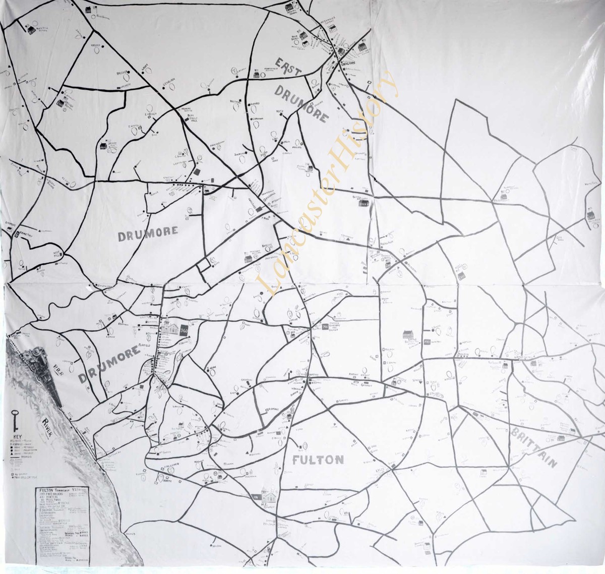
Photograph- Map showing Fulton and Drumore Townships.
Object ID
D-07-03-48
Date Range
1924/07/21
More detail
1 image
Object Name
Negative
Collection
Darmstaetter Collection
Title
Photograph- Map showing Fulton and Drumore Townships.
Description
Map showing Fulton and Drumore Townships. 1 print only
Date Range
1924/07/21
Year Range From
1924
Storage Location
LancasterHistory, Lancaster, PA
Studio
Darmstaetter's
Subcategory
Documentary Artifact
Classification
Maps
Object Name
Negative
Film Size
11 x 7 inches
Object ID
D-07-03-48
Negative Number
yes
Other Number
614-1666
Images
Less detail
More Like This
Permalink
Toggle Full Record
Negative
https://collections.lancasterhistory.org/en/permalink/e0651e36-b53c-4c86-a707-733813415542
Collection
Darmstaetter Collection
Title
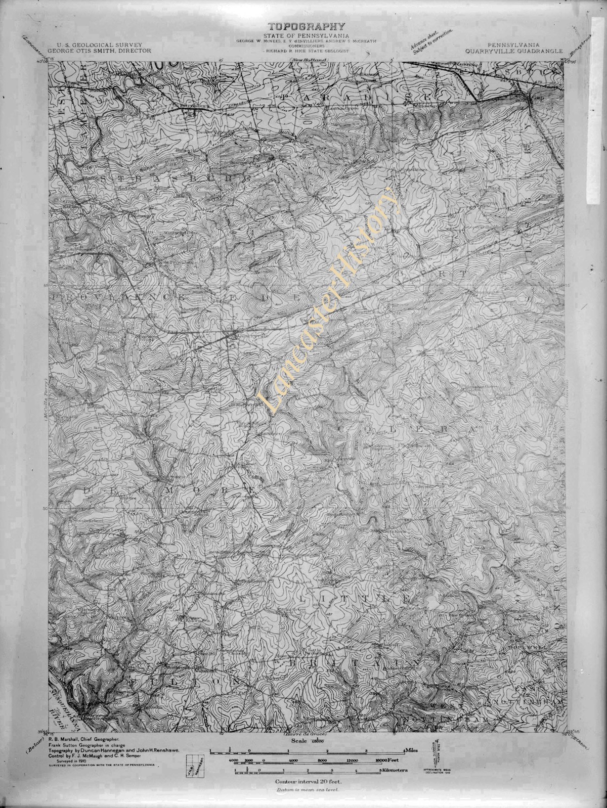
Photograph- Map--Topography of the State of Pennsylvania.
Object ID
D-07-03-46
More detail
1 image
Object Name
Negative
Collection
Darmstaetter Collection
Title
Photograph- Map--Topography of the State of Pennsylvania.
Description
Map--Topography of the State of Pennsylvania. 1 print only
Storage Location
LancasterHistory, Lancaster, PA
Studio
Darmstaetter's
Subcategory
Documentary Artifact
Classification
Maps
Place
Pennsylvania
Object Name
Negative
Film Size
6.5 x 8.5 inches
Object ID
D-07-03-46
Negative Number
yes glass
Other Number
G 71B 165n
Images
Less detail
More Like This
Permalink
Toggle Full Record
Negative
https://collections.lancasterhistory.org/en/permalink/c0c4524c-e47b-45e7-a502-752110992490
Collection
Darmstaetter Collection
Title
Photograph- Map of Lancaster city.
Object ID
D-07-03-45
Date Range
1926/04/05
More detail
1 image
Object Name
Negative
Collection
Darmstaetter Collection
Title
Photograph- Map of Lancaster city.
Description
Map of Lancaster city. 1 print only
Date Range
1926/04/05
Year Range From
1926
Storage Location
LancasterHistory, Lancaster, PA
Studio
Darmstaetter's
Subcategory
Documentary Artifact
Classification
Maps
Place
Lancaster
Object Name
Negative
Film Size
7 x 5 inches
Object ID
D-07-03-45
Negative Number
yes
Other Number
644-559
Images
Less detail
More Like This
Permalink
20 records – page 1 of 1.
Prev
Next