It appears no script is enabled within your browser. Please enable JavaScript to use this site.
Skip header and navigation
Toggle navigation
Collections
Search
Help
Privacy
Your Selections:
0
Items
Staff Login
Revise Search
Revise Search
Revise search
Search
Data Source
Photographs
8499
×
Data Source
All
A
B
C
D
E
F
G
H
I
J
K
L
M
N
O
P
Q
R
S
T
U
V
W
X
Y
Z
Sort
By Count
Alphabetical
Filtered by
Filter
Loading...
Collection
General Collection
17067
Lancaster Recreation Commission Photograph Collection
9102
Henry Kauffman Photograph Collection
7167
Darmstaetter Collection
Heritage Center Collection
5261
Actors Company Photograph Collection
3373
Johnny Hauck Photograph Collection
2583
Sarah Ann Stauffer Photograph Collection
2032
Postcard Collection
2006
John D. Denney, Jr. Photograph Collection
Bruce Ryder Photograph Collection
1308
Samuel Dyke Photograph Collection
839
More
×
Collection
All
A
B
C
D
E
F
G
H
I
J
K
L
M
N
O
P
Q
R
S
T
U
V
W
X
Y
Z
Sort
By Count
Alphabetical
Filtered by
Filter
Loading...
Subject
Documentary Artifact
8490
Dwellings
357
Military
251
World War I
250
Houses
210
Uniforms
196
Soldiers
192
Portraits
176
Automobiles
168
Construction
156
Students
149
Schools
144
More
×
Subject
All
A
B
C
D
E
F
G
H
I
J
K
L
M
N
O
P
Q
R
S
T
U
V
W
X
Y
Z
Sort
By Count
Alphabetical
Filtered by
Filter
Loading...
Name
Darmstaetter's
6773
Wickersham, John H.
37
Leinbach, Scott W.
15
Shenk, Omar H.
14
Zook, Walter
13
Wohlsen, Herman
12
Darmstaetter, Harcourt
11
Denney, John, Sr.
10
Gara, Elizabeth
9
Murry, Ken
9
Darmstaetter, Douglas
8
Shaub, Henry Y.
8
More
×
Name
All
A
B
C
D
E
F
G
H
I
J
K
L
M
N
O
P
Q
R
S
T
U
V
W
X
Y
Z
Sort
By Count
Alphabetical
Filtered by
Filter
Loading...
Place
Lancaster
2426
Columbia
278
Manheim Twp.
177
Lancaster Twp.
117
Millersville
113
Strasburg Twp.
95
Manheim
88
East Donegal Twp.
72
Lititz
66
Quarryville
65
East Hempfield Twp.
54
Mount Joy
50
More
×
Place
All
A
B
C
D
E
F
G
H
I
J
K
L
M
N
O
P
Q
R
S
T
U
V
W
X
Y
Z
Sort
By Count
Alphabetical
Filtered by
Filter
Loading...
Decade
1020s
1
1190s
4
1720s
1
1820s
2
1860s
1
1870s
3
1880s
9
1890s
42
1900s
76
1910s
345
1920s
3081
1930s
1548
1940s
114
1950s
44
1960s
38
1970s
14
1980s
71
1990s
23
2000s
2
×
Decade
All
A
B
C
D
E
F
G
H
I
J
K
L
M
N
O
P
Q
R
S
T
U
V
W
X
Y
Z
Sort
By Count
Alphabetical
Filtered by
Filter
Loading...
Material
Print, Photographic
7022
Negative
1338
Negative, Glass Plate
134
Negative, Sheet Film
3
Transparency, Slide
2
×
Material
All
A
B
C
D
E
F
G
H
I
J
K
L
M
N
O
P
Q
R
S
T
U
V
W
X
Y
Z
Sort
By Count
Alphabetical
Filtered by
Filter
Loading...
Online Media
Image
×
Online Media
All
A
B
C
D
E
F
G
H
I
J
K
L
M
N
O
P
Q
R
S
T
U
V
W
X
Y
Z
Sort
By Count
Alphabetical
Filtered by
Filter
Loading...
Advanced Search
Help
more like: 5F58E4EF-9540-4971-874D-011722330483
Image
Darmstaetter Collection
John D. Denney, Jr. Photograph Collection
Sorted by
Relevance
Sort by Title
Expand All
Collapse All
List View
Gallery View
Print
10 records – page 1 of 1.
Prev
Next
Toggle Full Record
Negative
https://collections.lancasterhistory.org/en/permalink/c646568d-8c52-406a-ba0e-558305303232
Collection
Darmstaetter Collection
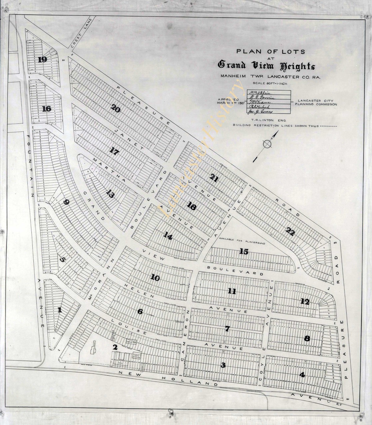
Title
Photograph- Plan for lots in Grandview Heights.
Object ID
D-07-03-56
More detail
1 image
Object Name
Negative
Collection
Darmstaetter Collection
Title
Photograph- Plan for lots in Grandview Heights.
Description
Plan for lots in Grandview Heights. 1 print only
Storage Location
LancasterHistory, Lancaster, PA
Studio
Darmstaetter's
Subcategory
Documentary Artifact
Classification
Maps
Place
Manheim Twp.
Object Name
Negative
Film Size
8 x 10 inches
Object ID
D-07-03-56
Negative Number
yes
Other Number
660-870
Images
Less detail
More Like This
Permalink
Toggle Full Record
Negative
https://collections.lancasterhistory.org/en/permalink/7723bebb-3aa3-432f-abec-170944938900
Collection
Darmstaetter Collection
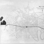
Title
Photograph- Plan for Greater Lancaster showing Wheatland Hills.
Object ID
D-07-03-55
Date Range
January 24, 1927
More detail
1 image
Object Name
Negative
Collection
Darmstaetter Collection
Title
Photograph- Plan for Greater Lancaster showing Wheatland Hills.
Description
Plan for Greater Lancaster showing Wheatland Hills. 1 print only
Date Range
January 24, 1927
Storage Location
LancasterHistory, Lancaster, PA
Studio
Darmstaetter's
Subcategory
Documentary Artifact
Classification
Maps
Place
East Hempfield Twp.
Object Name
Negative
Film Size
10 x 8 inches
Object ID
D-07-03-55
Negative Number
yes
Other Number
660-257
Images
Less detail
More Like This
Permalink
Toggle Full Record
Negative
https://collections.lancasterhistory.org/en/permalink/7b4479be-5ce0-4aed-b9d1-296882065808
Collection
Darmstaetter Collection
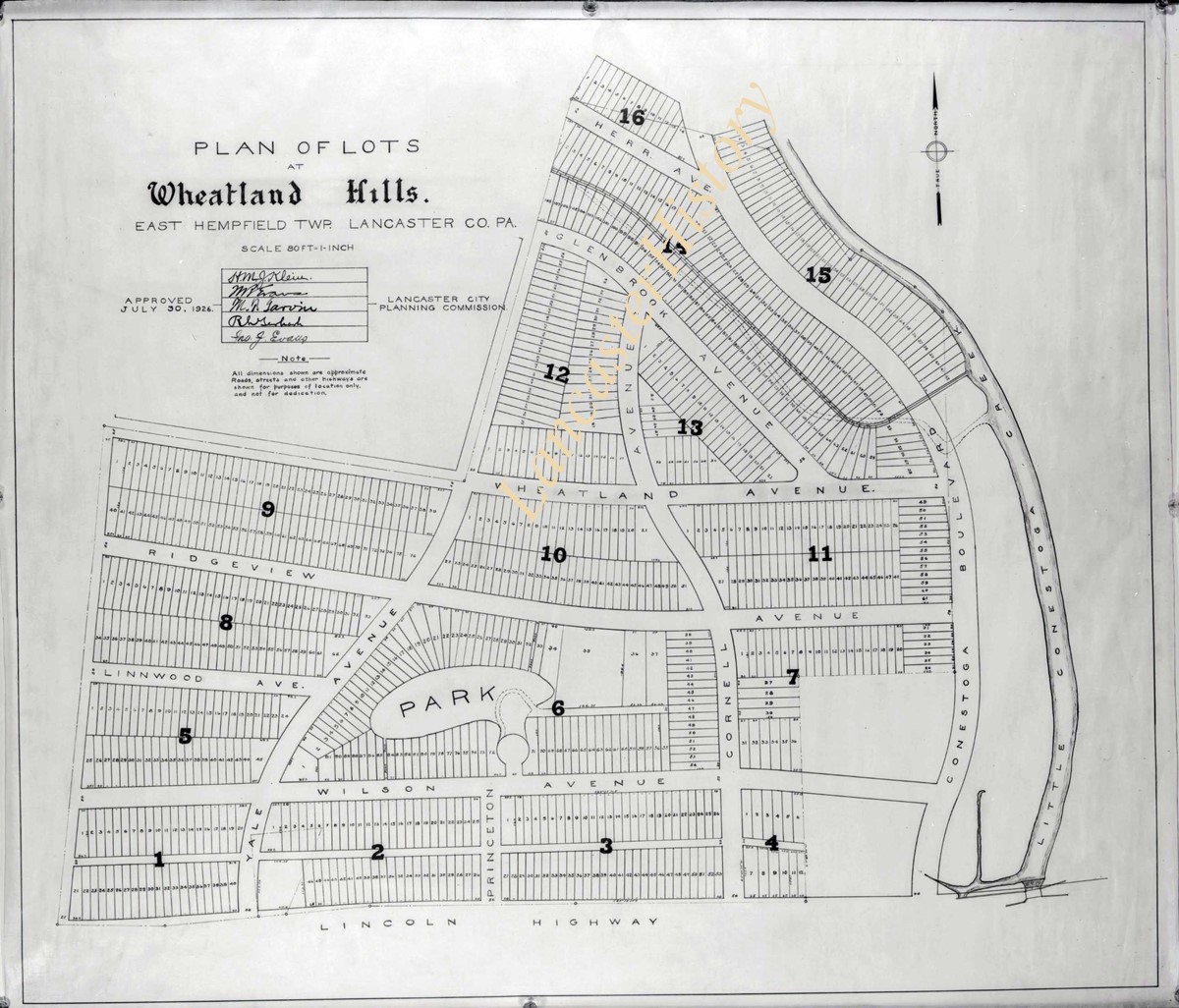
Title
Photograph- Plan of lots at Wheatland Hills.
Object ID
D-07-03-54
More detail
1 image
Object Name
Negative
Collection
Darmstaetter Collection
Title
Photograph- Plan of lots at Wheatland Hills.
Description
Plan of lots at Wheatland Hills. 1 print only
Storage Location
LancasterHistory, Lancaster, PA
Studio
Darmstaetter's
Subcategory
Documentary Artifact
Classification
Maps
Place
East Hempfield Twp.
Object Name
Negative
Film Size
10 x 8 inches
Object ID
D-07-03-54
Negative Number
yes
Other Number
660-180
Images
Less detail
More Like This
Permalink
Toggle Full Record
Negative
https://collections.lancasterhistory.org/en/permalink/cfeaaee4-cdc4-4b21-aef9-829150874936
Collection
Darmstaetter Collection
Title
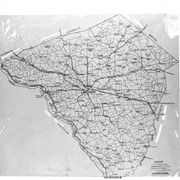
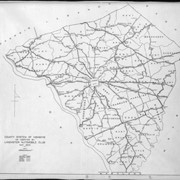
Photograph- Map of Lancaster County.
Object ID
D-07-03-53
Date Range
1926/02/22
More detail
1 image
Object Name
Negative
Collection
Darmstaetter Collection
Title
Photograph- Map of Lancaster County.
Description
Map of Lancaster County. 1 print only
Date Range
1926/02/22
Year Range From
1926
Storage Location
LancasterHistory, Lancaster, PA
Studio
Darmstaetter's
Subcategory
Documentary Artifact
Classification
Maps
Place
Lancaster County
Object Name
Negative
Film Size
10 x 8 inches
Object ID
D-07-03-53
Negative Number
yes
Other Number
642-435
Images
Less detail
More Like This
Permalink
Toggle Full Record
Negative
https://collections.lancasterhistory.org/en/permalink/23988159-db5d-4ca5-b01e-153188656558
Collection
Darmstaetter Collection
Title
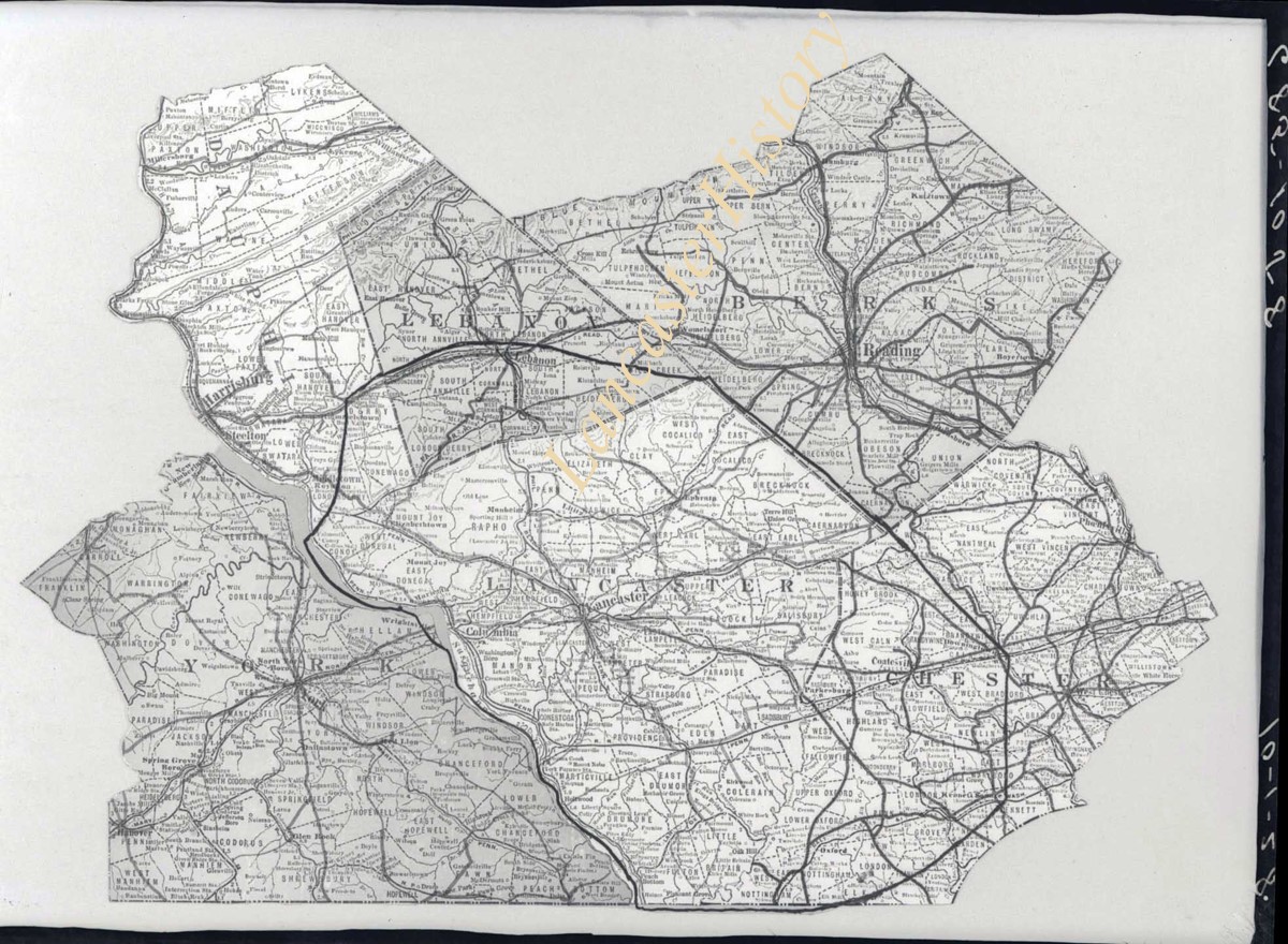
Photograph- Map showing Berks, Lebanon, York, Chester, and Lancaster Counties.
Object ID
D-07-03-52
Date Range
1928/10/01
More detail
1 image
Object Name
Negative
Collection
Darmstaetter Collection
Title
Photograph- Map showing Berks, Lebanon, York, Chester, and Lancaster Counties.
Description
Map showing Berks, Lebanon, York, Chester, and Lancaster Counties. 1 print only
Date Range
1928/10/01
Year Range From
1928
Storage Location
LancasterHistory, Lancaster, PA
Studio
Darmstaetter's
Subcategory
Documentary Artifact
Classification
Maps
Object Name
Negative
Film Size
6.5 x 5 inches
Object ID
D-07-03-52
Negative Number
yes
Other Number
685-1058
Images
Less detail
More Like This
Permalink
Toggle Full Record
Negative
https://collections.lancasterhistory.org/en/permalink/7bf4d352-83bc-411e-b713-389752566549
Collection
Darmstaetter Collection
Title
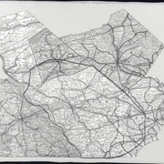
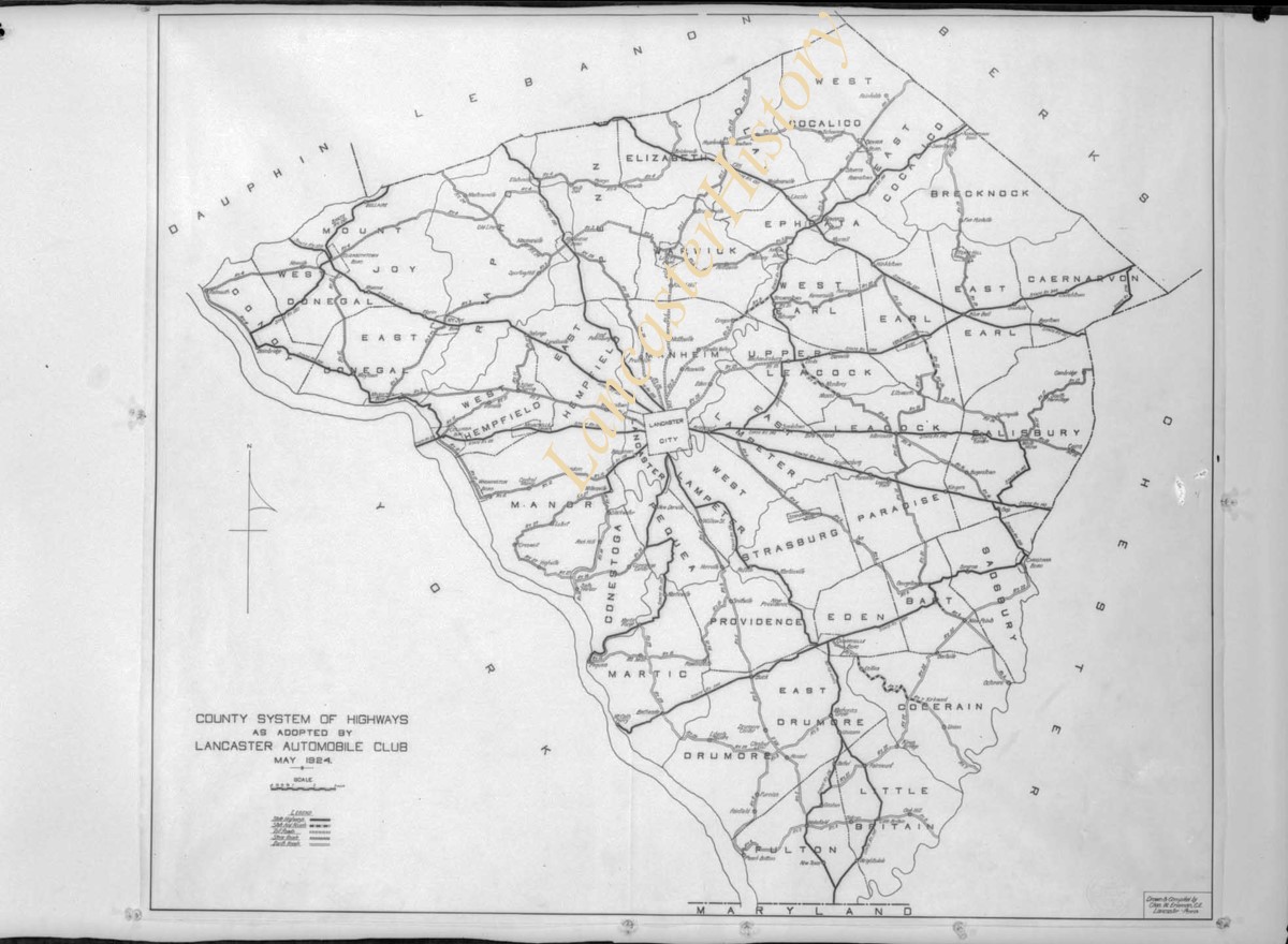
Photograph- Map showing county system of highways as adopted by the Lancaster Automobile Club, May 1924.
Object ID
D-07-03-51
Date Range
1924/05/19
More detail
1 image
Object Name
Negative
Collection
Darmstaetter Collection
Title
Photograph- Map showing county system of highways as adopted by the Lancaster Automobile Club, May 1924.
Description
Map showing county system of highways as adopted by the Lancaster Automobile Club, May 1924. 1 print only
Date Range
1924/05/19
Year Range From
1924
Storage Location
LancasterHistory, Lancaster, PA
Studio
Darmstaetter's
Subcategory
Documentary Artifact
Classification
Maps
Place
Lancaster County
Object Name
Negative
Film Size
6.5 x 5 inches
Object ID
D-07-03-51
Negative Number
yes
Other Number
613-1493
Images
Less detail
More Like This
Permalink
Toggle Full Record
Negative
https://collections.lancasterhistory.org/en/permalink/970653d0-e548-4cad-a0d2-755934254994
Collection
Darmstaetter Collection
Title
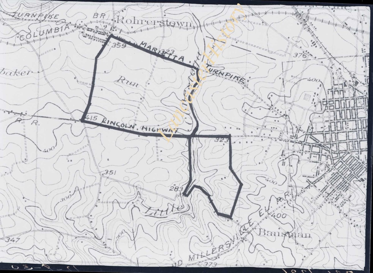
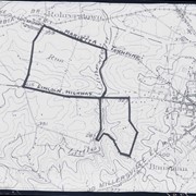
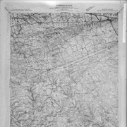
Photograph- Map showing topography and Lincoln Highway and Marietta Turnpike.
Object ID
D-07-03-50
Date Range
1930/17/09
More detail
1 image
Object Name
Negative
Collection
Darmstaetter Collection
Title
Photograph- Map showing topography and Lincoln Highway and Marietta Turnpike.
Description
Map showing topography and Lincoln Highway and Marietta Turnpike. 1 print only
Date Range
1930/17/09
Year Range From
1930
Storage Location
LancasterHistory, Lancaster, PA
Studio
Darmstaetter's
Subcategory
Documentary Artifact
Classification
Maps
Place
Lancaster County
Object Name
Negative
Film Size
6.5 x 5 inches
Object ID
D-07-03-50
Negative Number
yes
Other Number
721-1796
Images
Less detail
More Like This
Permalink
Toggle Full Record
Negative
https://collections.lancasterhistory.org/en/permalink/b8877825-0ed6-4461-a4da-234099163642
Collection
Darmstaetter Collection
Title
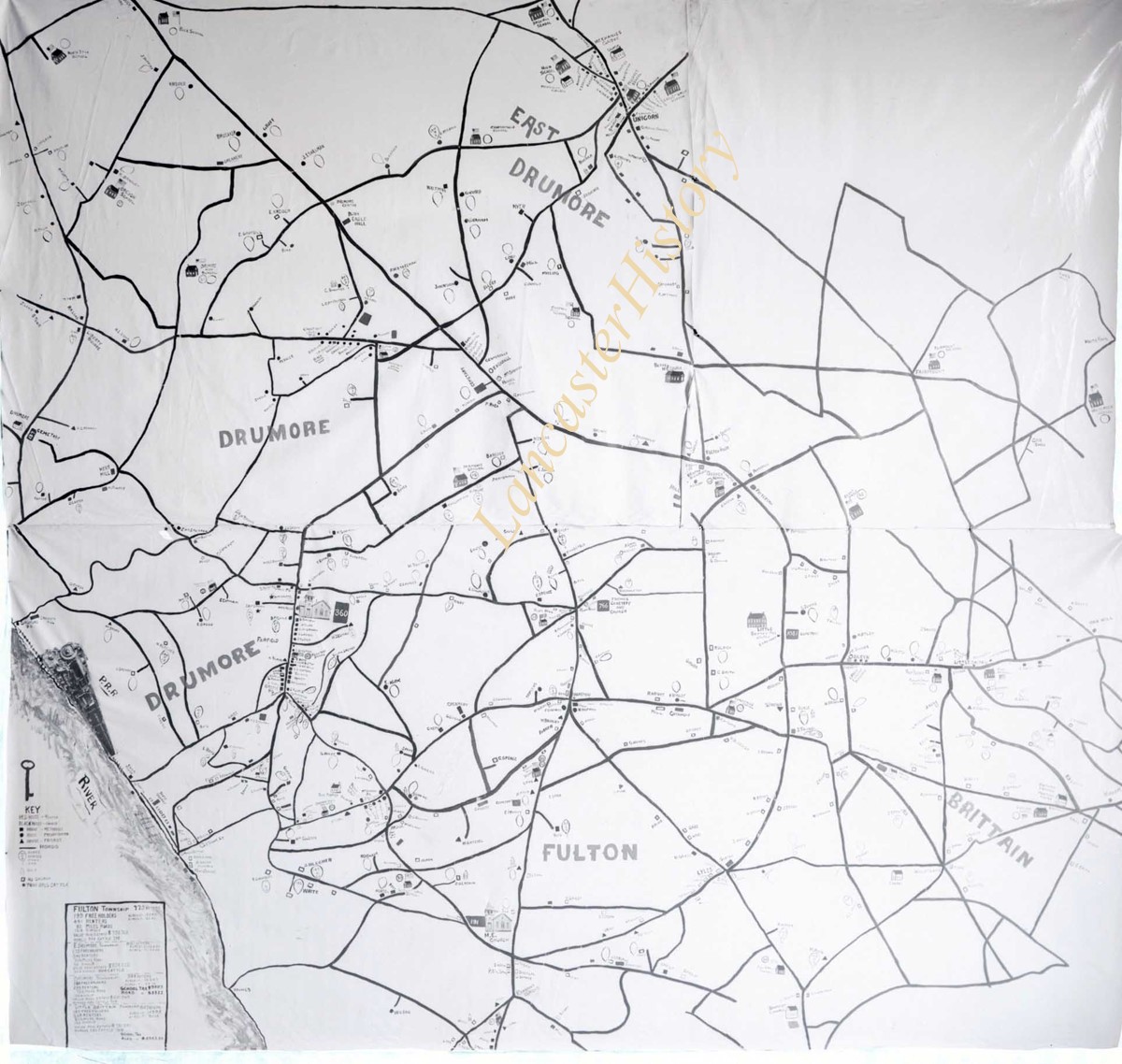
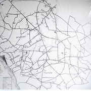
Photograph- Map showing Fulton and Drumore Townships.
Object ID
D-07-03-48
Date Range
1924/07/21
More detail
1 image
Object Name
Negative
Collection
Darmstaetter Collection
Title
Photograph- Map showing Fulton and Drumore Townships.
Description
Map showing Fulton and Drumore Townships. 1 print only
Date Range
1924/07/21
Year Range From
1924
Storage Location
LancasterHistory, Lancaster, PA
Studio
Darmstaetter's
Subcategory
Documentary Artifact
Classification
Maps
Object Name
Negative
Film Size
11 x 7 inches
Object ID
D-07-03-48
Negative Number
yes
Other Number
614-1666
Images
Less detail
More Like This
Permalink
Toggle Full Record
Negative
https://collections.lancasterhistory.org/en/permalink/e0651e36-b53c-4c86-a707-733813415542
Collection
Darmstaetter Collection
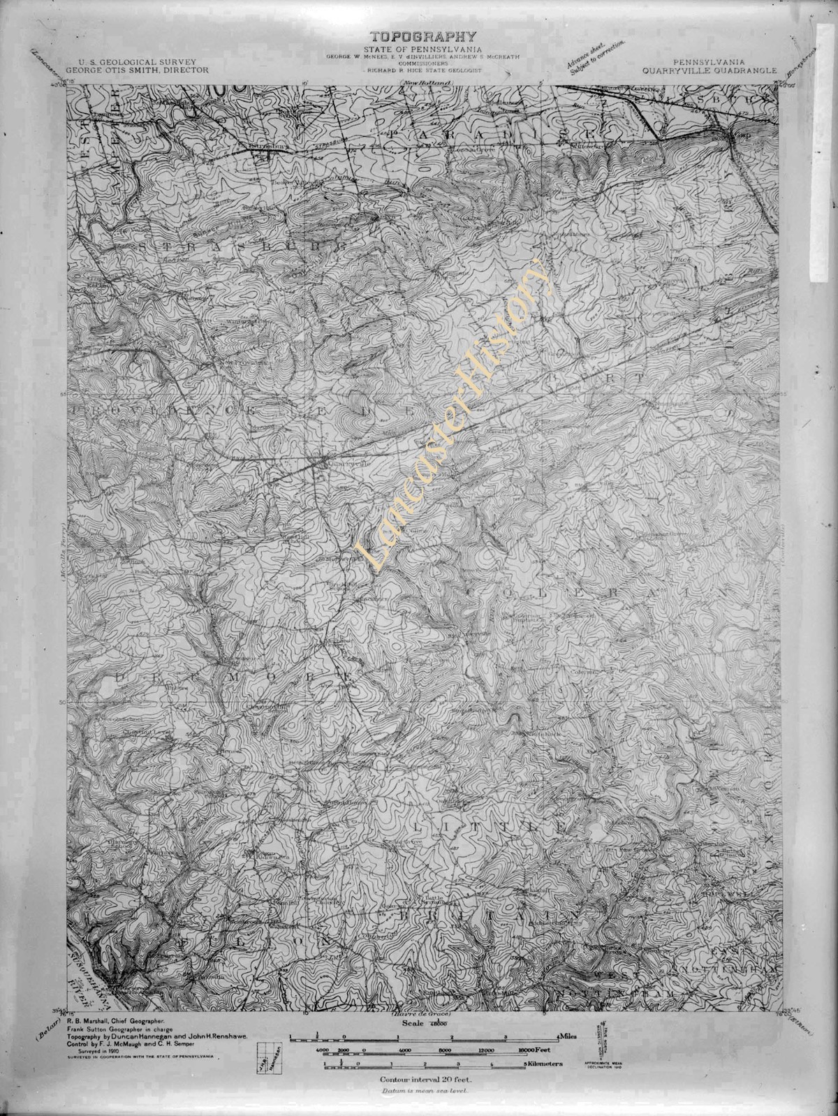
Title
Photograph- Map--Topography of the State of Pennsylvania.
Object ID
D-07-03-46
More detail
1 image
Object Name
Negative
Collection
Darmstaetter Collection
Title
Photograph- Map--Topography of the State of Pennsylvania.
Description
Map--Topography of the State of Pennsylvania. 1 print only
Storage Location
LancasterHistory, Lancaster, PA
Studio
Darmstaetter's
Subcategory
Documentary Artifact
Classification
Maps
Place
Pennsylvania
Object Name
Negative
Film Size
6.5 x 8.5 inches
Object ID
D-07-03-46
Negative Number
yes glass
Other Number
G 71B 165n
Images
Less detail
More Like This
Permalink
Toggle Full Record
Negative
https://collections.lancasterhistory.org/en/permalink/c0c4524c-e47b-45e7-a502-752110992490
Collection
Darmstaetter Collection
Title
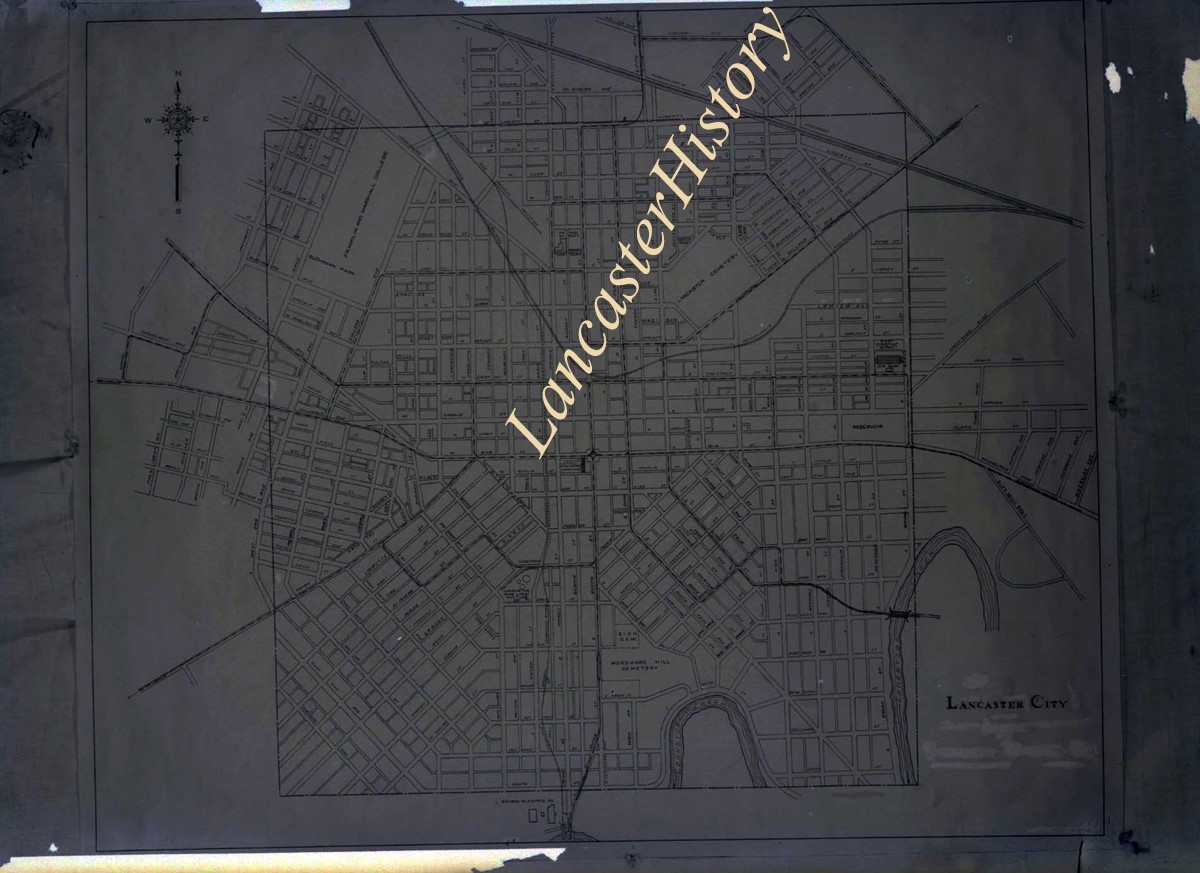
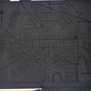
Photograph- Map of Lancaster city.
Object ID
D-07-03-45
Date Range
1926/04/05
More detail
1 image
Object Name
Negative
Collection
Darmstaetter Collection
Title
Photograph- Map of Lancaster city.
Description
Map of Lancaster city. 1 print only
Date Range
1926/04/05
Year Range From
1926
Storage Location
LancasterHistory, Lancaster, PA
Studio
Darmstaetter's
Subcategory
Documentary Artifact
Classification
Maps
Place
Lancaster
Object Name
Negative
Film Size
7 x 5 inches
Object ID
D-07-03-45
Negative Number
yes
Other Number
644-559
Images
Less detail
More Like This
Permalink
10 records – page 1 of 1.
Prev
Next