Photograph- The old cemetery near Camargo. Conditions poor.
Description
The old cemetery near Camargo. Conditions poor.
Provenance
Loose photo from album #32, Lancaster County Churches and Cemeteries. Gathered by A. Hunter Rineer for his book of the same name, published in 1985 by LCHS.
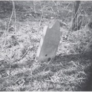
Photograph- A Myers grave in the old cemetery near Camargo.
Description
A Myers grave in the old cemetery near Camargo.
Provenance
Loose photo from album #32, Lancaster County Churches and Cemeteries. Gathered by A. Hunter Rineer for his book of the same name, published in 1985 by LCHS.
Photograph- Grave of Eliza Myers in the old cemetery near Camargo.
Description
Grave of Eliza Myers in the old cemetery near Camargo.
Provenance
Loose photo from album #32, Lancaster County Churches and Cemeteries. Gathered by A. Hunter Rineer for his book of the same name, published in 1985 by LCHS.
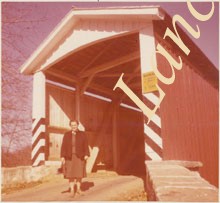
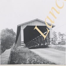
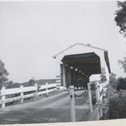
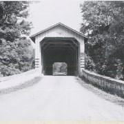
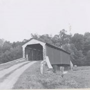
Photograph- Eshleman's Mill covered bridge across Pequea Creek, east of Paradise and Gordonville and north of Leaman Place, between Paradise and Leacock townships.
Photograph- Eshleman's Mill covered bridge across Pequea Creek, east of Paradise and Gordonville and north of Leaman Place, between Paradise and Leacock townships.
Description
Eshleman's Mill covered bridge across Pequea Creek, east of Paradise and Gordonville and north of Leaman Place, between Paradise and Leacock townships.
Provenance
Lancaster County covered bridge photos taken by M. E. Schroll and Kathryn L. Sauder taken between 1956 and 1958.
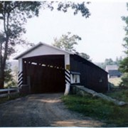
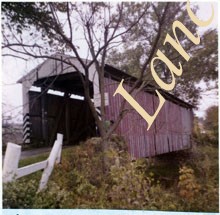
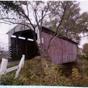
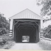
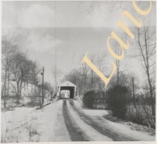
Photograph- End view of Gable's Fording covered bridge across Muddy Creek near Hinkletown, between Ephrata and Earl townships. Bridge no longer standing.
Photograph- End view of Gable's Fording covered bridge across Muddy Creek near Hinkletown, between Ephrata and Earl townships. Bridge no longer standing.
Description
End view of Gable's Fording covered bridge across Muddy Creek near Hinkletown, between Ephrata and Earl townships. Bridge no longer standing.
Provenance
Lancaster County covered bridge photos taken by M. E. Schroll and Kathryn L. Sauder taken between 1956 and 1958.
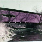
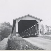
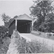
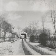
Photograph- Bell Bank covered bridge across the Octoraro Creek four miles south of Nine Points, between Colerain Township, Lancaster County and Upper Oxford Township, Chester County.
Photograph- Bell Bank covered bridge across the Octoraro Creek four miles south of Nine Points, between Colerain Township, Lancaster County and Upper Oxford Township, Chester County.
Description
Bell Bank covered bridge across the Octoraro Creek four miles south of Nine Points, between Colerain Township, Lancaster County and Upper Oxford Township, Chester County.
Provenance
Lancaster County covered bridge photos taken by M. E. Schroll and Kathryn L. Sauder taken between 1956 and 1958.