It appears no script is enabled within your browser. Please enable JavaScript to use this site.
Skip header and navigation
Toggle navigation
Collections
Search
Help
Privacy
Your Selections:
0
Items
Staff Login
Revise Search
Revise Search
Revise search
Search
Data Source
Archives
34845
Photographs
7835
×
Data Source
All
A
B
C
D
E
F
G
H
I
J
K
L
M
N
O
P
Q
R
S
T
U
V
W
X
Y
Z
Sort
By Count
Alphabetical
Filtered by
Filter
Loading...
Collection
Quarter Sessions
30639
Mayor's Court
3546
Henry Kauffman Photograph Collection
2884
Darmstaetter Collection
1329
General Collection
1103
Lancaster Recreation Commission Photograph Collection
957
Johnny Hauck Photograph Collection
549
War of 1812 Militia Trials
484
Brown Family Photograph Collection
374
DeWalt Products Collection
189
Coroners' Inquests
97
Bruce Ryder Photograph Collection
88
More
×
Collection
All
A
B
C
D
E
F
G
H
I
J
K
L
M
N
O
P
Q
R
S
T
U
V
W
X
Y
Z
Sort
By Count
Alphabetical
Filtered by
Filter
Loading...
Subject
Documentary Artifact
33842
Quarter Sessions
17660
Charge: assault and battery
3809
Recognizance
3654
Charge: larceny
2281
Charge: fornication and bastardy
1889
Charge: surety of the peace
1558
Sports
560
Charge: assault
543
Boxing
509
Pugilism
509
Persons of color
485
More
×
Subject
All
A
B
C
D
E
F
G
H
I
J
K
L
M
N
O
P
Q
R
S
T
U
V
W
X
Y
Z
Sort
By Count
Alphabetical
Filtered by
Filter
Loading...
Name
Darmstaetter's
1426
Heiges, George L.
164
Smith, John
117
Coroner
97
Miller, John
89
Hostetter, Harry B.
63
Miller, Jacob
55
Ryder, Bruce
54
Smith, Henry
50
Thompson, John
50
Hamilton, John
48
Smith, George
47
More
×
Name
All
A
B
C
D
E
F
G
H
I
J
K
L
M
N
O
P
Q
R
S
T
U
V
W
X
Y
Z
Sort
By Count
Alphabetical
Filtered by
Filter
Loading...
Place
Lancaster
2129
Salisbury Twp.
396
Manheim
121
Lancaster Twp.
74
Manheim Twp.
69
Columbia
67
Rapho Twp.
44
Earl Twp.
42
Manor Twp.
41
Philadelphia, Pennsylvania
41
East Hempfield Twp.
39
Ephrata
39
More
×
Place
All
A
B
C
D
E
F
G
H
I
J
K
L
M
N
O
P
Q
R
S
T
U
V
W
X
Y
Z
Sort
By Count
Alphabetical
Filtered by
Filter
Loading...
Decade
1720s
1
1740s
10
1750s
286
1760s
249
1770s
742
1780s
616
1790s
860
1800s
1267
1810s
2235
1820s
2116
1830s
2467
1840s
2920
1850s
3769
1860s
2788
1870s
3092
1880s
3807
1890s
6851
1900s
821
1910s
43
1920s
858
1930s
452
1940s
31
1950s
31
1960s
192
1970s
53
1980s
23
1990s
145
×
Decade
All
A
B
C
D
E
F
G
H
I
J
K
L
M
N
O
P
Q
R
S
T
U
V
W
X
Y
Z
Sort
By Count
Alphabetical
Filtered by
Filter
Loading...
Material
Print, Photographic
57528
Record, Judicial
Statement, Financial
32308
Indictment
30020
Documents
17049
Transparency, Slide
10634
Negative
Probate
6633
Petition
5220
Record, Marriage
3096
Estate Inventory
2970
Negative, Glass Plate
2264
More
×
Material
All
A
B
C
D
E
F
G
H
I
J
K
L
M
N
O
P
Q
R
S
T
U
V
W
X
Y
Z
Sort
By Count
Alphabetical
Filtered by
Filter
Loading...
Archival Hierarchy
Item
34829
Series
13
Fonds
3
×
Archival Hierarchy
All
A
B
C
D
E
F
G
H
I
J
K
L
M
N
O
P
Q
R
S
T
U
V
W
X
Y
Z
Sort
By Count
Alphabetical
Filtered by
Filter
Loading...
Online Media
Image
7834
PDF
68
×
Online Media
All
A
B
C
D
E
F
G
H
I
J
K
L
M
N
O
P
Q
R
S
T
U
V
W
X
Y
Z
Sort
By Count
Alphabetical
Filtered by
Filter
Loading...
Advanced Search
Help
more like: 169A29B5-95A8-4CF4-9A40-446175428630
Record, Judicial
Negative
Sorted by
Title
Sort by Relevance
Expand All
Collapse All
List View
Gallery View
Print
10 records – page 1 of 1.
Prev
Next
Toggle Full Record
Negative
https://collections.lancasterhistory.org/en/permalink/c646568d-8c52-406a-ba0e-558305303232
Collection
Darmstaetter Collection
Title
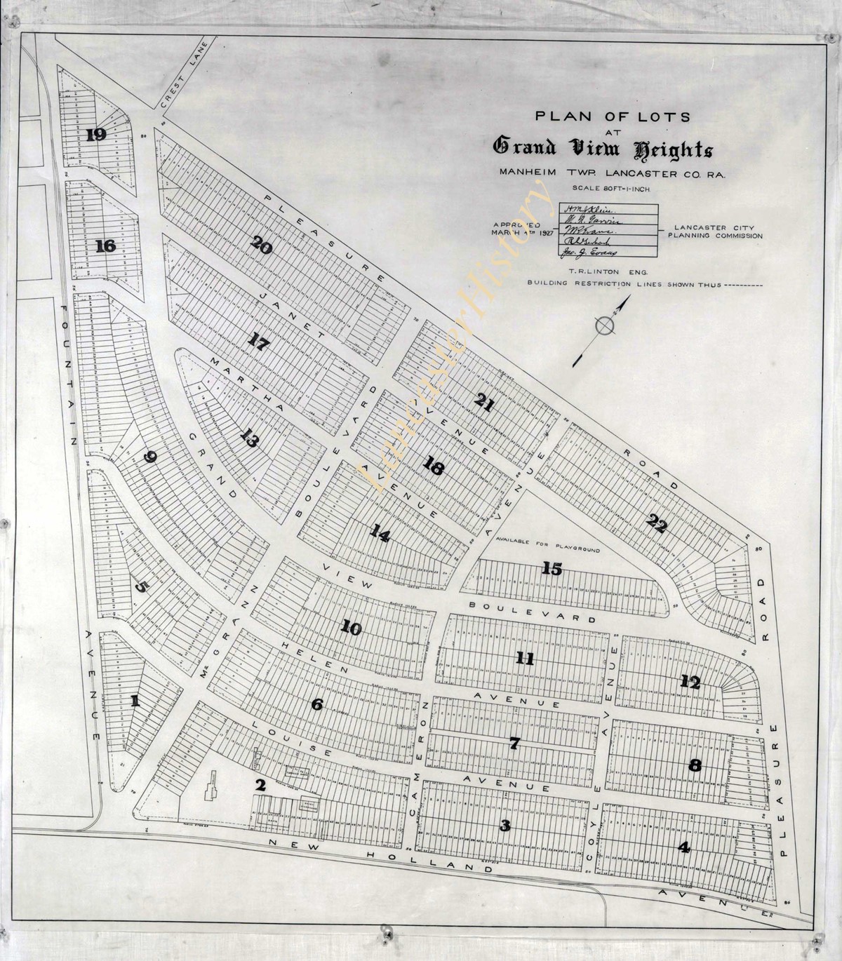
Photograph- Plan for lots in Grandview Heights.
Object ID
D-07-03-56
More detail
1 image
Object Name
Negative
Collection
Darmstaetter Collection
Title
Photograph- Plan for lots in Grandview Heights.
Description
Plan for lots in Grandview Heights. 1 print only
Storage Location
LancasterHistory, Lancaster, PA
Studio
Darmstaetter's
Subcategory
Documentary Artifact
Classification
Maps
Place
Manheim Twp.
Object Name
Negative
Film Size
8 x 10 inches
Object ID
D-07-03-56
Negative Number
yes
Other Number
660-870
Images
Less detail
More Like This
Permalink
Toggle Full Record
Negative
https://collections.lancasterhistory.org/en/permalink/7723bebb-3aa3-432f-abec-170944938900
Collection
Darmstaetter Collection
Title
Photograph- Plan for Greater Lancaster showing Wheatland Hills.
Object ID
D-07-03-55
Date Range
January 24, 1927
More detail
1 image
Object Name
Negative
Collection
Darmstaetter Collection
Title
Photograph- Plan for Greater Lancaster showing Wheatland Hills.
Description
Plan for Greater Lancaster showing Wheatland Hills. 1 print only
Date Range
January 24, 1927
Storage Location
LancasterHistory, Lancaster, PA
Studio
Darmstaetter's
Subcategory
Documentary Artifact
Classification
Maps
Place
East Hempfield Twp.
Object Name
Negative
Film Size
10 x 8 inches
Object ID
D-07-03-55
Negative Number
yes
Other Number
660-257
Images
Less detail
More Like This
Permalink
Toggle Full Record
Negative
https://collections.lancasterhistory.org/en/permalink/7b4479be-5ce0-4aed-b9d1-296882065808
Collection
Darmstaetter Collection
Title
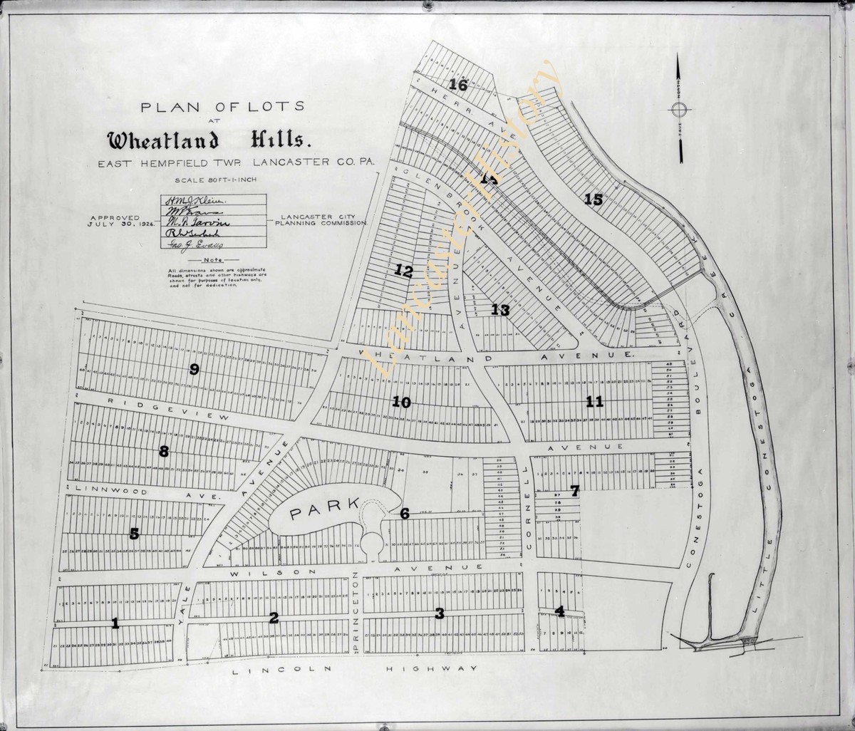
Photograph- Plan of lots at Wheatland Hills.
Object ID
D-07-03-54
More detail
1 image
Object Name
Negative
Collection
Darmstaetter Collection
Title
Photograph- Plan of lots at Wheatland Hills.
Description
Plan of lots at Wheatland Hills. 1 print only
Storage Location
LancasterHistory, Lancaster, PA
Studio
Darmstaetter's
Subcategory
Documentary Artifact
Classification
Maps
Place
East Hempfield Twp.
Object Name
Negative
Film Size
10 x 8 inches
Object ID
D-07-03-54
Negative Number
yes
Other Number
660-180
Images
Less detail
More Like This
Permalink
Toggle Full Record
Negative
https://collections.lancasterhistory.org/en/permalink/cfeaaee4-cdc4-4b21-aef9-829150874936
Collection
Darmstaetter Collection
Title
Photograph- Map of Lancaster County.
Object ID
D-07-03-53
Date Range
1926/02/22
More detail
1 image
Object Name
Negative
Collection
Darmstaetter Collection
Title
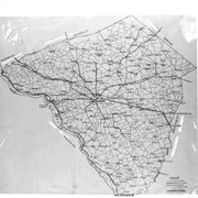
Photograph- Map of Lancaster County.
Description
Map of Lancaster County. 1 print only
Date Range
1926/02/22
Year Range From
1926
Storage Location
LancasterHistory, Lancaster, PA
Studio
Darmstaetter's
Subcategory
Documentary Artifact
Classification
Maps
Place
Lancaster County
Object Name
Negative
Film Size
10 x 8 inches
Object ID
D-07-03-53
Negative Number
yes
Other Number
642-435
Images
Less detail
More Like This
Permalink
Toggle Full Record
Negative
https://collections.lancasterhistory.org/en/permalink/23988159-db5d-4ca5-b01e-153188656558
Collection
Darmstaetter Collection
Title
Photograph- Map showing Berks, Lebanon, York, Chester, and Lancaster Counties.
Object ID
D-07-03-52
Date Range
1928/10/01
More detail
1 image
Object Name
Negative
Collection
Darmstaetter Collection
Title
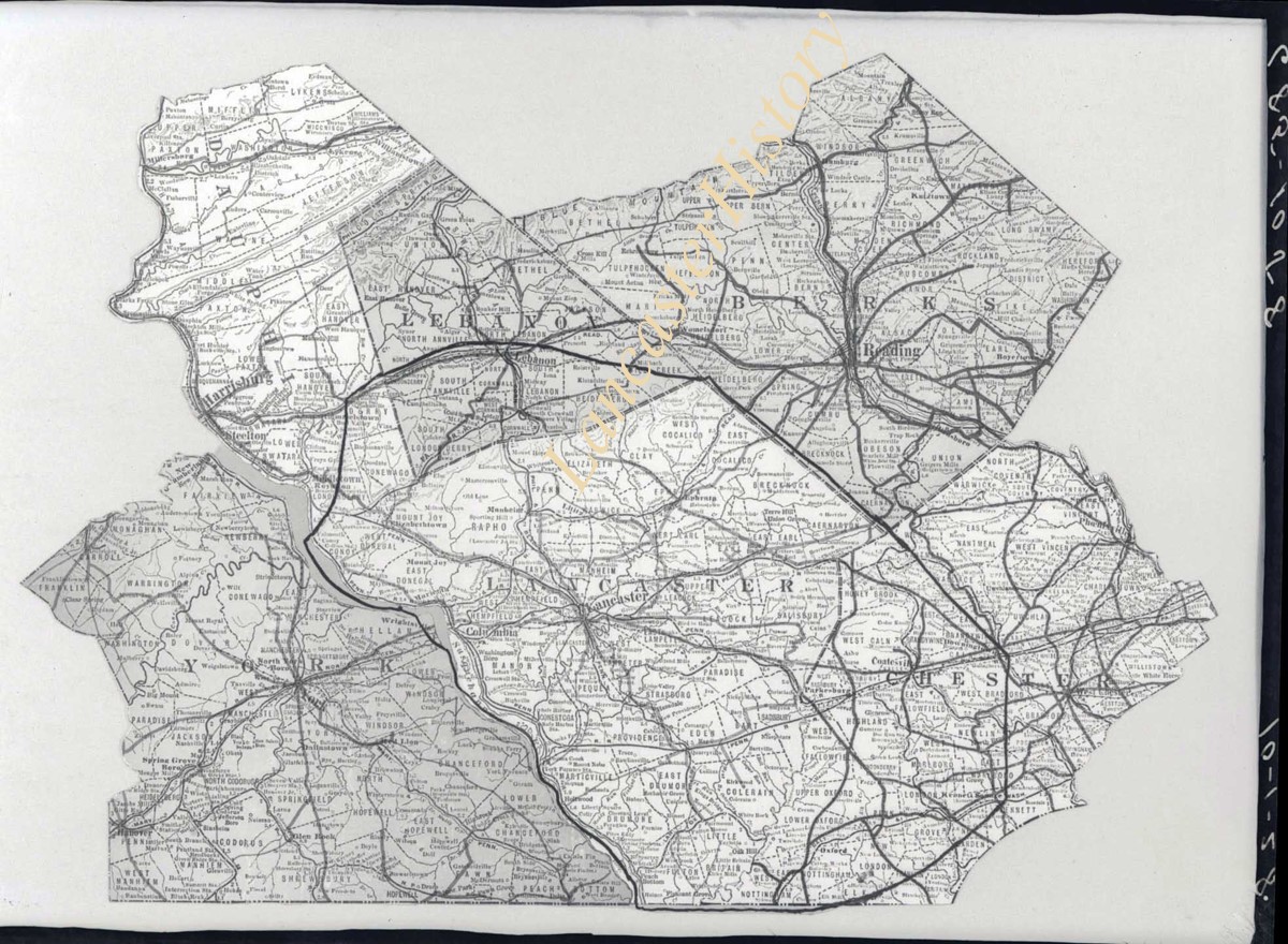
Photograph- Map showing Berks, Lebanon, York, Chester, and Lancaster Counties.
Description
Map showing Berks, Lebanon, York, Chester, and Lancaster Counties. 1 print only
Date Range
1928/10/01
Year Range From
1928
Storage Location
LancasterHistory, Lancaster, PA
Studio
Darmstaetter's
Subcategory
Documentary Artifact
Classification
Maps
Object Name
Negative
Film Size
6.5 x 5 inches
Object ID
D-07-03-52
Negative Number
yes
Other Number
685-1058
Images
Less detail
More Like This
Permalink
Toggle Full Record
Negative
https://collections.lancasterhistory.org/en/permalink/7bf4d352-83bc-411e-b713-389752566549
Collection
Darmstaetter Collection
Title
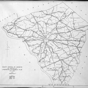
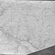
Photograph- Map showing county system of highways as adopted by the Lancaster Automobile Club, May 1924.
Object ID
D-07-03-51
Date Range
1924/05/19
More detail
1 image
Object Name
Negative
Collection
Darmstaetter Collection
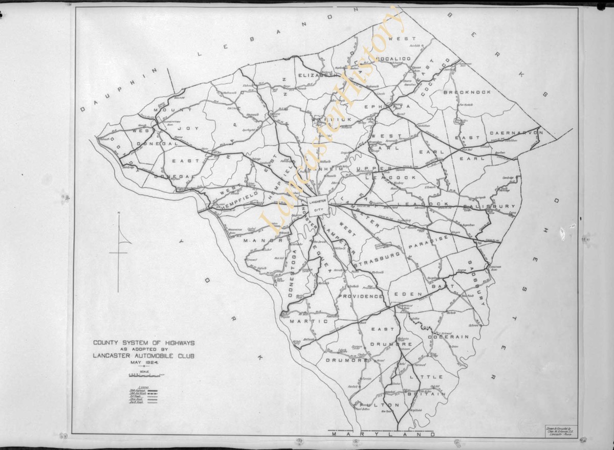
Title
Photograph- Map showing county system of highways as adopted by the Lancaster Automobile Club, May 1924.
Description
Map showing county system of highways as adopted by the Lancaster Automobile Club, May 1924. 1 print only
Date Range
1924/05/19
Year Range From
1924
Storage Location
LancasterHistory, Lancaster, PA
Studio
Darmstaetter's
Subcategory
Documentary Artifact
Classification
Maps
Place
Lancaster County
Object Name
Negative
Film Size
6.5 x 5 inches
Object ID
D-07-03-51
Negative Number
yes
Other Number
613-1493
Images
Less detail
More Like This
Permalink
Toggle Full Record
Negative
https://collections.lancasterhistory.org/en/permalink/970653d0-e548-4cad-a0d2-755934254994
Collection
Darmstaetter Collection
Title
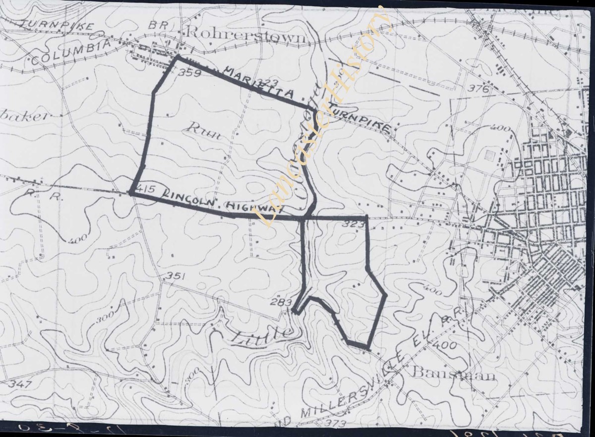
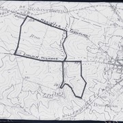
Photograph- Map showing topography and Lincoln Highway and Marietta Turnpike.
Object ID
D-07-03-50
Date Range
1930/17/09
More detail
1 image
Object Name
Negative
Collection
Darmstaetter Collection
Title
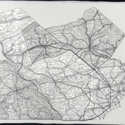
Photograph- Map showing topography and Lincoln Highway and Marietta Turnpike.
Description
Map showing topography and Lincoln Highway and Marietta Turnpike. 1 print only
Date Range
1930/17/09
Year Range From
1930
Storage Location
LancasterHistory, Lancaster, PA
Studio
Darmstaetter's
Subcategory
Documentary Artifact
Classification
Maps
Place
Lancaster County
Object Name
Negative
Film Size
6.5 x 5 inches
Object ID
D-07-03-50
Negative Number
yes
Other Number
721-1796
Images
Less detail
More Like This
Permalink
Toggle Full Record
Negative
https://collections.lancasterhistory.org/en/permalink/5f58e4ef-9540-4971-874d-011722330483
Collection
Darmstaetter Collection
Title
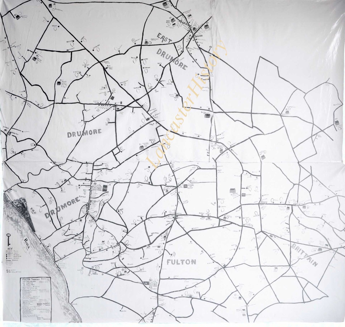
Photograph- Map showing Martic, Fulton, and Drumore Townships.
Object ID
D-07-03-49
Date Range
1927/08/29
More detail
1 image
Object Name
Negative
Collection
Darmstaetter Collection
Title
Photograph- Map showing Martic, Fulton, and Drumore Townships.
Description
Map showing Martic, Fulton, and Drumore Townships. 1 print only
Date Range
1927/08/29
Year Range From
1927
Storage Location
LancasterHistory, Lancaster, PA
Studio
Darmstaetter's
Subcategory
Documentary Artifact
Classification
Maps
Object Name
Negative
Film Size
10 x 8 inches
Object ID
D-07-03-49
Negative Number
yes
Other Number
670-910
Images
Less detail
More Like This
Permalink
Toggle Full Record
Negative
https://collections.lancasterhistory.org/en/permalink/b8877825-0ed6-4461-a4da-234099163642
Collection
Darmstaetter Collection
Title
Photograph- Map showing Fulton and Drumore Townships.
Object ID
D-07-03-48
Date Range
1924/07/21
More detail
1 image
Object Name
Negative
Collection
Darmstaetter Collection
Title
Photograph- Map showing Fulton and Drumore Townships.
Description
Map showing Fulton and Drumore Townships. 1 print only
Date Range
1924/07/21
Year Range From
1924
Storage Location
LancasterHistory, Lancaster, PA
Studio
Darmstaetter's
Subcategory
Documentary Artifact
Classification
Maps
Object Name
Negative
Film Size
11 x 7 inches
Object ID
D-07-03-48
Negative Number
yes
Other Number
614-1666
Images
Less detail
More Like This
Permalink
Toggle Full Record
Negative
https://collections.lancasterhistory.org/en/permalink/ff5edae3-2be8-4d17-bf9f-317768612450
Collection
Darmstaetter Collection
Title
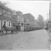
Photograph- Street scene showing a line of people, buildings, and 1 horse and buggy.
Object ID
D-07-03-47
More detail
1 image
Object Name
Negative
Collection
Darmstaetter Collection
Title
Photograph- Street scene showing a line of people, buildings, and 1 horse and buggy.
Description
Street scene showing a line of people, buildings, and 1 horse and buggy. 1 print only
Storage Location
LancasterHistory, Lancaster, PA
Studio
Darmstaetter's
Subcategory
Documentary Artifact
Classification
Horses
Streets & Highways
Object Name
Negative
Film Size
10 x 8 inches
Object ID
D-07-03-47
Negative Number
yes glass
Other Number
G 300B
Images
Less detail
More Like This
Permalink
10 records – page 1 of 1.
Prev
Next