The George Steinman Papers, Series 1 contains an album, compiled by George Steinman, with many photographs of buildings, tombstones, monuments and scenes of Lancaster city and county. Ephemera and newspaper articles are among the photographs. Represented in the album are Postlethwaite's Tavern, hotels and taverns, fire houses, the Conestoga massacre, churches, cemeteries, Ephrata Cloister, prominent citizens and their homes, Stehli Silk Mill, and schools. The four boxes contain orginal correspondence, documents, photographs and ephemera or and pertaining to the same subject matter as the album.
The George Steinman Papers, Series 2 is a collection of original correspondence, documents, photographs, and ephemera primarily compiled by George Steinman. The contents of Series 2 represent Lancaster city and county events, prominent citizens, buildings, monuments, churches, cemeteries, schools, and businesses. Most of what Steinman collected relates to 18th and 19th century Pennsylvania, highlighting Lancaster and Philadelphia. One of the key events highlighted is the Revolutionary war; with documents and images related to Philadelphia, George Washington, the Atlee family, and General Edward Hand. There are images relating to the Christiana Riot and to various buildings in early Lancaster; including but not limited to the Old Jail, the British Prison, and Postlethwaite's Tavern. Also included in the collection is currency printed by Benjamin Franklin in Philadelphia in 1764, and Confederate States currency and bonds.
Preferred Citation: Title or description of item, date (day, month, year), Collection Title (MG#), Series #, Box #, Folder #, (or Object ID), LancasterHistory, Lancaster, Pennsylvania. URL if applicable. Date accessed (day, month, year).
"Mr. Geo. Steinman who started this collection of pictures. This book was presented to the Lanc. Co. Historical Society after his death by Mr. Geo. S. Franklin."
John M. Gibson is recorded as the donor, 1968, in LancasterHistory's accession records.
LancasterHistory is committed to preserving and providing access to materials chronicling Lancaster County's heritage. As a historical resource, this document reflects the racial prejudices and actions of the era. In order to maintain the historical integrity and context of collection items, LancasterHistory does not censor historical documents or edit language, titles, or organization names when transcribing original content.
Access Conditions / Restrictions
Please use digital images and transcriptions when available.
The use of the original album is restricted. Please contact Research@LancasterHistory.org with questions.
Copyright
Images have been provided for research purposes only. Please contact Research@LancasterHistory.org for a high-resolution image and permission to publish.
LancasterHistory retains the rights to the digital images and content presented. The doctrine of fair use allows limited use of copyrighted material without permission from the copyright holder. Fair use includes comment, criticism, teaching, and private scholarship. Any images and data downloaded, printed or photocopied for these purposes should provide a citation. All other uses beyond those allowed by fair use require written permission.
Permission for reproduction and/or publication must be obtained in writing from LancasterHistory. Persons wishing to publish any material from this site must assume all responsibility for identifying and satisfying any claimants of copyright or other use restrictions. Publication fees may apply.
Credit
Courtesy of LancasterHistory, Lancaster, Pennsylvania.
Other Numbers
MG-184
Classification
MG0184
Description Level
Fonds
Custodial History
Series 1 processed and finding aid prepared PK and MSH, 2008. Series 2 finding aid prepared by JE, 2018. Added to database 20 July 2021.
Digitization of this document was funded by the Pennsylvania Historical and Museum Commission, PHMC Appl ID # C980002119, 2021-2024.
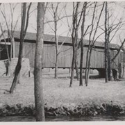
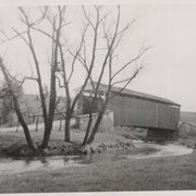
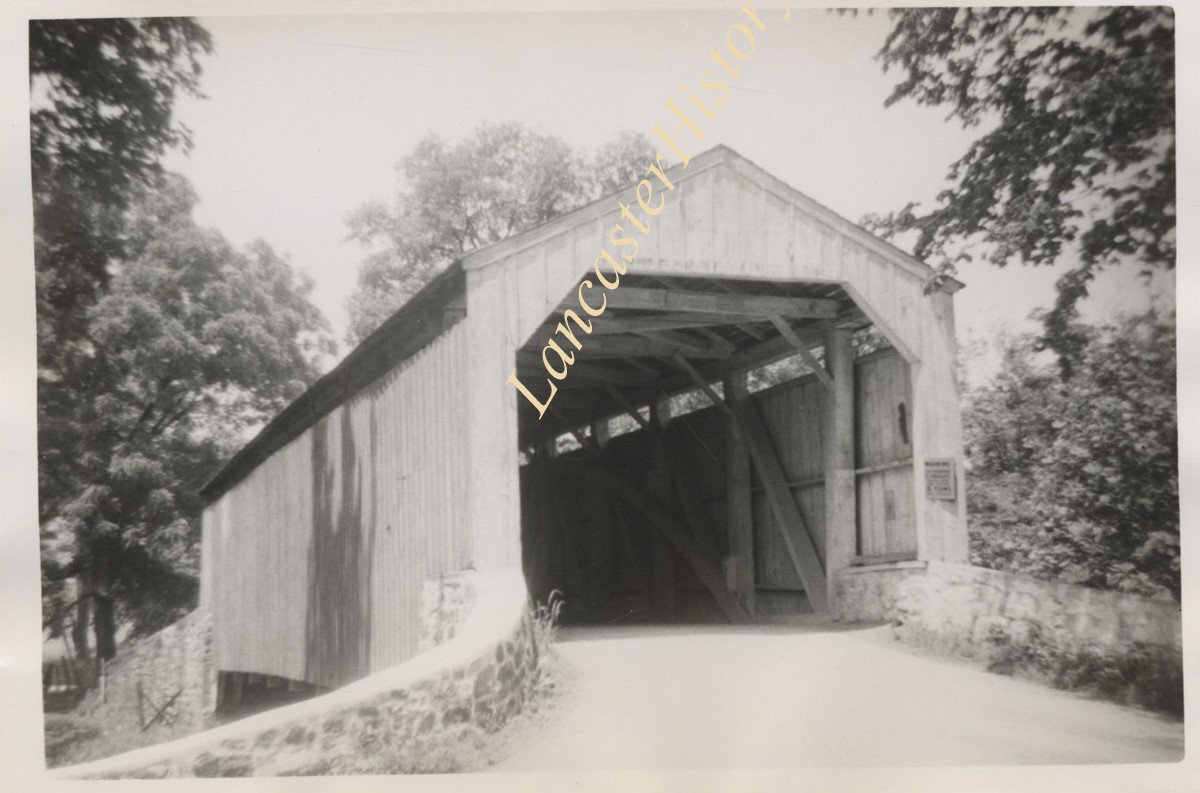
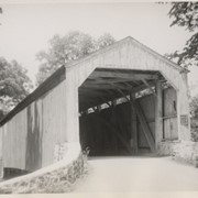
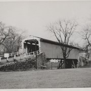
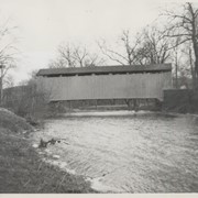
Poole Forge covered bridge, one mile west of Churchtown in Caernarvon Township. State supervised bridge on road LR 36053, built 1859, single span 99 feet long.
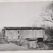
Isaac Shearer's Mill covered bridge, one mile north of Goodville in Caernarvon Township. County maintained on road T-773, built 1878, single span 88 feet long.
Isaac Bear's Mill covered bridge, one mile southwest of Martindale in East Earl Township. County maintained on road T-674, built in 1876, single span 94 feet long.
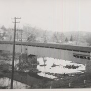
Bushong's Mill, near Oregon between Upper Leacock and Manheim Townships. State supervised on road LR 36009, built in 1843, longest single span in the county, 195 feet long.
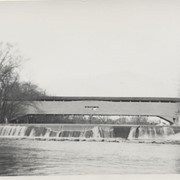
Slackwater, aslo known as Shober's Paper Mill, one mile south of Millersville between Conestoga and Manor Townships. State supervised on road LR 36008, oldest bridge still standing, built 1839, double span 269 feet long.
Fry's Mill, one mile east of Hahnstown between Ephrata and East Cocalico Townships. County maintained on road T-813, built in 1849, single span 95 feet long.
Gable's Fording, one mile northeast of Hinkletown, near confluence with Conestoga River, between Earl and Ephrata Townships. State supervised on road LR 36052, built in 1872, single span 129 feet long.
Bucher's Mill, .5 mile west of Reamstown in East Cocalico Township. County maintained on road T-955 just off Route 222, built in 1881, single span 60 feet long.