This collection contains Thomas Baker's three surveying books which document land and property ownership in southern Lancaster County, primarily Colerain Township from 1856-1902. Octorara Creek, Kirkwood, Christiana and Upper Oxford Twp. are among the place names.
Admin/Biographical History
Thomas Baker traces his ancestry back to Sir Richard Baker (1568), born in the county of Kent, England. In 1685, seven generations before Thomas Baker was born, Joseph Baker immigrated to Delaware County, Pennsylvania. Born in Chatham, Chester County to Lewis and Diana Baker, Thomas was well-educated; a teacher until 1840, when he commenced the study of surveying. Land surveying is the location of points on, above and below the surface of the earth and the relation of those points to a common reference system. Employed at Jonathon Goss, at Unionville Academy in Chester, he surveyed over 650 farms in Lancaster County's Colerain Township. He married in 1855; his family adhering to his Quaker faith. The Biographical Annals in Lancaster, published in 1903, describes Baker as "…a man esteemed by his neighbors for his many good qualities and excellent character, and in disposition he is a man of warm heart and kindly feeling."
Preferred Citation: Title or description of item, date (day, month, year), Collection Title (MG#), Box #, Folder #, (or Object ID), LancasterHistory, Lancaster, Pennsylvania. URL if applicable. Date accessed (day, month, year).
Access Conditions / Restrictions
Please make an appointment by contacting the Research Staff at Research@LancasterHistory.org prior to visit.
Copyright
Collection may be photographed. Please direct questions to Research Center Staff at Research@LancasterHistory.org.
Permission for reproduction and/or publication must be obtained in writing from LancasterHistory.
Persons wishing to publish any material from this collection must assume all responsibility for identifying and satisfying any claimants of copyright or other use restrictions. Publication fees may apply.
Credit
Courtesy of LancasterHistory, Lancaster, Pennsylvania.
Description Level
Item
Custodial History
Cataloged by JP, Summer 2013. Add to database 23 October 2023.
Topographic Survey for the southwest corner of Maple Ave. and Perry Street in Lancaster Twp.
Description
Topographic Survey for Lancaster Township Supervisors. South West Cor. of Maple Ave. and Perry Street, Lancaster, PA. Scale: 1/8" = 1 Foot. H. F. Huth.
Blueprints for alterations and additions (BLUE_F013_DrMcNinch)
Notes
Preferred Citation: Title or description of item, date (day, month, year), Collection Title (MG#), Box #, Folder #, (or Object ID), LancasterHistory, Lancaster, Pennsylvania. URL if applicable. Date accessed (day, month, year).
Access Conditions / Restrictions
Please make an appointment by contacting the Research Staff at Research@LancasterHistory.org prior to visit.
Copyright
Collection may be photographed. Please direct questions to Research Center Staff at Research@LancasterHistory.org.
Permission for reproduction and/or publication must be obtained in writing from LancasterHistory.
Persons wishing to publish any material from this collection must assume all responsibility for identifying and satisfying any claimants of copyright or other use restrictions. Publication fees may apply.
Credit
Courtesy of LancasterHistory, Lancaster, Pennsylvania.
Description Level
Item
Custodial History
Cataloged by JP, Summer 2013. Add to database 23 October 2023.
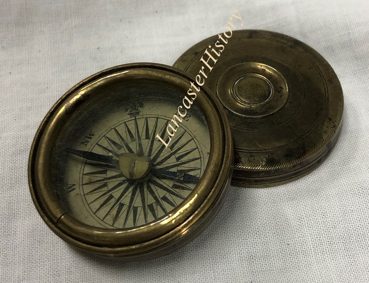
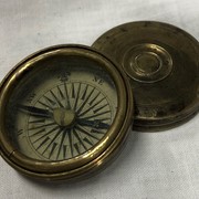
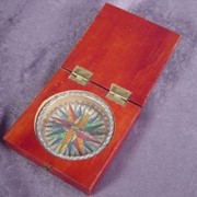
Compass housed in a round, turned brass case with fitted lid. Scored circles decorate exterior. Inside case bottom is paper printed with decoration and cardinal points. Blued needle has gold-stenciled "N" on one end. Flat glass window on top held with brass retaining ring. Lid screws onto case bottom.
Handwritten note states compass brought to America from Nuremburg, Germany by immigrant ancestor John Leonard Ellmaker(1697-1782) in 1726.
Unknown German maker
Provenance
Descent within Ellmaker family to donor, then donated to the Heritage Center.
Journal of the Lancaster County Historical Society ; v. 72, no. 1
Summary
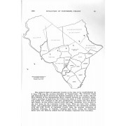
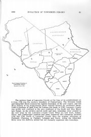
This article presents a series of maps that depict the creation of the county's townships as well as providing information on the boundaries of Lancaster County when it was established in 1729.